SYNOPSIS
A large but shallow upper low is moving across the E Europe while ridging is expanding from SW Europe into central Europe. A deep trough with surface cyclone pushes from N Atlantic into the western Europe and UK.
DISCUSSION
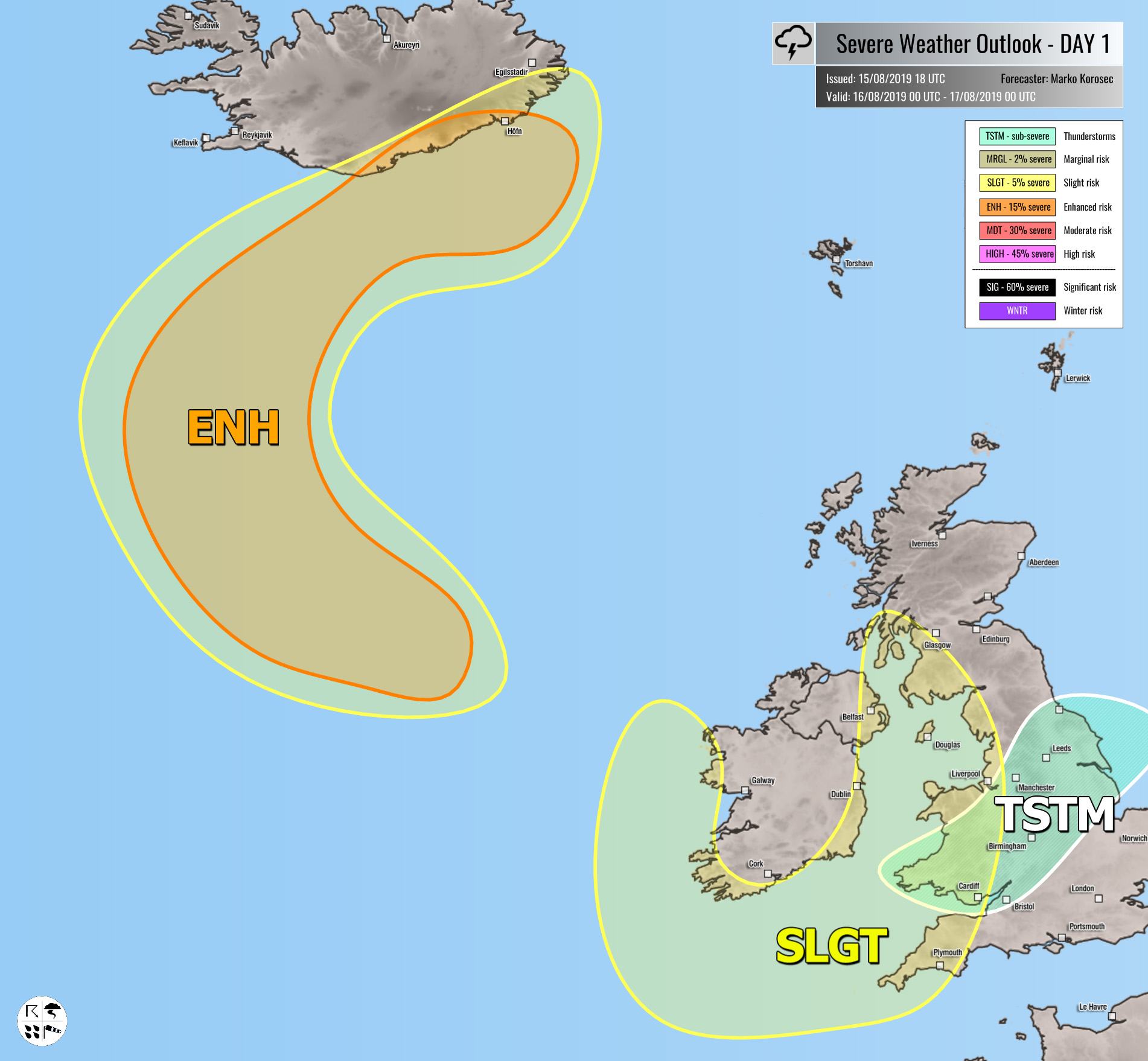
SLGT risk has been issued for coastal Ireland, Northern Ireland, SW Scotland, Wales and SW England with threat for severe non-convective winds with gusts in excess of 90 km/h locally. Windstorm is associated with the deep cyclone moving NE further north. Isolated storms seems possible across Wales and N England in the afternoon as well.
ENH / SLGT risks have been issued for S Iceland into the N Atlantic with threat for severe non-convective winds with gusts in excess of 110 km/h locally. Windstorm is associated with the deep cyclone moving between Iceland and Scotland.
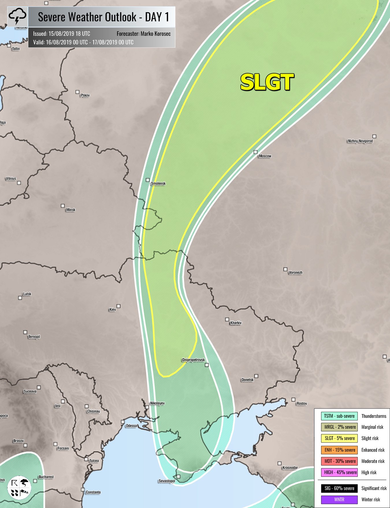
SLGT risk has been issued for NE Ukraine into W Russia with threat for severe storms, capable of producing severe winds, large hail, torrential rainfall and tornadoes. Organized storms are expected along the cold front, fueled by moderate MLCAPE and moderate shear. Supercells with large hail and damaging winds are possible.
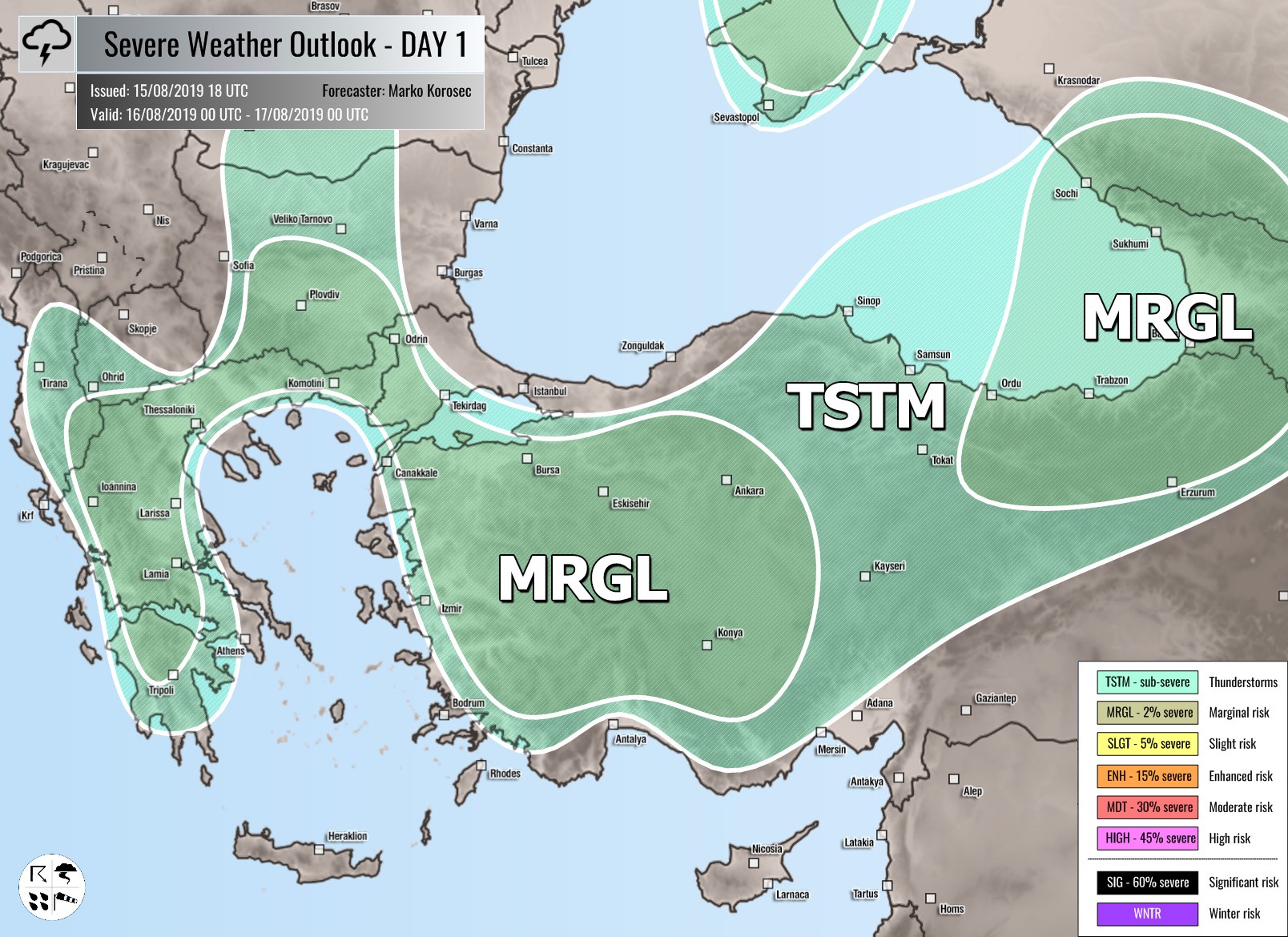
MRGL risk has been issued for S Balkans into Turkey and Georgia with isolated threat for severe storms, capable of producing severe winds, large hail and torrential rainfall.
TSTM risk areas have been placed where convective storms are likely to occur but should remain sub-severe.


