SYNOPSIS
A deep trough with a large surface cyclone continues over W Europe towards the Norwegian sea while ridge builds up over central Europe. A weakening upper low with a short-wave moves across the Black Sea region.
DISCUSSION
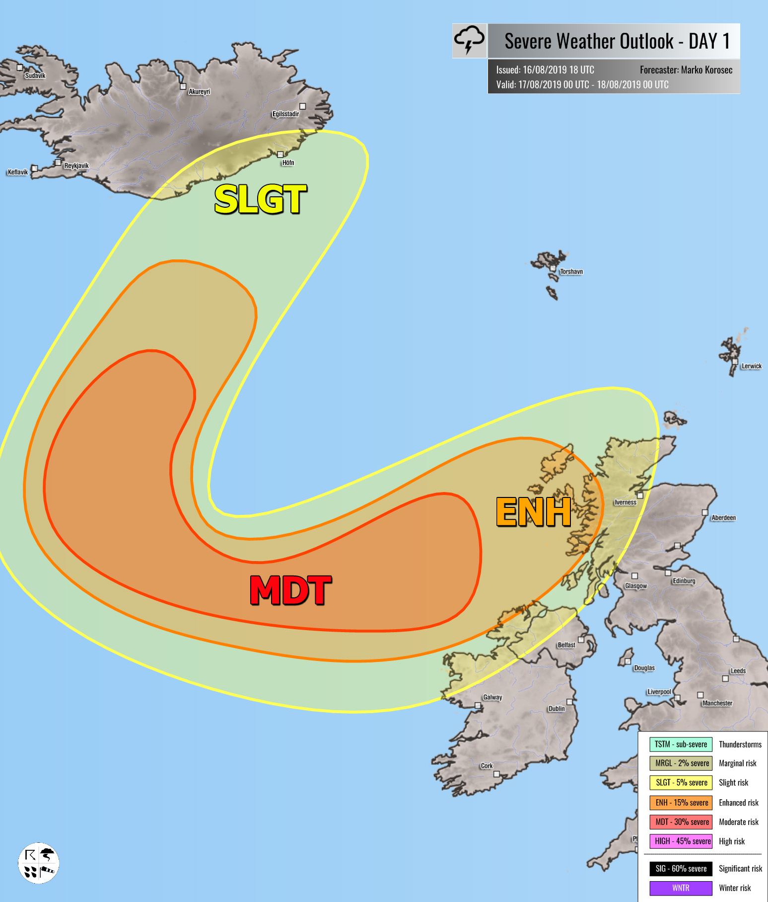
MDT / ENH / SLGT risks have been issued for SE Iceland into the N Atlantic, NW Ireland, Northern Ireland and W Scotland threat for severe to extremely severe non-convective winds with gusts in excess of 100-120 km/h locally. Windstorm is associated with the deep cyclone moving towards NE just north of UK. Peak gusts in excess of 120 km/h are expected to remain over the open waters of N Atlantic.
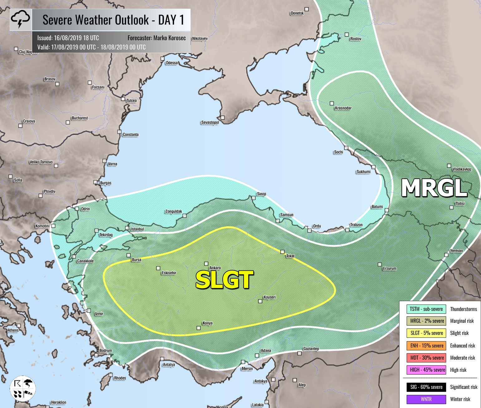
SLGT / MRGL risks have been issued for Turkey and Georgia with isolated threat for severe storms, capable of producing severe winds, large hail and torrential rainfall.
MRGL risk has been issued for N Morocco into NW Algeria with threat for isolated severe storms, capable of producing severe winds, large hail and torrential rainfall.
TSTM risk areas have been placed where convective storms are likely to occur but should remain sub-severe.


