VALID FOR 10-06-2014
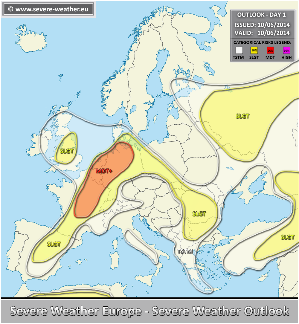
A MDT+ risk has been issued for E-CNTRL France, Benelux and W-N Germany with threats for large to very large hail, severe wind gusts, heavy rainfall and some marginal tornado threat. Another round of severe storms is expected starting by mid afternoon and a severe weather outbreak is likely towards the evening hours. Given the extremely unstable airmass coupled with moderately strong shear, discrete severe hailstorms with hailstones in excess of 6 cm in diameter are again quite possible across the MDT+ risk area. If storms merge into clusters in the evening, damaging winds and large hail will be primary threats overnight.
A SLGT risk has been issued for the areas surrounding the MDT+ risk, including NE Spain, W-CNTRL France, W Switzerland, parts of Germany and WSW Poland with threat for large hail, severe wind gusts and heavy rainfall. A SLGT risk has also been extended into E Balkans where some isolated severe storms are possible, enhancing large hail, severe winds and heavy rain threat.
A SLGT risk has been issued for central UK with threat for heavy rainfall, tornadoes, marginally large hail and wind gusts.
A SLGT risk has been issued for W Russia with threat for large hail, heavy rainfall and severe wind gusts.
A SLGT risk has been issued for E-CNTRL Turkey, Georgia and extreme SW Russia with threat for for large hail, heavy excessive rainfall and severe wind gusts.
A SLGT risk has been issued for N Algeria and NE Morocco with threat for for large hail, heavy rainfall and severe wind gusts.
