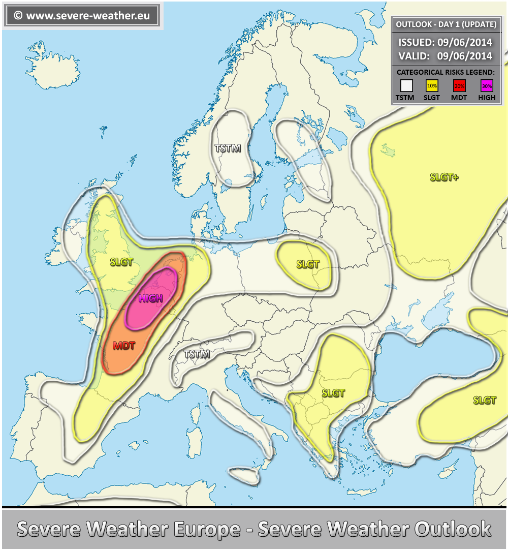
VALID FOR 09-06-2014 – UPDATE
Refer to the primary outlook for the synopsis details:
*** A severe weather outbreak appears likely across NE France into Belgium and parts of the Netherlands later this afternoon and evening hours. ***
A HIGH risk has been issued for NE France, Belgium and parts of the Netherlands with threat for very large hail, severe damaging winds, tornadoes and torrential rainfall. Strongly to extremely unstable environment, coupled with moderately strong shear and strongly helical environment is supportive of an outbreak of intense severe storms later today. Despite models overdoing SFC dewpoints, it apprears likely that at least 2500-3500 J/kg of MLCAPE will become available by mid afternoon before additional storms will initiate and rapidly organize into intense supercells within the favorable 50-60 kt deep layer shear across the risk area. Expect storms to continue forming with higher coverage / intensity in late afternoon and evening hours when merging into large clusters is likely while spreading NNE-wards. While very large hail, tornadoes, damaging winds and torrential rain are likely with discrete / isolated supercells, once the clusters form, severe damaging winds and large hail will be the main threat along the bowing line segments or possible bow echo in the evening hours.
A MDT risk has been issued for surrounding areas of HIGH risk where less coverage, but still intense storms (supercells) are likely. Large to very large hail, severe winds, torrential rain and some tornado threat seem possible.
No changed have been done to the rest of the primary outlook.

