SYNOPSIS
A large upper trough persists over W Russia while a long-wave trough with an embedded deep low is located over N Atlantic and W Europe. An upper ridge is located over the Mediterranean. In between, a strong SW-erly jet stream is extended across central Europe.
DISCUSSION
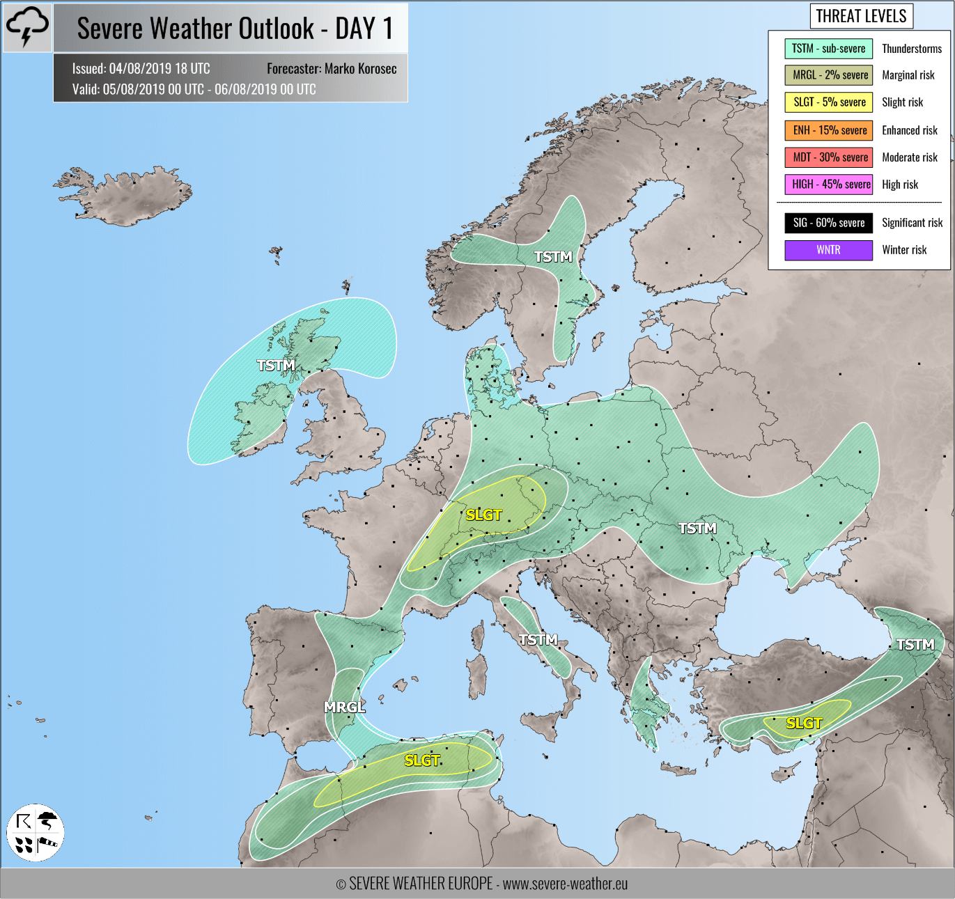
SLGT risk has been issued for E France, S Germany, N Switzerland into W Czechia with threat for isolated severe storms, capable of producing severe winds, marginally large hail and torrential rainfall. Marginal to moderate MLCAPE within sheared environment could support a few isolated organized storms in the afternoon hours.
SLGT risk has been issued for S Turkey with threat for severe storms, capable of producing severe winds, large hail and torrential rainfall. Instability with MLCAPE near 1500-2000 J/kg and near 40 kt of bulk shear should result in a few supercells with large hail threat.
SLGT risk has been issued for NE Morocco across N Algeria into N Tunisia with threat for severe storms, capable of producing severe winds, large to very large hail and torrential rainfall. Supercells are likely to develop under strong instability and shear over the region and could locally deliver very large hail and severe winds.
MRGL risk has been issued for E Spain with isolated threat for severe storms, capable of producing large hail and severe winds.
TSTM risk areas have been placed where convective storms are likely to occur but should remain sub-severe.