SYNOPSIS
An upper low is centered over the S Balkan peninsula, surrounded by high-pressure systems / ridging pattern across SW, central, east and north Europe. A deep trough is located over the N Atlantic and W Europe. A surface low develops over N France with a surface cold front extended south and a diffuse warm front to its NE across Benelux and N Germany.
DISCUSSION
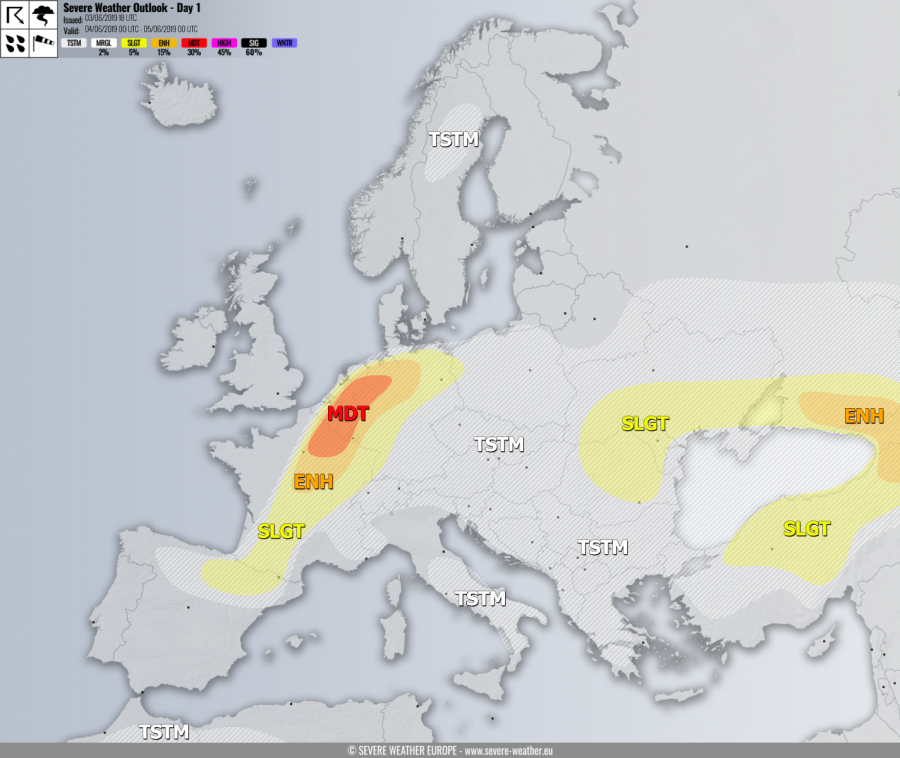
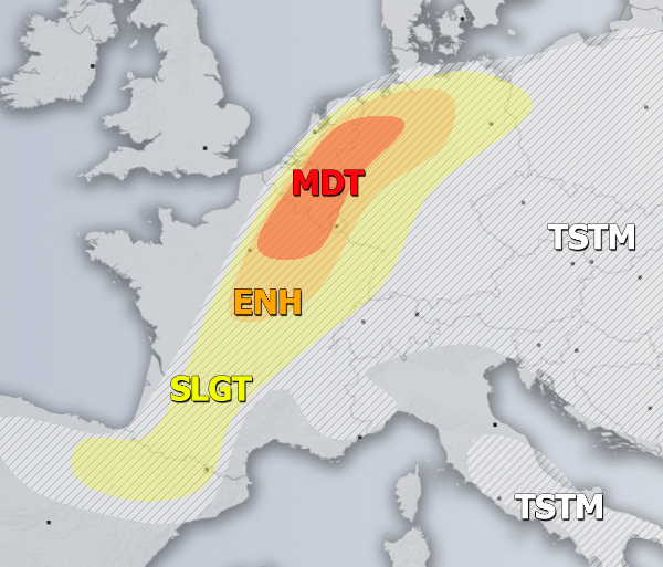
MDT / ENH risks have been issued for NE France, Benelux into NW Germany with threat for severe storms, capable of producing severe winds, tornadoes, large to very large hail and torrential rainfall with flash floods. A rather widespread convective activity is expected within the strongly unstable and moderately sheared environment. A short-wave with large-scale forcing arrives during the afternoon and evening hours, providing lift for discrete supercell storms initiation along the surface front. While large hail and torrential rainfall will be the primary threats, an enhanced near-surface wind field should provide favorable LL shear and helicity for tornadic storms as well. Especially over the northern half of the MDT risk area. Storms could merge into a cluster with bowing segments towards the evening hours.
SLGT risk has been issued for areas surrounding the MDT / ENH risks including W/N Germany, SW and central France into NE Spain where more isolated threat for severe storms exists. These storms should be capable of producing large hail, severe winds and torrential rainfall.
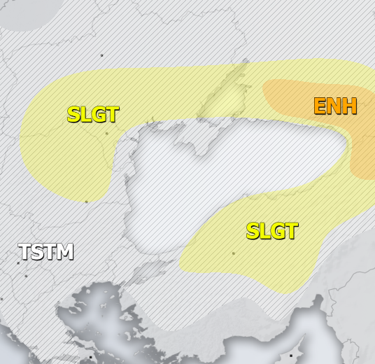
ENH risk has been issued for NE Turkey, Georgia into SW Russia with threat for severe storms, capable of producing severe winds, torrential / excessive rainfall and large to very large hail. A strong instability overlapped with moderate shear should result in widespread organized storms with local flash floods as well.
SLGT risk has been issued for areas surrounding the ENH risk including N Turkey, S Ukraine into Moldova and NE Romania with more isolated threat for severe storms, capable of producing torrential / excessive rainfall, large hail and severe winds. Slow moving storms should develop flash floods threat as well.
TSTM risk areas have been placed where convective storms are likely to occur but should remain sub-severe.
Mesoscale discussion:
UPDATE: Severe thunderstorms in parts of N-CNTRL France and Benelux today – June 4, 2019


