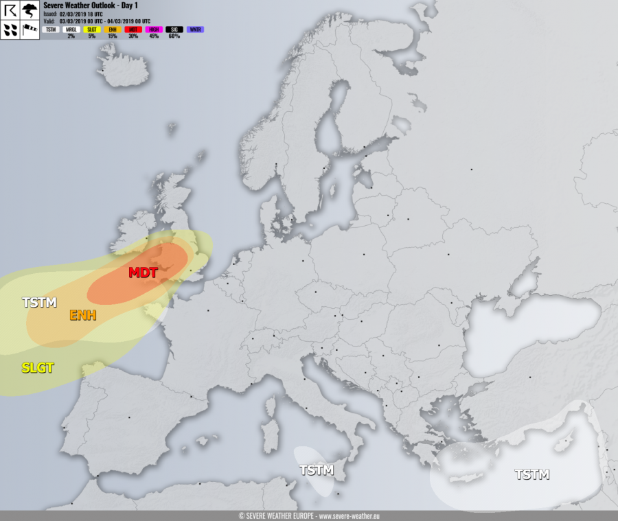
VALID FOR 03-03-2019
SYNOPSIS
An upper ridge is placed across southwestern and central Europe while two short waves are located in the southern and eastern Mediterranean. One wave crosses Sicily while another ejects into the Middle East. A very deep trough is nearing the western Europe and pushes an intense surface cyclone into the British Isles and Ireland.
DISCUSSION
MDT risk has been issued for southwest England, Wales and further southwest into the Atlantic ocean with threat for severe to extremely severe wind gusts, locally in excess of 130 km/h. Very heavy rainfall is expected near the center of the low across southeast Ireland and Wales in the afternoon and evening hours. High waves are expected along the coast as well.
ENH risk has been issued for areas surrounding the MDT risk including extreme southeast Ireland and northwest France with threat for severe to extremely severe winds, locally reaching 110-130 km/h. High waves are expected along the coast as well.
SLGT risk has been issued across the southern Ireland, England, Wales, northwest France, the Bay of Biscay and the extreme northwest Spain with threat for severe winds – gusts up to 90-120 km/h are possible locally, especially if storms develop and contribute to stronger downward momentum for higher wind gusts.
TSTM risks have been issued for the Bay of Biscay, southern Tyrrhenian sea into west Sicily and across the eastern Mediterranean where storms are likely.
Mesoscale discussion:
Another deep cyclone will cross the British Isles on Sunday, March 3rd
