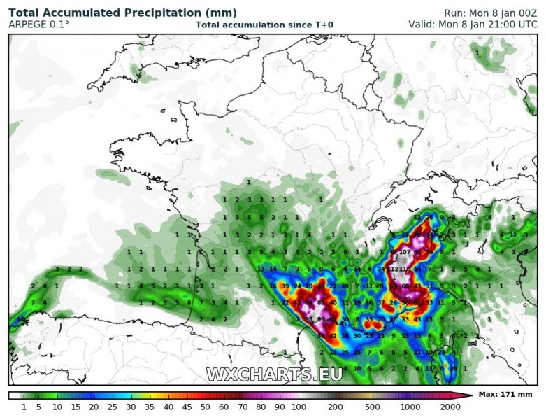
The expected episode of intense rainfall over southern France has started. A persistent line of thunderstorms is ongoing between Marseille and Montpellier. Heavy rainfall is expected with these thunderstorms. Also, there is enhanced threat for marginally large to large hail and tornadoes.
Lightning activity over southern France, mid-morning, Monday. Follow these storms on radar. Map: Blitzortung.
High-resolution models indicate up to around 100 mm of rainfall locally by the late afternoon and early evening. Expect local flooding.
Amount of fresh snow across the Alps by early Tuesday. ARPEGE model guidance. Map: Wxcharts.eu.
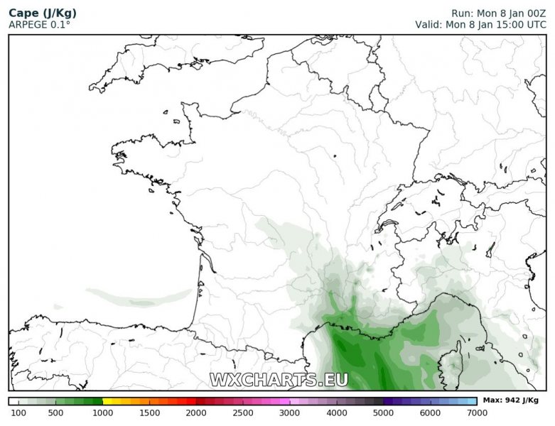
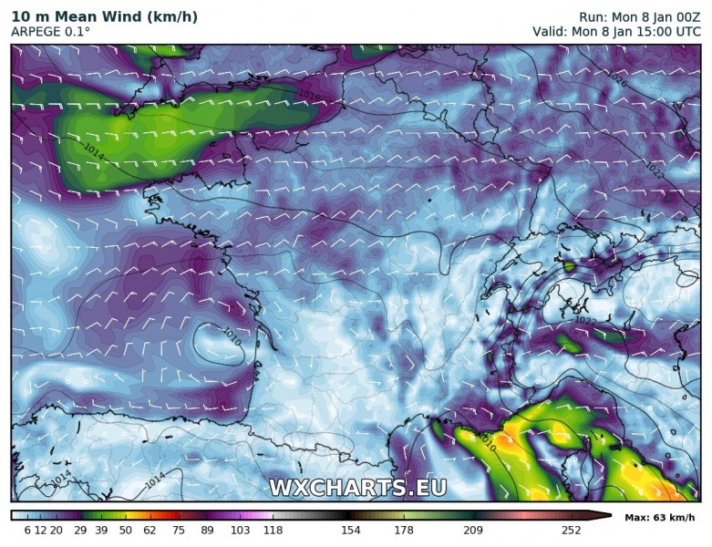
Also, up to 500-800 J/kg MLCAPE is available, overlapping with quite impressive shear, up to 40-50 kt; the environment is certainly supportive of rotating updrafts within the line of training cells. In addition to persistent heavy rainfall from successive training cells, there is enhanced threat for marginally large to large hail with these storms. Strong low level southeasterly and easterly winds enhance low level shear. There is good overlap with steep low-level lapse rates, enhancing the threat for tornadoes.
MLCAPE off the coast of southern France in mid-afternoon, Monday. ARPEGE model guidance. Map: Wxcharts.eu.
Surface winds in the mid-afternoon, Monday. ARPEGE model guidance. Map: Wxcharts.eu.


