Cyclone Ophelia is moving northeastward, affecting parts of the UK and Ireland with storm force winds. It is gradually weakening.
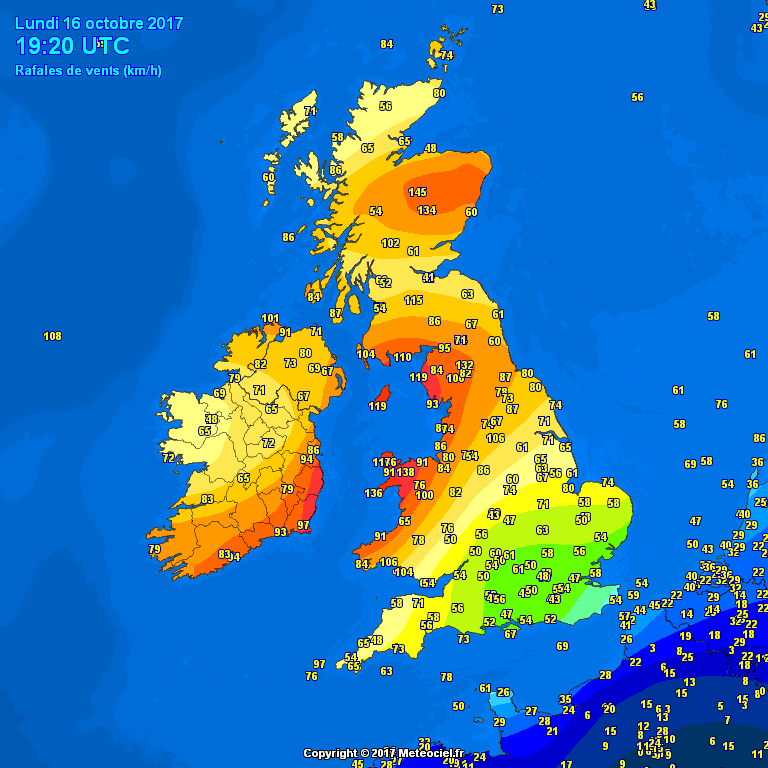
Peak winds of post-tropical cyclone Ophelia have now shifted over the northern and central part of the British Isles, peak gusts of up to 145 km/h reported in Scotland, 136 km/h in Wales.
Current peak wind gusts across the British Isles and Ireland. Map: Meteociel.fr.
Short recap of Ophelia’s landfall
Hurricane Ophelia transitioned into a post-tropical cyclone late yesterday / early today, heading for landfall in SW Ireland in the early afternoon.
[fb_plugin post href=https://www.facebook.com/severeweatherEU/videos/2099598773596546/]
[fb_plugin post href=https://www.facebook.com/severeweatherEU/videos/2099612626928494/]
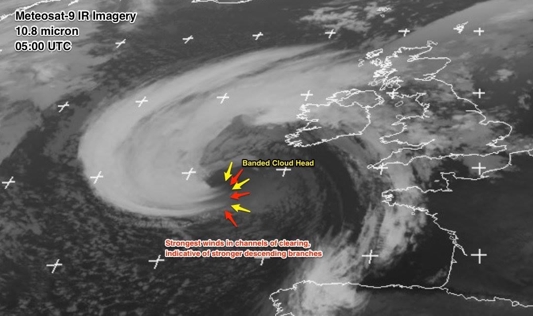
A sting jet likely developed just before landfall, with peak wind gusts reavh 191 km/h in Ireland’s southernmost point, Fastnet Rock.
Satellite analysis of post-tropical storm Ophelia rapidly approaching Ireland this morning. Notice the branches of “banded cloud head” pushed towards the SW Ireland, indicating that the sting jet structure is likely developed. Source: EUMETSAT.
Some preliminary peak wind gust speed values so far:
- 191 km/h – Fastnet Lighthouse
- 158 km/h – Glenanne (UK)
- 155 km/h – Roches Point
- 145 km/h – Cairngorm (UK)
- 136 km/h – Aberdaron (UK)
- 135 km/h – Bouee 60023 (off SSE Ireland)
- 134 km/h – Cairnwell (UK)
- 125 km/h – Isle of Man (UK)
- 124 km/h – Cork Airport
- 123 km/h – Dundernnan (UK)
- 119 km/h – Valentia
- 119 km/h – Sherkin Island
- 119 km/h – Saint Bees Head (UK)
Stay tuned for further updates.

