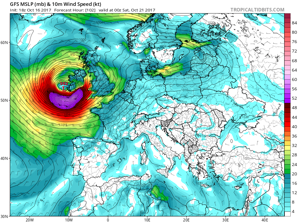
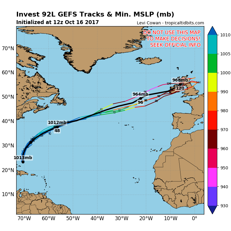
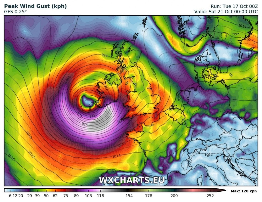
Interestingly, latest GFS model guidance indicates development of a new tropical depression that may affect the British Isles and Ireland. The system, designated Invest 92L is currently located east of the Bahamas and will track ENE-wards towards across the Atlantic in the next 72-96 hours. Current model guidance suggests the system could produce strong storm to hurricane winds in the vicinity of Ireland towards the end of the week.
While it is too early for detailed forecasts and future model runs may change significantly, the system definitely warrants monitoring. We will be providing further updates.


