A Medicane (Mediterranean tropical-like cyclone) has formed in the Ionian sea and is affecting the region with increasingly strong winds. We take a look at the latest high-resolution model guidance.
Latest high-resolution model gudiance is in good agreement for a slow loop inside the Ionian sea and strengthening of the system. All models indicate the system moving eastward towards the western coast of Greece tomorrow.
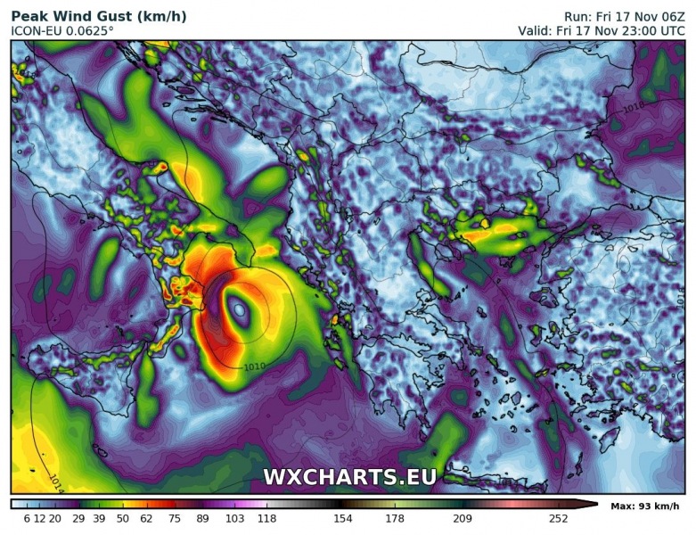
Latest ICON model guidance indicates the system strengthening today just off the southern coast of Italy and then moving southeastward across the Ionian sea tomorrow, while strengthening. Peak strength is indicated just before landfall over islands Kefalonia and Zakynthos, with winds gusting up to 120-130 km/h.
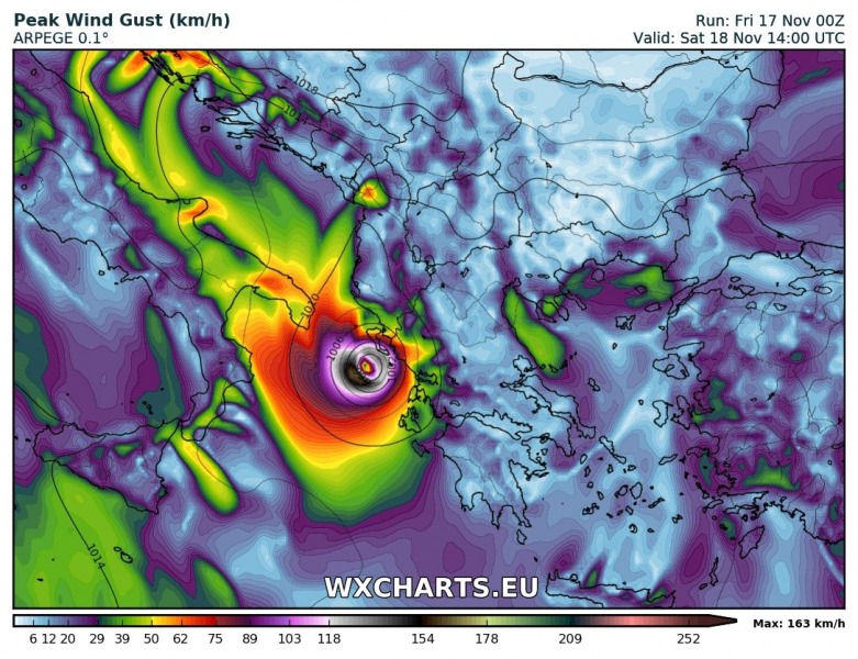
Latest ARPEGE model guidance has the system rapidly and very impressively intensifying later today and tomorrow as it moves from western across central Ionian sea. Peak wind gusts increase from 100 km/h today in the afternoon to 140-150 km/h by Saturday morning and up to nearly 170 km/h at landfall, currently projected just south of Corfu Island.
Current HIRLAM model guidance has the system strengthening just east of Calabria today and moving across the central into southeastern Ionian sea while strenghtning to peak sustained winds of over 100 km/h.
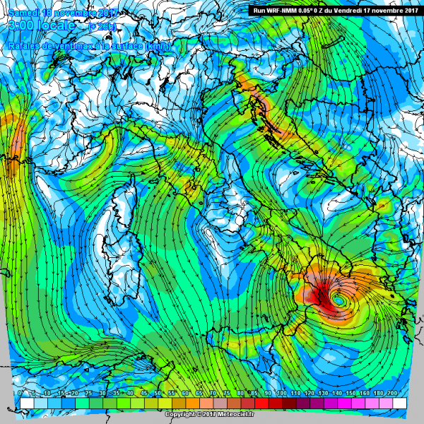
Current WRF-NMM model guidance indicates a similar track to HIRLAM, however, with lower expected maximum wind gusts (up to 80-90 km/h).
Stay tuned for more details as the system evolves today and tomorrow!


