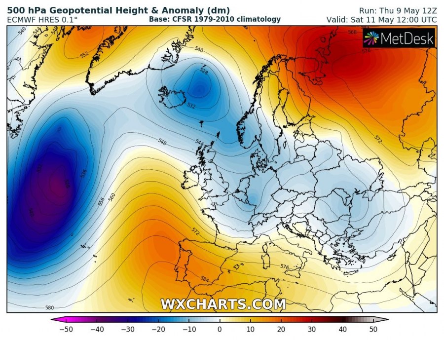
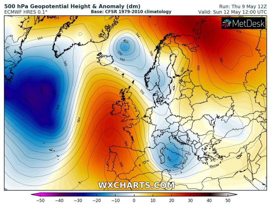
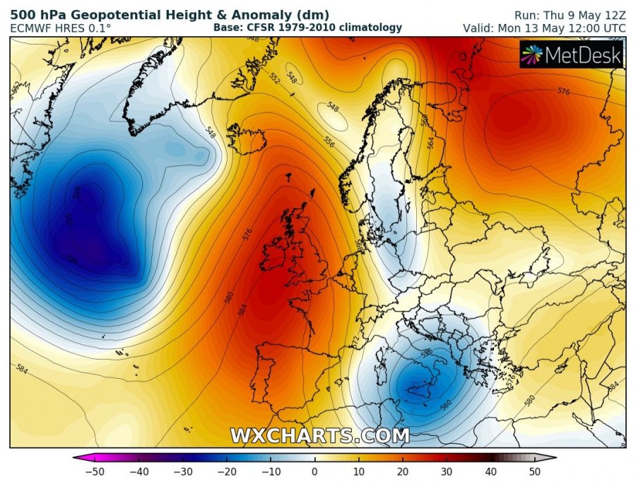
Believe it or not, significant cold outbreaks simply do not appear to want to stop affecting Europe this spring! Yet another deep trough/low is shaping up for central Europe early next week, delivering very cold airmass far south into the Mediterranean and the Balkans. Only a good week after the record-breaking cold outbreak last week. It would not be particularly surprising to see snowfall in lowlands and damaging frost again!
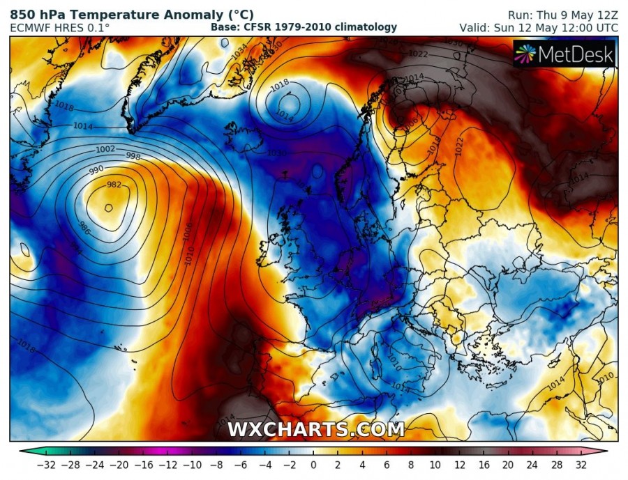
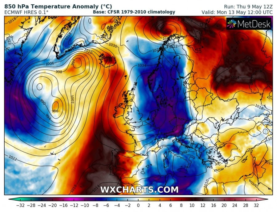
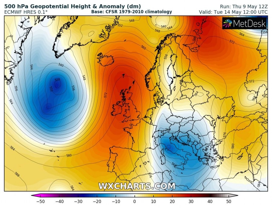
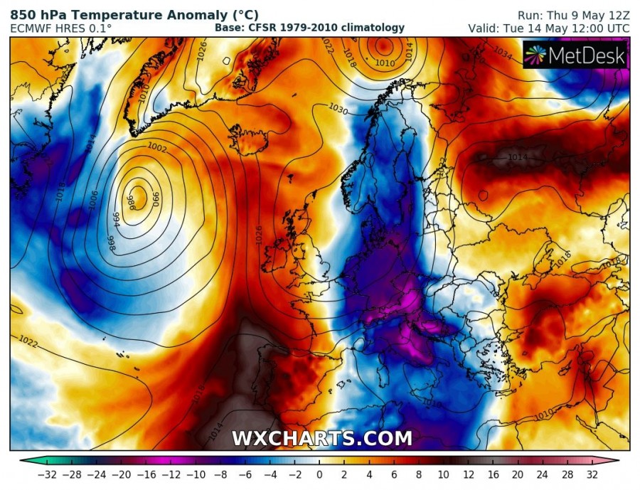
The now well established pattern dynamic is best visible in 850 mbar temperature anomaly maps. The very cold airmass develops on the eastern flank of a strengthening upper ridge across western Europe and the North Sea on Saturday and Sunday. A very significant cold outbreak then pushes towards continental Europe, with a strongly meridional northerly flow as a powerful upper ridge establishes over western Europe and the north Atlantic. By Monday, the upper ridge pushes also into northern Europe and closes the pattern with a large cutoff low developing into south-central Europe. The cold airmass is already overspreading Mediterranean by this time, the lowest temperatures at mid-level are expected on Tuesday. There may well be snowfall very low around the Alps and the WNW Balkans. The cold outbreak starts weakening through mid-week, fortunately. Meanwhile, the upper ridge pushes into the Arctic region.
In the mean time, it will remain very warm / hot over the Iberian peninsula where a very first heat wave of the year is expected to develop, see details:
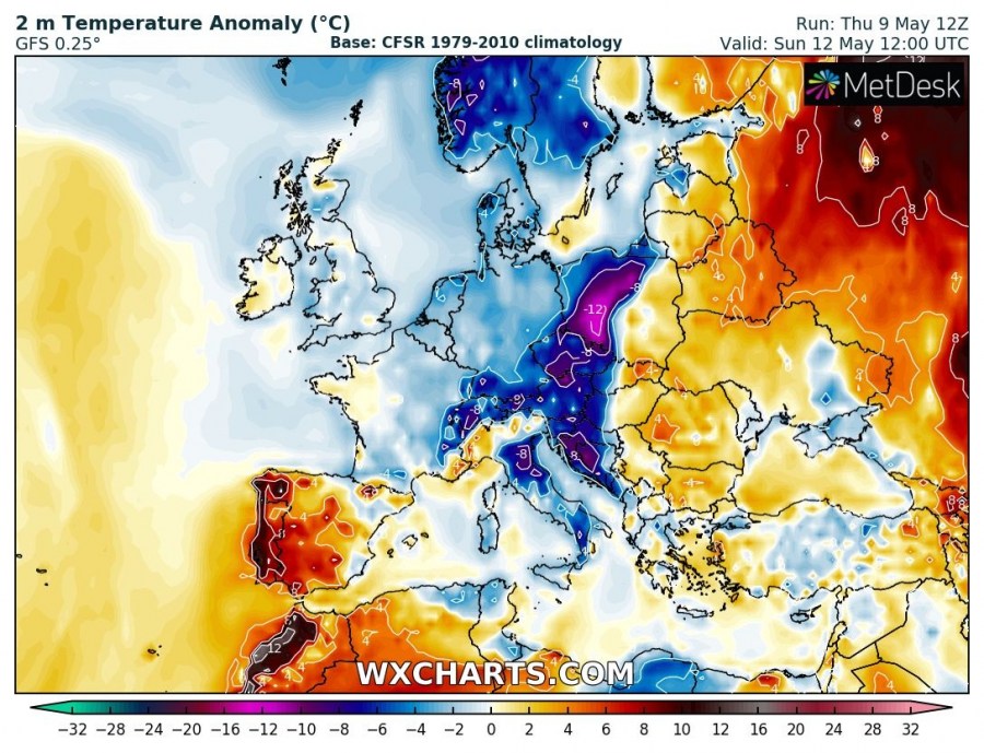
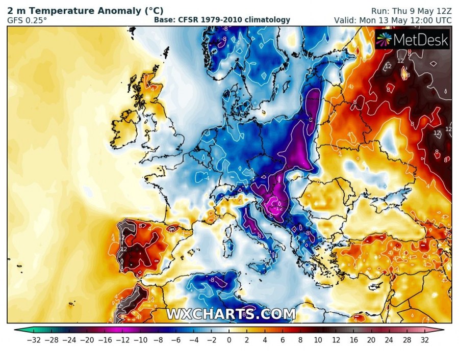
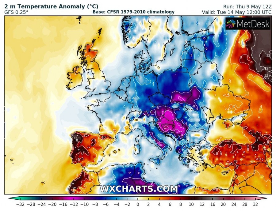
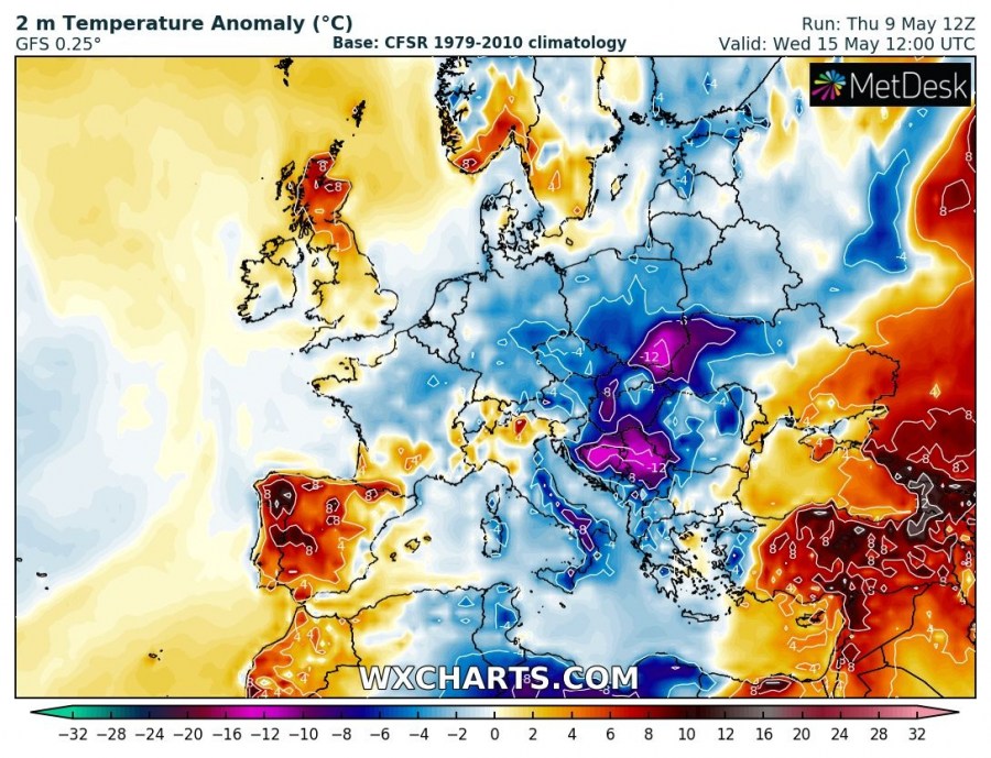
Looking at the 2 m temperature anomaly we can see very extremely anomalies developing during the daytime hours through Sunday and Wednesday.
The very cold airmass will spread across eastern Germany, the Czech Republic and western Poland towards Austria and NW Balkans on Sunday. It continues spreading across the whole of Poland on Monday, as well as across W Balkan peninsula and partly over Italy. On Tuesday, the peak of this cold outbreak is reached, centered over the Balkans with temperatures up to 15 °C below average for this period! Cold airmass also spreading into the S Mediterranean. Through mid-week the cold will start diminishing, but Wednesday still remains very cold over the Balkan peninsula and towards Poland, as well as Italy and the south-central Mediterranean.
Days from Tuesday to Thursday could potentially again bring damaging to locally devastating morning frost in parts of Europe. Indeed this strongly depends on clearing skies and position of the high-pressure system, but the potential for a major event is definitely there. Stay tuned for additional updates in the coming days!
See also – weekly pattern evolution:
