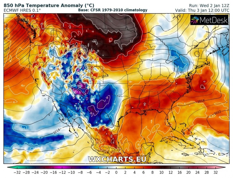
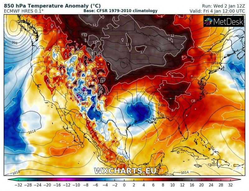
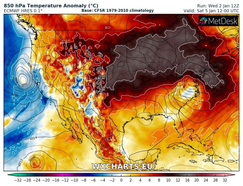
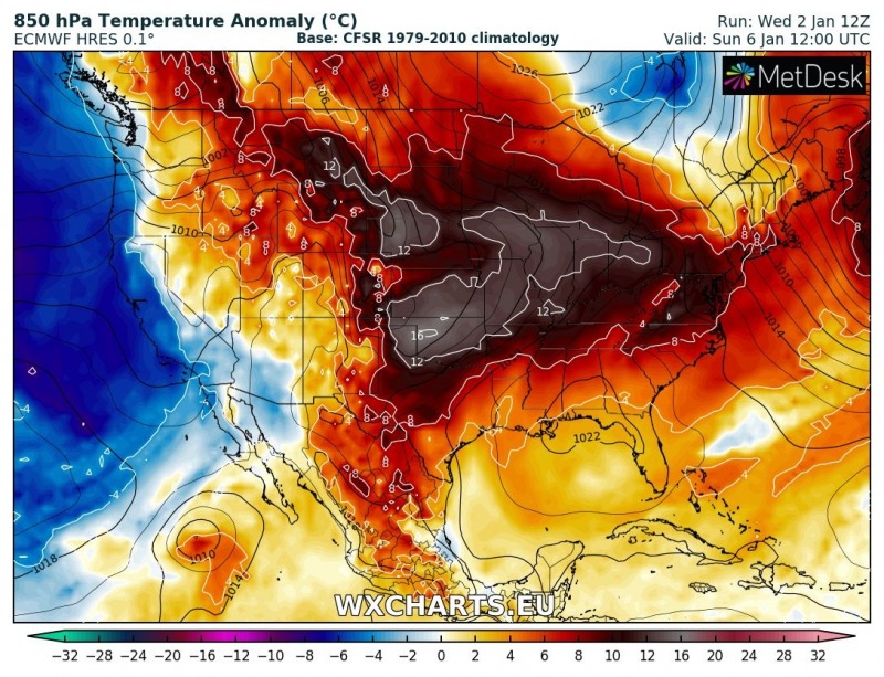
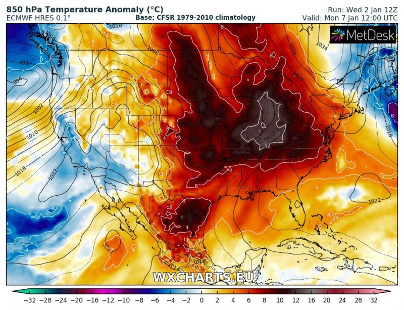
Europe is currently under the effect of a new Arctic outbreak, being pushed across the eastern half of the continent. Mid-range trends suggest the effect of the Polar Vortex split will take place through mid January. Across the Atlantic, the opposite pattern evolution is unfolding – significantly warmer weather than average across the United States!
Let us take a look over the latest model trends through the rest of this week into early next week. A strong ridge develops over the western Continental US and gradually moves towards east until Monday, and general southwesterly flow establishes across most of the country. This results in impressively warm weather with daily average temperatures 10-15 °C warmer than normal for early January.
The effect of the Polar Vortex split is not yet visible on the global models, usually takes 2-3 weeks, depends where the vortex splits – stay tuned for further updates!
