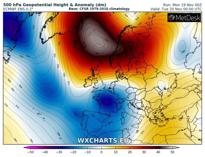
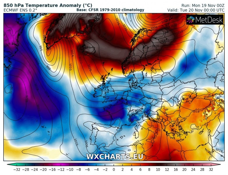
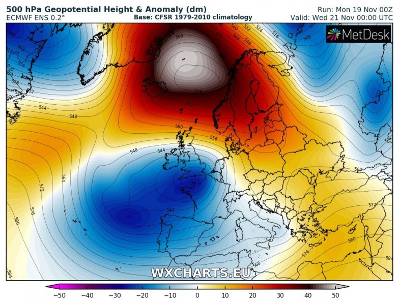
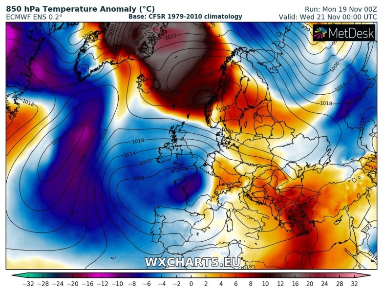
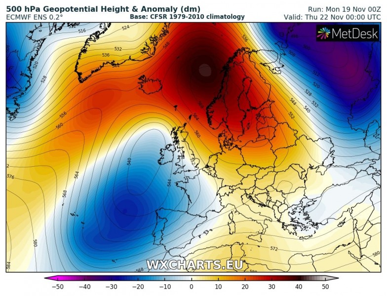
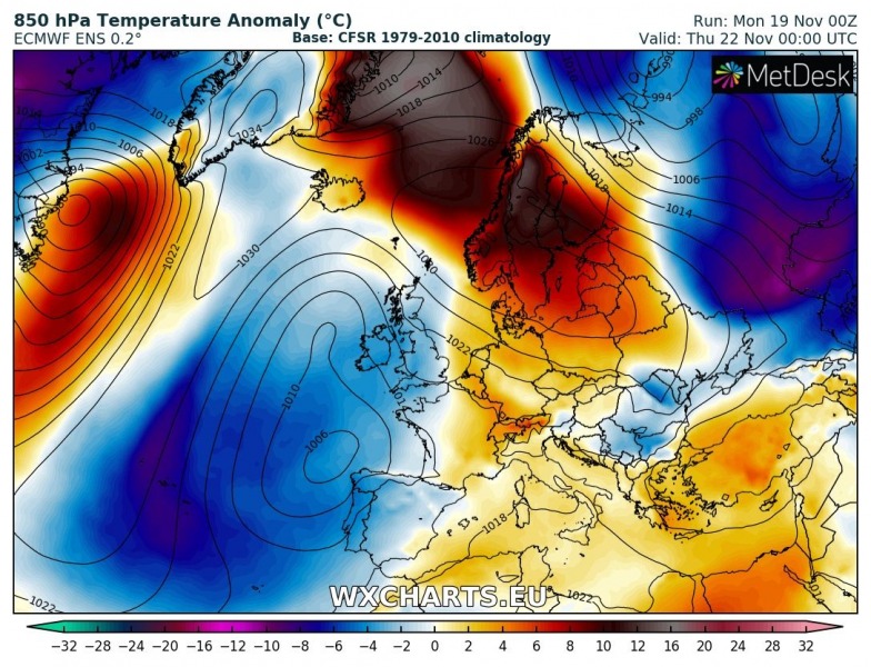
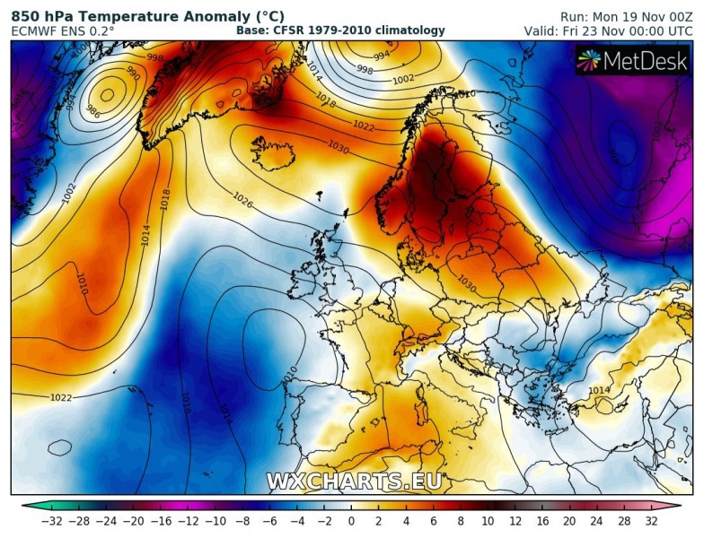
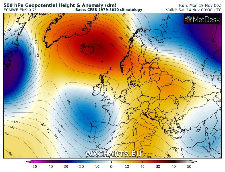
The pattern across Europe this week will be quite dynamic compared to the previous week, as strong ridging dominates the northern parts and allows a more zonal flow with strong system pushed east across our continent from the Atlantic ocean. Overall, the Arctic region will remain very warm while changing weather with cold and warm periods is expected across west-central Europe and also in the Mediterranean.
Tuesday, Nov 20th
A powerful ridge is centered over the Arctic region while a deep trough / upper low is centered over France. This results in cyclone with strong moist advection pushed into the northern Mediterranean and NW Balkan peninsula where heavy snowfall and blizzard conditions are expected. Very warm day is expected across Iceland, most of Scandinavia into NW Russia. Cold day expected across the west-central Europe.
Wednesday, Nov 21st
The pattern remains very similar to the day before, an extensive strong ridge dominates the Arctic region while a large upper trough maintains over the western and southwestern Europe. Extreme, near 15 °C above normal temperatures develop over Greenland. Significantly colder weather than average remains over the British Isles, Ireland and France while warmer weather returns into the northern Balkan peninsula and eastern Europe. Excessive rainfall threat develops over the central Italy and SW Balkan peninsula. This will also start rapid melting of most of the fresh snow.
Thursday, Nov 22nd
The strong ridge over the Arctic region translates towards Scandinavia while gradually weakening, but very warm airmass remains and also affects large part of Scandinavia. The large upper low over WSW Europe begin weakening, warmer weather also returns into central Europe.
https://www.severe-weather.eu/calendar-2019/
Friday, Nov 23rd
While the upper low over WSW Europe continues weakening, ridging from Arctic region and the northern Europe expands towards east-central Europe. Meanwhile, ridging also develops over the south-central Medtierranean.
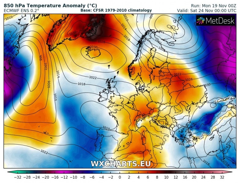
Saturday, Nov 24th
Very similar situation over the weekend as on Friday, ridging dominates north, east, central and southern Europe while weak upper low remains over the Bay of Biscay and Iberian peninsula. Warm advection maintains above normal temperatures ahead of the trough towards central Europe. A short upper trough pushes across NW Russia and brings colder weather into the northern Scandinavia again. Meanwhile, warm weather spreads across large part of Europe.
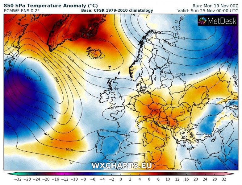
Sunday, Nov 25th
An upper ridge over the central Europe weakens and weak upper low pushes in from the west. Ridge over the Mediterranean pushes into the Balkan peninsula. Colder weather spreads across the Iberian peninsula into the western Mediterranean while the Russian trough brings colder weather across most of Scandinavia and NE Europe.
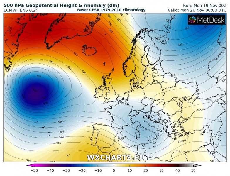
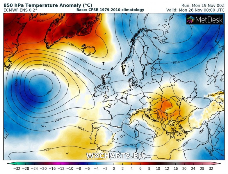
Monday, Nov 26th
Upper low / trough enters Mediterranean and brings dynamic weather and more rainfall into the region. As well as colder weather. Ridge to its east vanishes while ridging remains over the Arctic region.
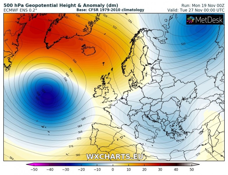
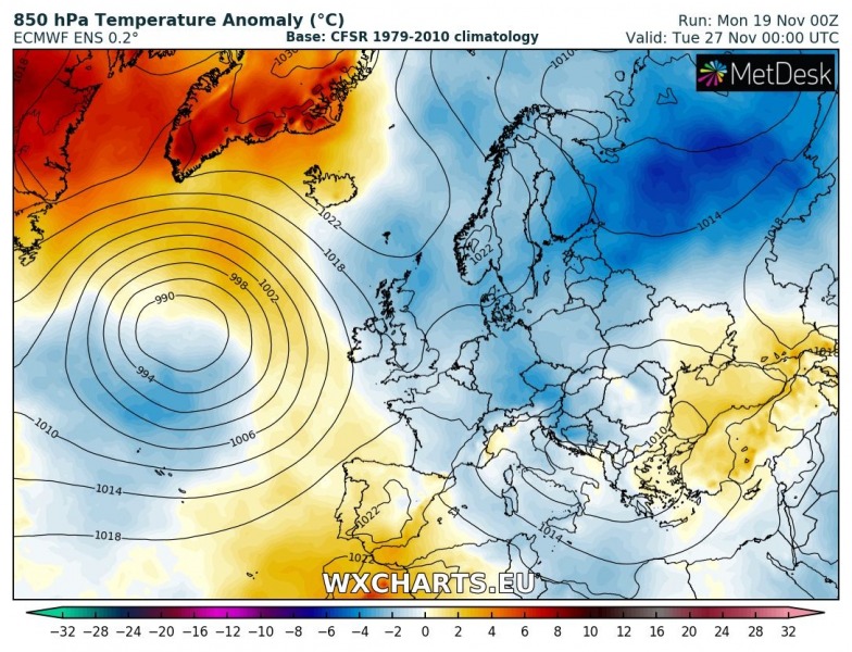
Tuesday, Nov 27th
Trough over the Mediterranean expands into the Balkan peninsula as well, bringing unsettled conditions there. While strong ridging remains over the far N Atlantic and Arctic region, a new deep trough/low develops south of it and pushes towards the western Europe.
As we can see, this week will be quite dynamic over the large part of Europe and could potentially bring dangerous severe weather into some areas. From heavy snowfall and blizzard conditions across NW Balkan peninsula tonight, but also excessive rainfall threat across central Italy and SW Balkan peninsula by mid week. Another more dynamic event seems more likely over the weekend into early next week across the Mediterranean and Balkan peninsula region – more on this later this week.
