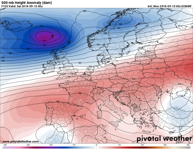
Our continent will mostly be dominated by a strong ridge across south-central Europe this week, while deep systems with dynamic weather are expected across the northern parts of the continent. The main features of interest will be a large upper low over SE Europe and a weak upper low on the western side of the omega blocking ridge, over the Iberian peninsula.
Tuesday – Sept 11th
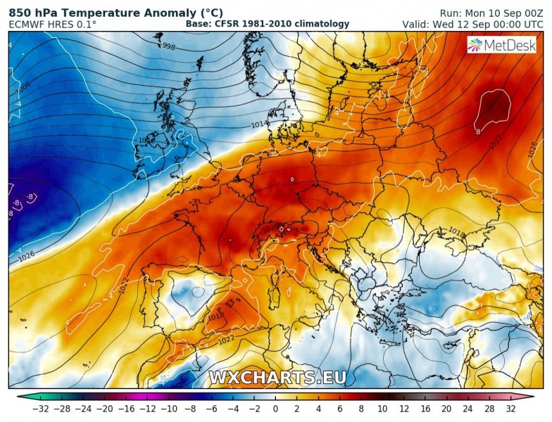
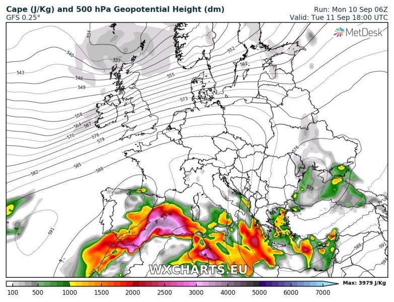
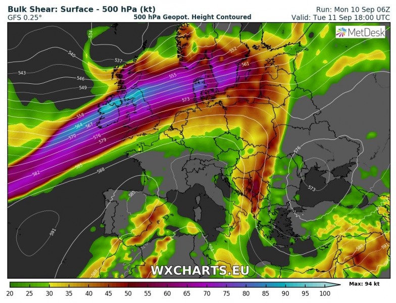
Early this week, the pattern is characterized by a strengthening upper ridge from western into central Europe and a deep trough over the N Atlantic. This will bring much warmer weather again. Two weak upper lows are the focus for convective weather: one is over the Iberian peninsula and the other one is the developing large low over the SE Europe – Black sea and Turkey. Both will bring unsettled conditions with severe weather possible, especially across E Spain and SW Mediterranean, as well as across the Aegean sea and E Mediterranean.
Thursday – Sept 13th
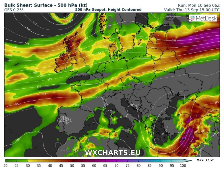
The deep low from N Atlantic will push across northern Europe while an upper ridge also expands into eastern Europe. In response to this, the upper low over SE Europe pushes further south and deepens. Moderate instability will develop under the upper low while strong shear will be available on its eastern flank. This development will become favorable for organized severe storms across eastern half of Turkey, Cyprus and eastern Mediterranean region towards the Middle East.
Saturday/Sunday – Sept 15/16th
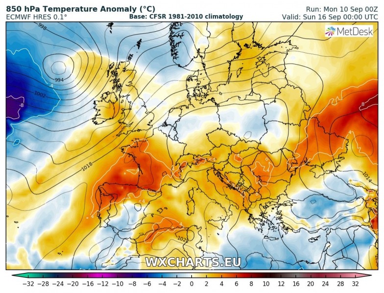
Over the weekend, the ridge gradually weakens and the pattern becomes more zonal with westerly winds across the northern half of Europe and partly across the central Europe. The upper low over the SE Europe diminishes while slowly moving into SW Russia. Meanwhile, a weak low deepens over Morocco and S Iberia and results in strong to extreme instability to build up across W Mediterranean and SE Spain. Together with improved wind shear, conditions will become favorable for organized storms – especially slow moving clusters with flash floods threat.
Monday – Sept 17th
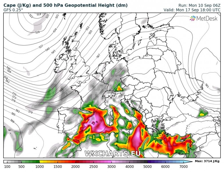
Early next week, the ridge across Europe strengthens again and temperatures could again rise to close to 30 °C in some places. To the west, the Atlantic becomes more active with a deep trough pushed far south towards the Azores which results in strong warm advection into central and north Europe. A frontal zone will develop in between and moisture return is likely under the “Spanish plume” across parts of west-central Europe.
Wednesday – Sept 19th
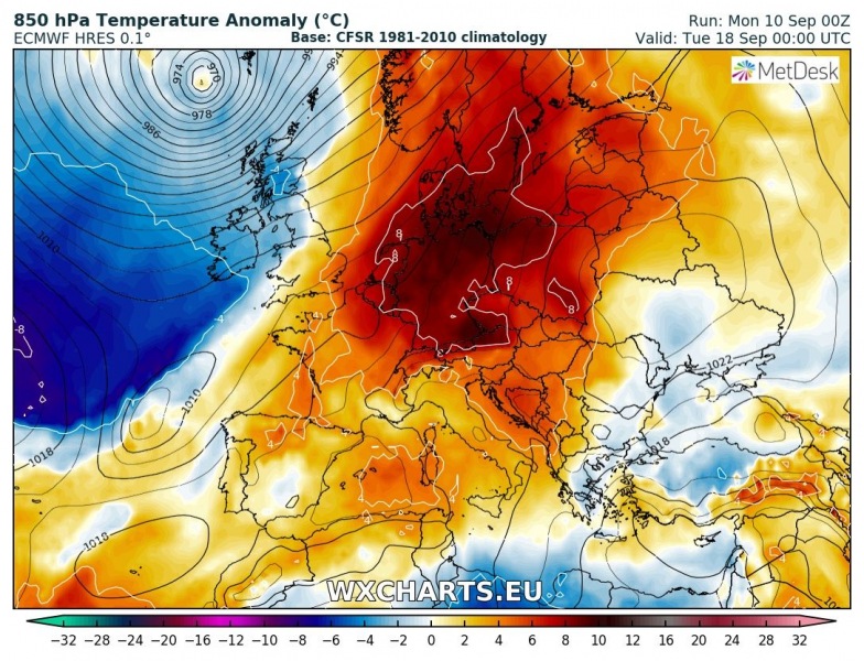
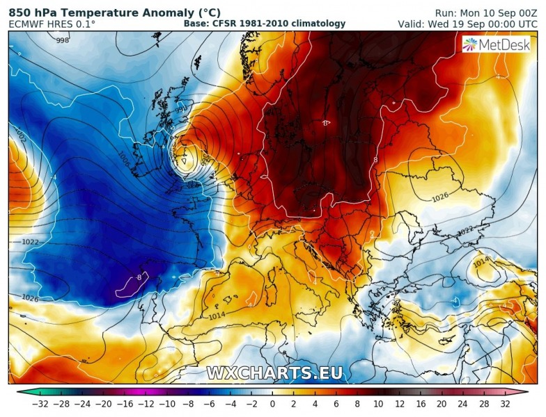
In response to the deepening trough over western Europe, the upper ridge across central Europe moves into NE Europe and strong warm advection is pushed into Scandinavia. Very warm days could develop. The deep system over WSW Europe will push a strong cold front into central Europe next week. However, a lot of uncertainity regarding the evolution exists as the event is still more than a week ahead.
Here is the GFS model 850 mb temperature trends animation through the next 10 days, warm period for much of Europe. Even some hot days are expected across south and central Europe this week.
We are monitoring the pattern evolution on daily basis, so please refer to other more detailed posts on various parts of Europe.

