A more dynamic weather pattern is now underway across Europe and the North Atlantic this week. Currently, there is a temporal strong upper ridge expanding across the continent, resulting in a very significant warm advection towards Scandinavia. 10-15 degrees C warmer weather will push across parts of Europe and towards the Arctic region. In its wake, cold weather will push into eastern Europe towards the weekend.
DYNAMIC PATTERN OVER EUROPE
We have been experiencing quite a stable pattern since late October in many parts of Europe, but this has changed over the last few days. A more dynamic North Atlantic has brought some troughs also into continental Europe this week.
Although this means the weather will be changing more often, it does bring some significant anomalies in both the warm and cool sides.
Wednesday through Thursday (Nov 18/19th)
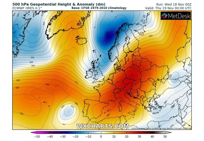
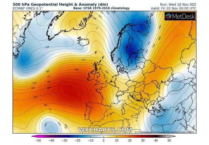
The overall pattern over Europe hints at a developing strong upper-level ridging today into tonight, centered over the east-central part of the continent. At the same time, a weak ridge over Greenland and Iceland helps the air mass advection from the Arctic region on its eastern side into the northeast Atlantic.
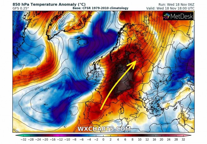
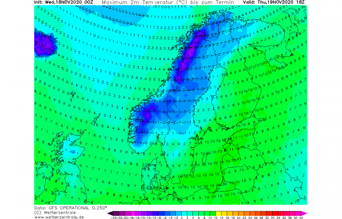
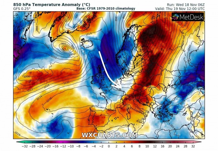
Under the ridge, a very significant warm advection is underway across much of the European continent on Wednesday. Spreading towards the north-northeast. The advection brings temperatures more than 12 °C warmer far north.
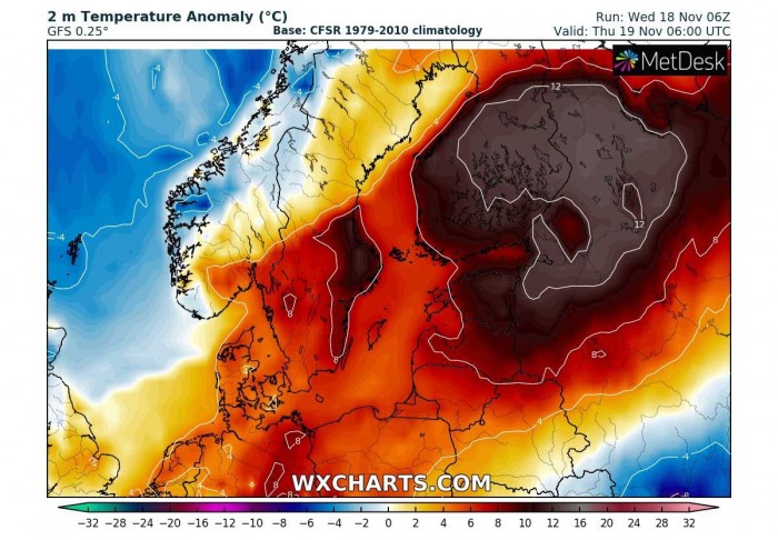
The advection will also bring significantly warmer air mass into Scandinavia, with more than 10 °C temperatures spreading into the Baltic region and southern Finland as well.
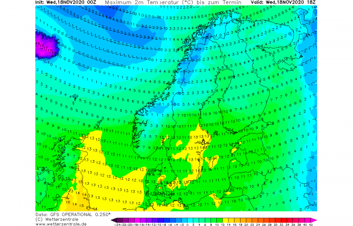
Southwesterly winds will help the temperatures to rise much higher also in the lowest parts, as thermal inversions will be broken. This is already happening today, on Wednesday, as low to mid-10s °C are seen over Sweden, around 10 °C over southern Finland and the Baltic region as well.
Another warm day is then also expected tomorrow, with slightly lower peak temperatures, but it will be around 10 °C also in central Finland and northwest Russia.
Meanwhile, the much colder air mass starts spreading into western Scandinavia from the northwest.
Friday, Nov 20th
Towards Friday, the ridge is soon interrupted by a new trough moving across northern Europe, delivering much colder weather there again. Strong ridge develops into west-southwest Europe again.
The warm advection will, however, continue further east-northeast on Friday, reaching western and northwestern Russia as well.
But a much colder air mass will begin spreading south in the trough’s wake, moving into west-northwest Europe and further towards southeast.
Here is the animation of the ICON-EU model, revealing a nice example of changing air mass across Europe. Animation includes 850 mbar temperature from Wednesday through Friday evening.
WEEKEND TRENDS
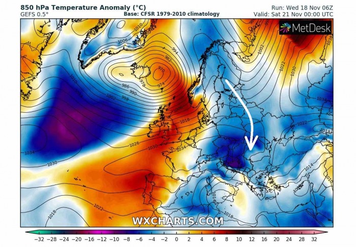
As the new ridge from the west emerges further east towards central Europe, the cold advection on its eastern side gradually continues spreading south across the whole of eastern Europe, reaching the Balkan peninsula as well.
The air mass will be the most pronounced over the northern parts of the peninsula by Friday and Saturday.
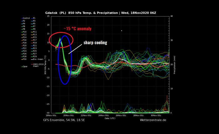
Here is the vertical cross-section for 850 mbar temperature (approx. 1500 m above sea level) for northern Poland, somehow in the middle of the most extreme warm advection towards northern Europe. Graphics by Wetterzentrale.de.
The temperature at this level will be roughly 15 °C above the long-term average, around 12-13 °C (the normal average for mid-November is around -2 °C at this level). We can also see a very sharp temperature drop soon after, ongoing through Thursday when temperatures fall even below the average for a few degrees by Friday morning.
That is almost 20 °C change in about 24 hours.
Over the weekend, there is another wave likely coming over Europe, so temperatures will continue changing from day to day and a stable warm or stable cold pattern is not expected. Unsettled weather will develop over western and northern Europe, with deep Atlantic depression possible.
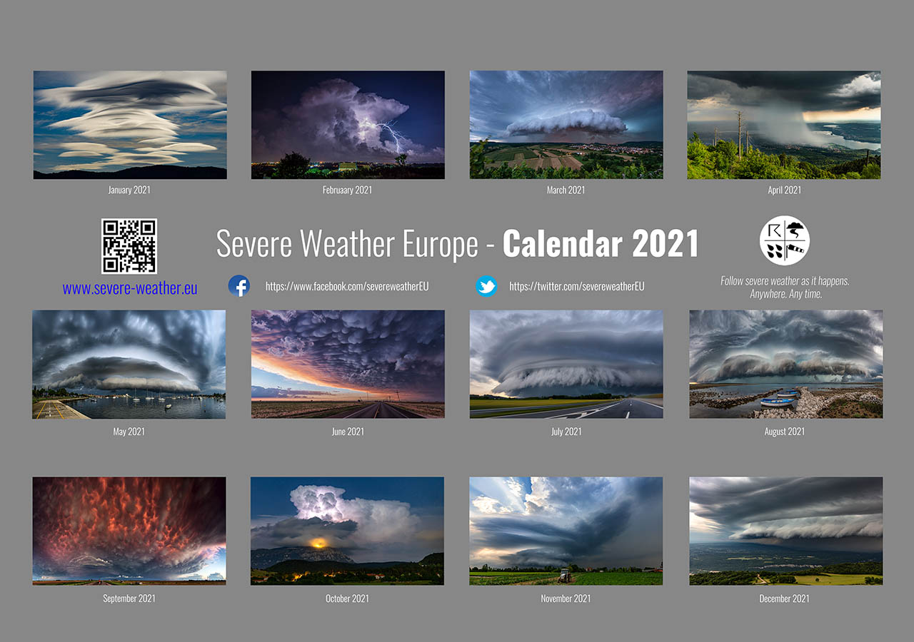
Don’t miss a chance for a nice gift for your friends, family or someone special… Weather calendar could be the perfect gift for them – see below:
