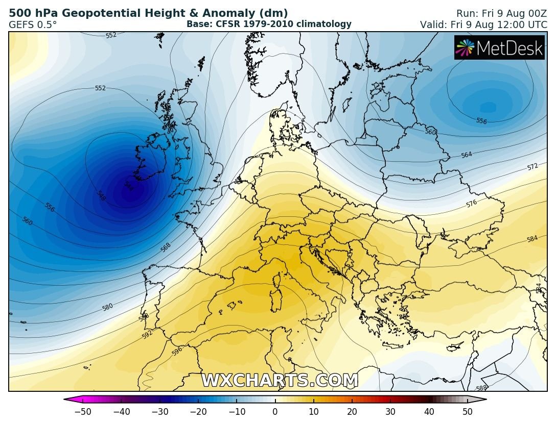
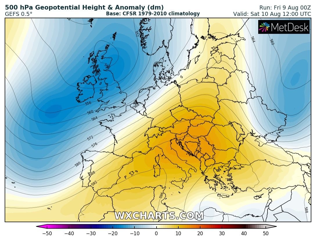
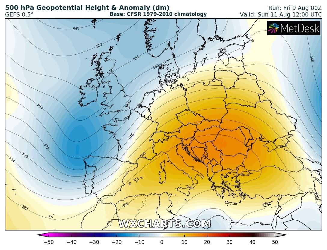
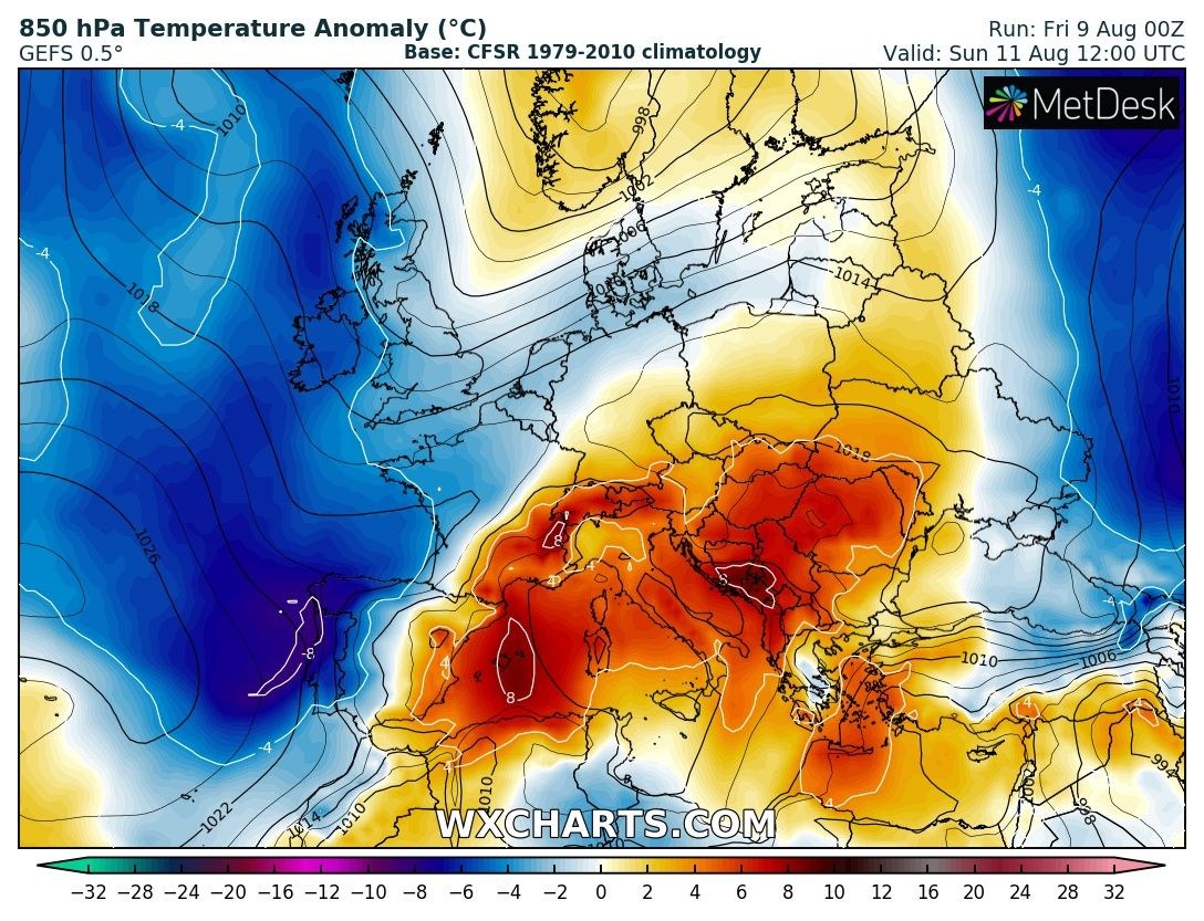
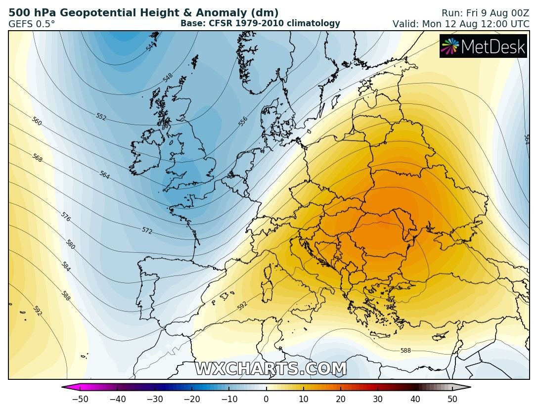
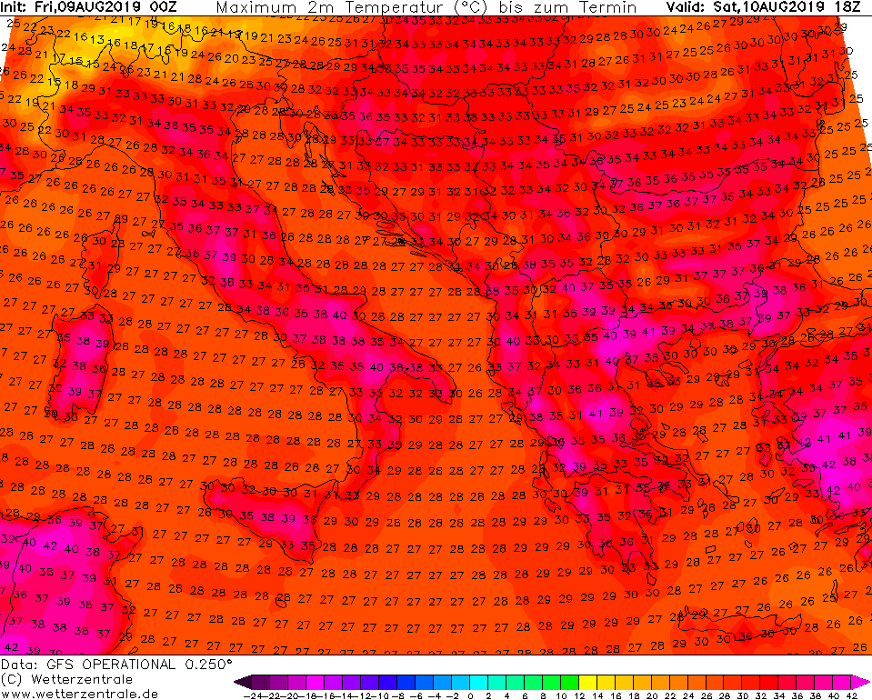
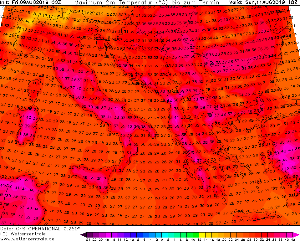
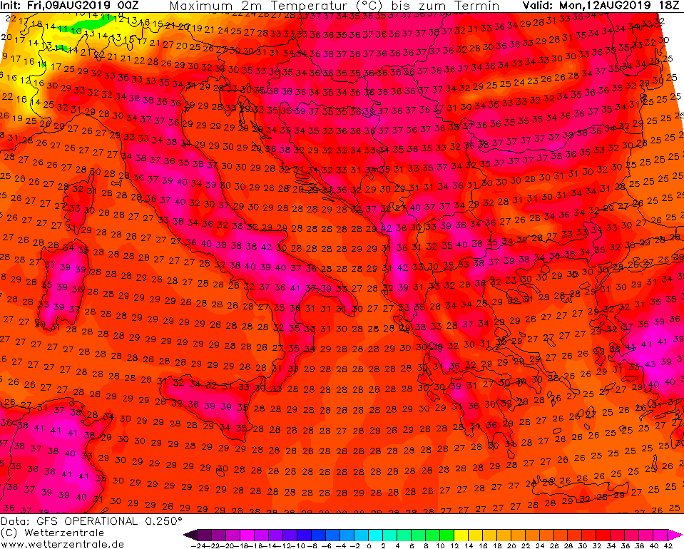
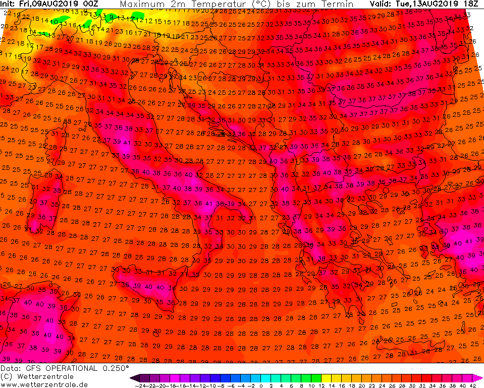
The pattern change is foreseen across Europe this weekend, as a strengthening upper ridge develops a relatively short (4 days only) but a significant heat wave across south-central parts of Europe and the Balkans. Temperatures will push into mid to upper 30s in many areas, locally even potentially soaring into low +40 °C!
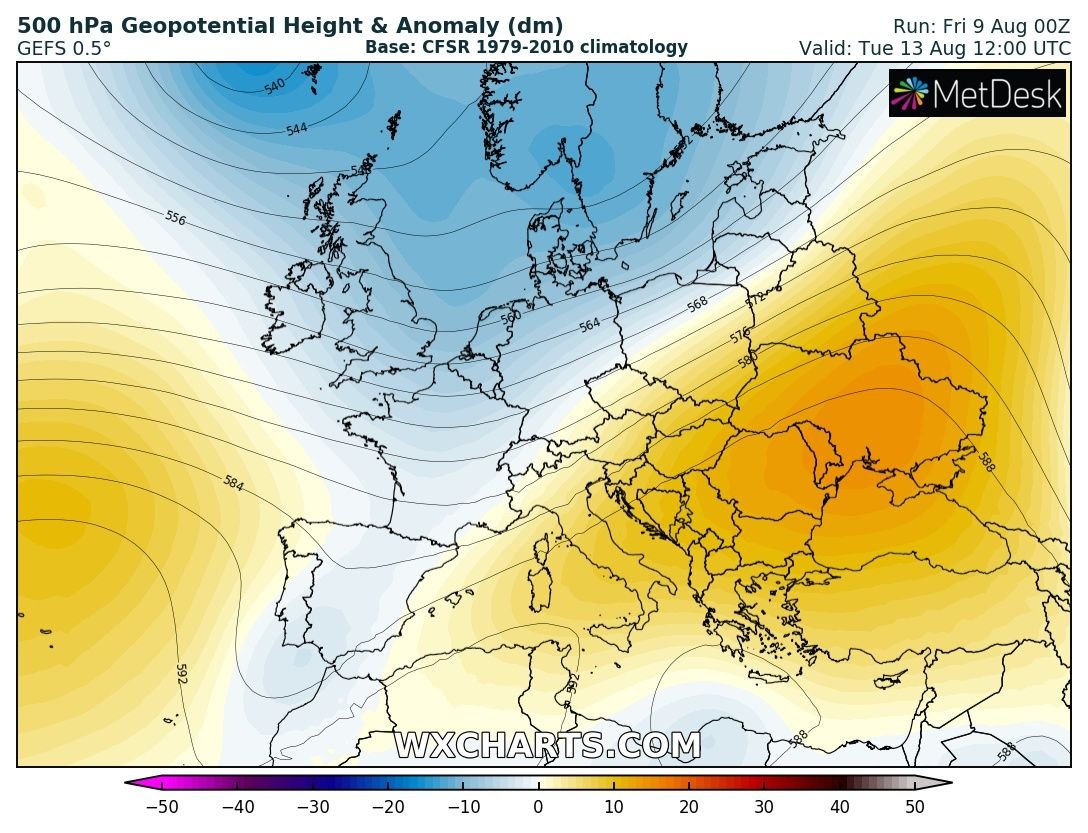
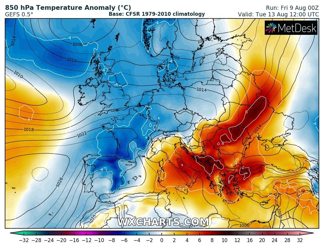
The pattern evolution indicates a deep trough over the N Atlantic and W Europe today (Friday) with a strengthening upper ridge over the Mediterranean and the Balkans. An extensive and strong ridge then persists across the southern half of the continent until Tuesday when a gradual cold advection pushes from the WSW Europe. Much colder weather develops across W Europe and Iberia early next week.
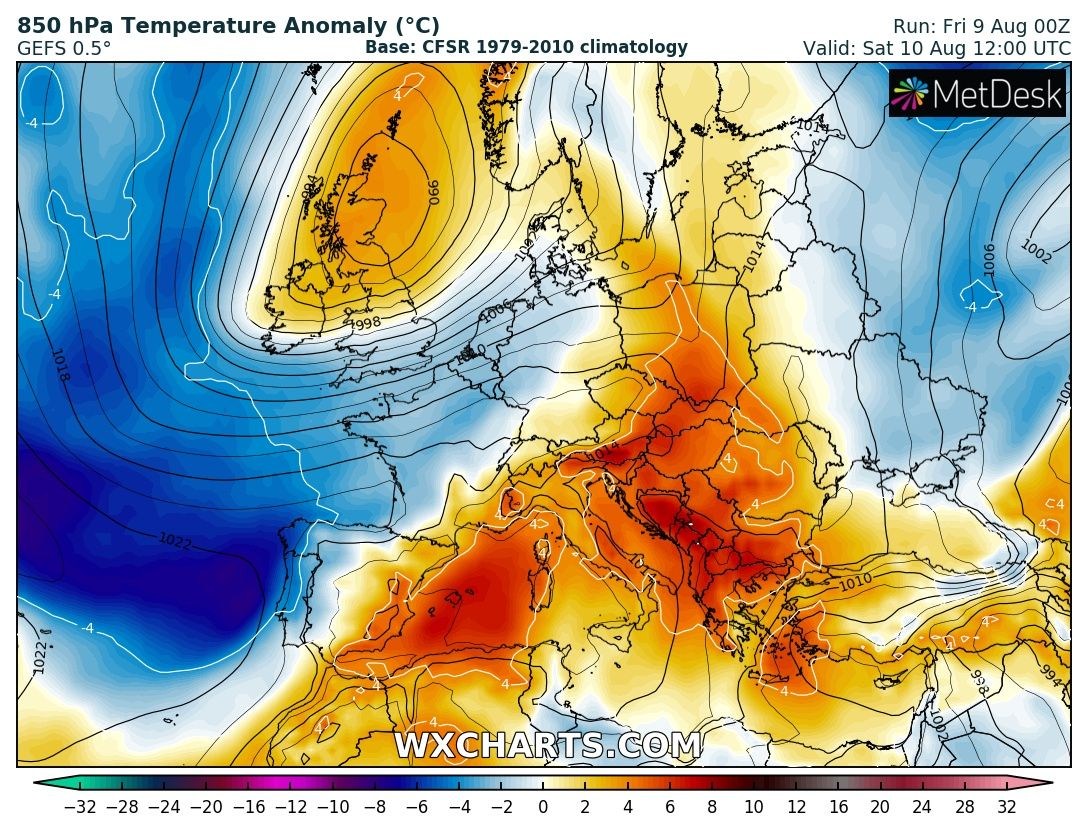
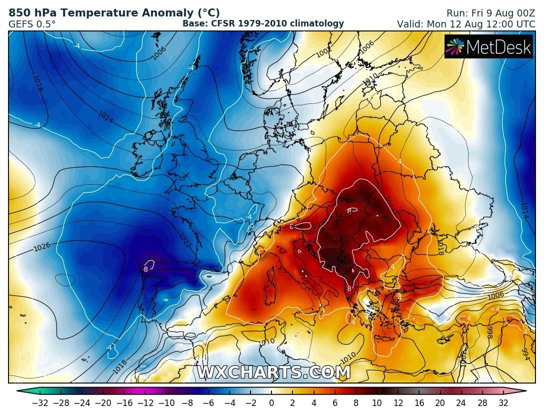
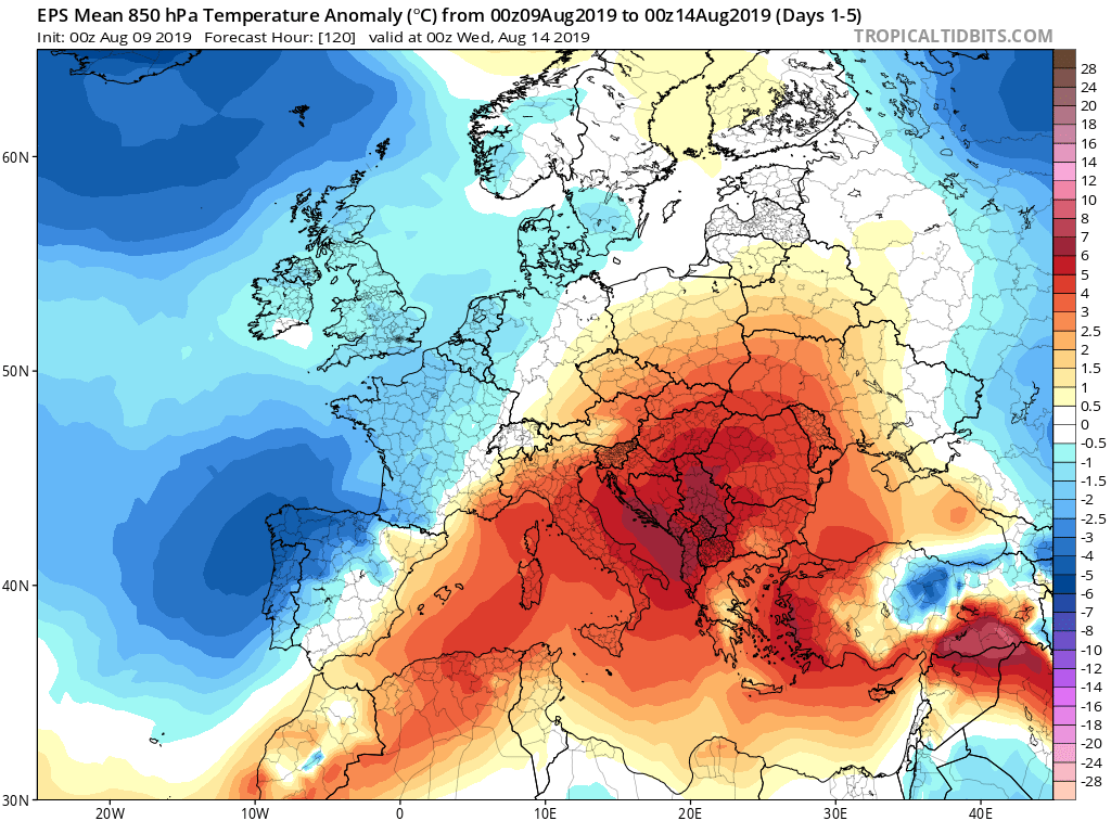
A 5-day 850 mbar temperature anomaly indicates a quite significant positive anomaly across southern Europe and especially across the Balkans – 5-8 °C warmer period than normally for mid-August.
Peak afternoon temperatures are expected to push into the upper 30s across south-central Italy, Greece and W Turkey over the weekend while it will intensify over the N Italy and N Balkans on Monday, nearing 40 °C is some places as well. After Tuesday, a cold front will bring cooler airmass from the Alpine region south into the N Balkans.
Stay alert for developing dangerous conditions and stay tuned for further updates and details!
