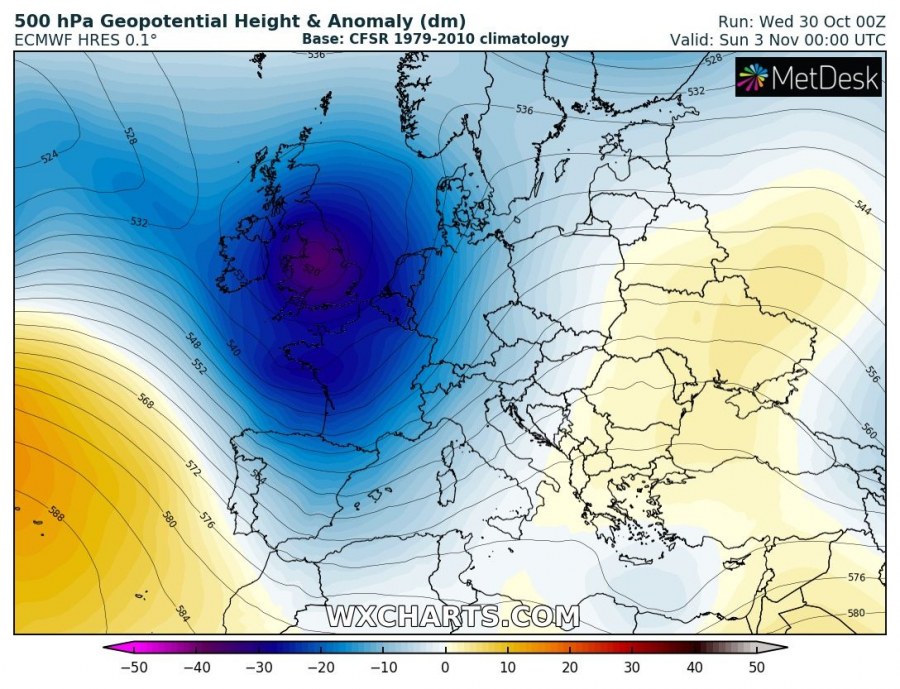
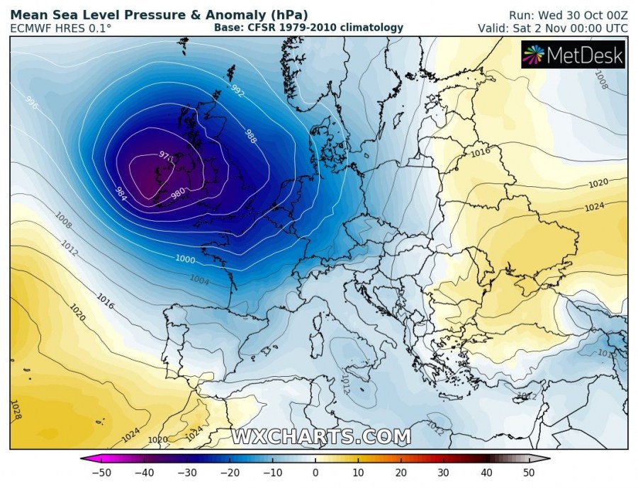
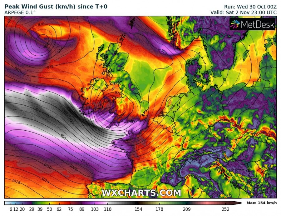
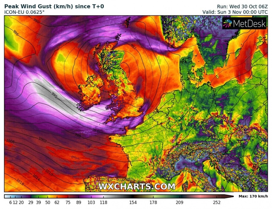
The expected pattern flip this weekend develops a very deep trough over the North Atlantic and western Europe, forming a deep cyclogenesis over the British Isles. As a result, a potentially severe windstorm could deliver extremely severe winds in excess of 130 km/h across S Ireland, Wales, SSW England and towards th NW France on Saturday.
A very deep cyclone establishes over western Europe, with central pressure down to around 975 mbar. The system will slowly travel across Ireland and the British Isles through Saturday and Sunday.
Peak wind gusts based on various models, GFS, ARPEGE and ICON-EU indicate severe to extremely severe winds can be possible along the southern flank of a large and deep cyclone. High-resolution models are indeed the most aggressive, but it appears likely peak gusts could locally meet extremely severe thresholds and reach 130-150 km/h. While GFS delivers the most intense winds across the Bay of Biscay into WNW France, ARPEGE and ICON-EU bring them further north.
We are closely monitoring the evolution of this potentially dangerous cyclone and windstorm – stay tuned for updates.


