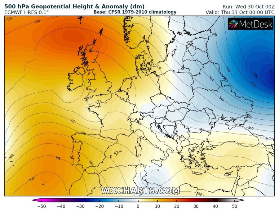
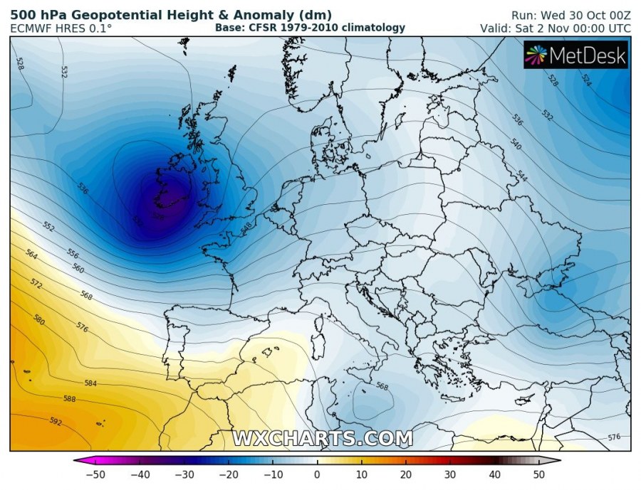
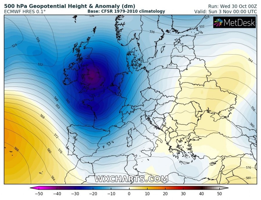
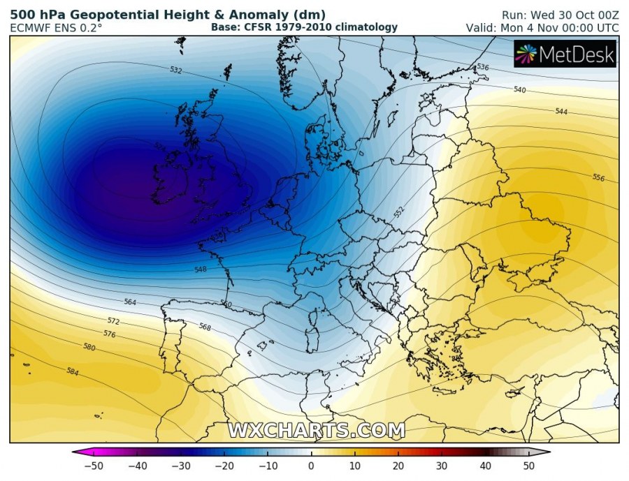
Autumn months usually have quite dynamic patterns as they’re changing or flipping more often than during summer or winter months. Early November won’t be an exception as the zonal flow will establish again over the Atlantic and together with strengthening trough over the Arctic region, bring deep trough towards western Europe as well. Ahead of deep troughing over the western parts of our continent, strong warm advection delivers much warmer weather into east-central Europe and the Balkans this weekend.
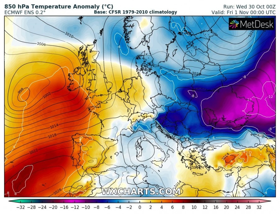
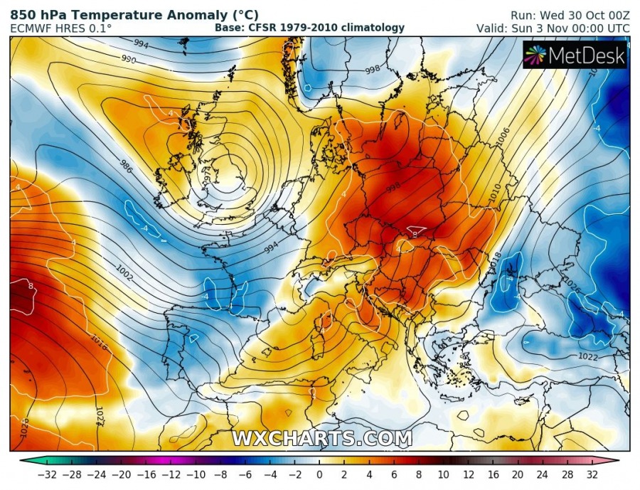
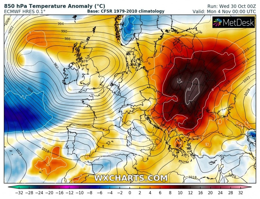
The pattern this week has established after a sharp flip during the past weekend with a strong ridge over the North Atlantic and WSW Europe. To the east of Europe, an Arctic outbreak pushed through yesterday and should continue until Friday. Over the weekend, deep troughs with intense cyclones develop over the North Atlantic again and move into western Europe. This then results in very strong warm advection under a strengthening upper ridge across eastern Europe and the Balkans through Sunday and Monday.
Temperature maps clearly indicate the results of a completely flipped pattern; Eastern Europe changes from Arctic outbreak these days with temperatures more than 10 °C below normal into much warmer weather with more than 10 °C above normal after Sunday, Nov 3rd. That’s almost 25 °C change from Friday until Monday morning (3 days change over Ukraine for example).
https://www.facebook.com/severeweatherEU/videos/424690178189491/
Stay tuned for some additional details on the pattern evolution in the coming days.
