A potentially very dangerous severe weather setup is in place over Romania and Bulgaria today. Widespread severe thunderstorms with threats for large to very large hail, torrential rainfall and severe winds are expected.
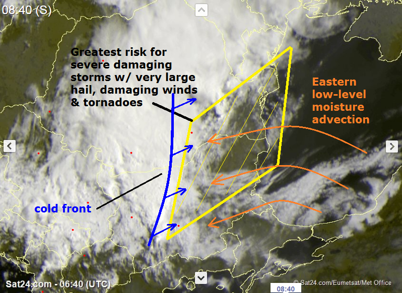
Extremely dangerous conditions are in place across S Romania into N Bulgaria today as a very moist LL airmass advects high moisture into this region, just ahead of an eastwards moving cold front and under strongly sheared environment. The cold front is already active and expect further development of rapidly organizing severe storms as it advances east. Moderately strong unstable BL will fuel storms to support threat for large to very large hail, severe damaging winds and even tornadoes given then enhanced LL shear and helicity within the easterly inflow LL winds. Below is a satellite analysis and the area marked in yellow where the most robust storms are expected today:
Morning analysis of satellite imagery, indicating strong thunderstorms already ongoing along the cold front. Image: Sat24.com
A very slowly moving shortwave trought with a pronounced surface low slowly moves across the region today. A strong 60 kt 500 mbar jetstream rounds the leading edge of the trough, witht he left exit region slowly passing over Bulgaria and southern Romania today.
500 mbar winds and height, GFS model guidance. Map: Pivotal Weather.
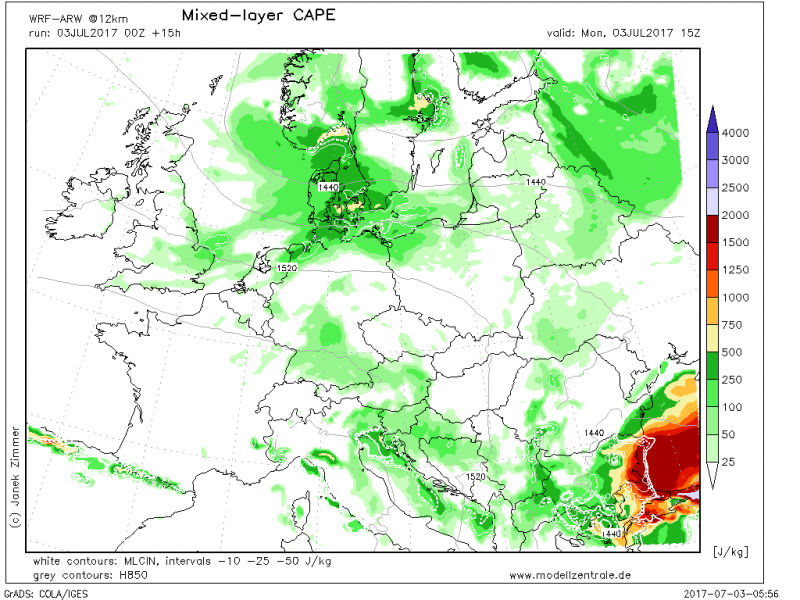
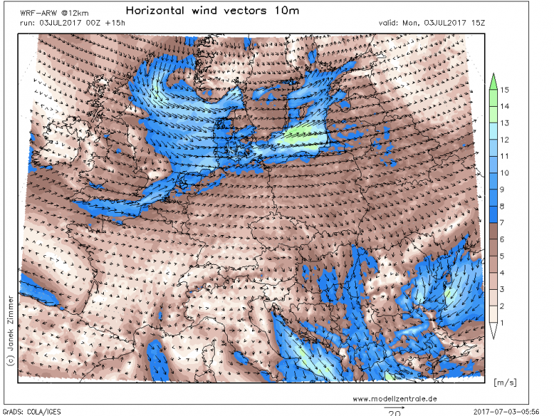
Very well pronounced easterly inflow across the risk area is advecting very moist BL moisture, surface dewpoints are in low 20s due to very warm Black sea surface temperature. Easterly component of low-level winds will promote strongly helical environment while high dewpoints promote very unstable airmass with MLCAPEs 1500-2000 J/kg locally.
MLCAPE, WRF model guidance. Map: Modellzentrale.de
10m winds, WRF model guidance. Map: Modellzentrale.de
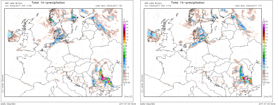
Simulated radar reflectivity, indicating very strong thunderstorms over eastern Bulgaria. WRF model guidance. Map: Modellzentrale.de.
Slow moving front and numerous storms should support flooding, including very intense / torrential rainfall with flash floods threat. More than 100 mm should accumulate across the broad area while locally rainfall amounts in excess of 150 mm are possible as well.
24 hour rainfall amounts, WRF model guidance. Map: Modellzentrale.de
While some storms could be discrete intense supercells, they should eventually merge into a large cluster of storms, MCS/QLCS with an intense squall line(s).
Thunderstorms are already ongoing along the cold front over western Bulgaria as of mid-morning. Expect storms to move eastwards, with coverage and severe potential increasing as temperatures rise across the mostly clear E Bulgaria and SE Romania.
https://www.facebook.com/severeweatherEU/videos/2037228679833556/
Follow the events via radar / satellite sites:
Stay alert and we welcome you to report any severe weather events.


