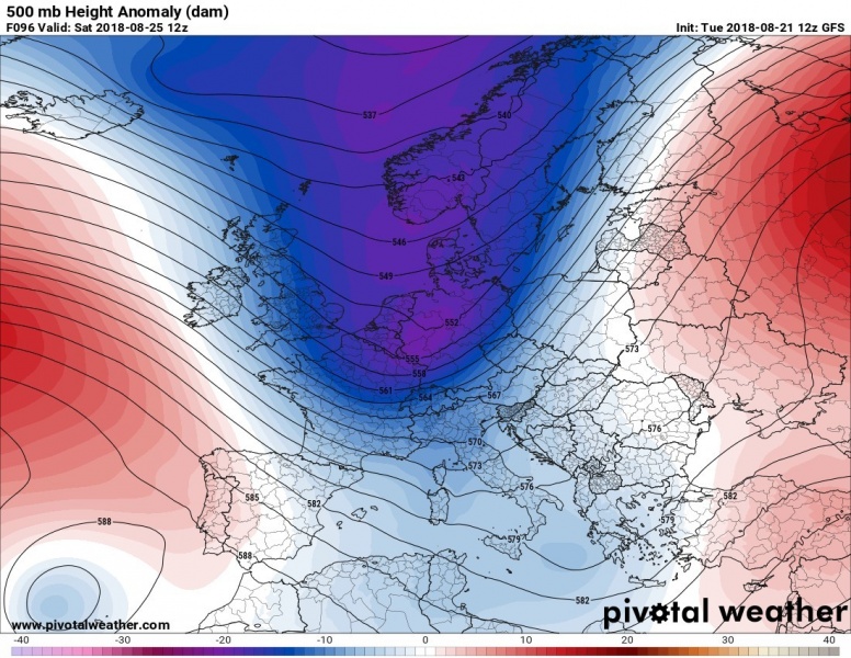
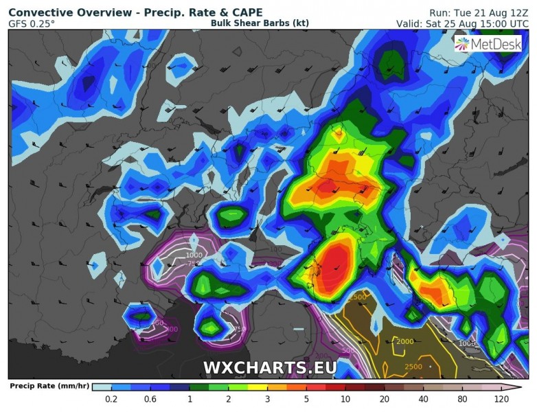
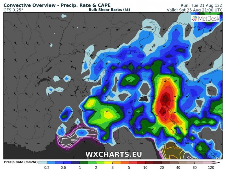
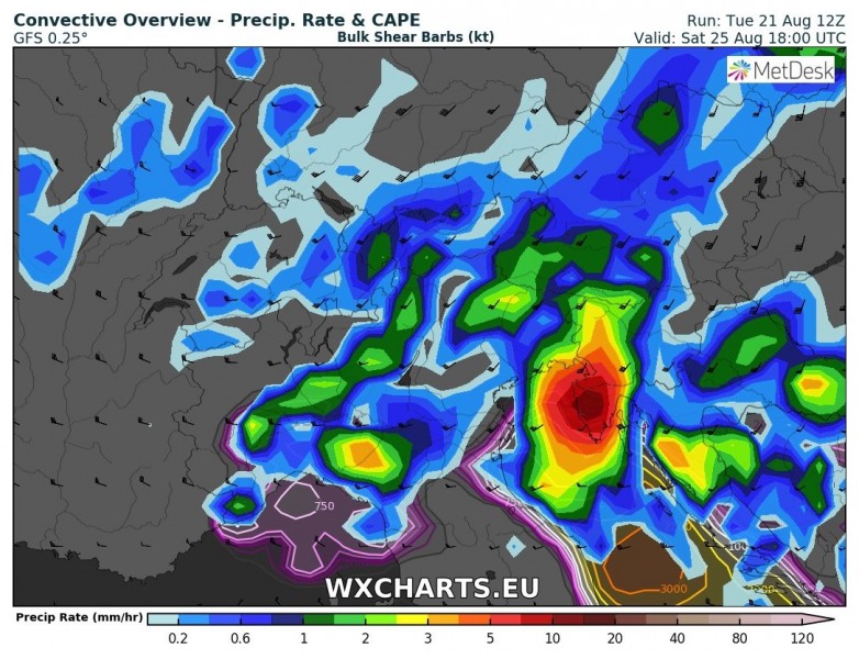
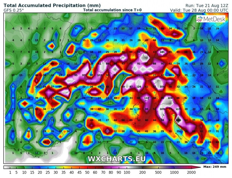
The approaching deep trough and the associated frontal system is setting up to produce an episode of severe weather across the northern Mediterranean region this weekend. Severe thunderstorms and torrential rainfall are expected.
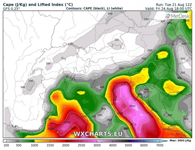
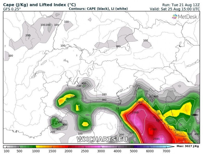
Strong instability will develop across south of the Alps. Current northern Adriatic sea surface temperatures are up to 28-29 °C, locally even 30 °C. Strong evaporation is driving dewpoints in the low to mid 20s and providing a very moist airmass ahead of the upcoming disturbance. Strong to potentially extreme instability is expected to build up over the northern Adriatic region with 2000-3000 J/kg MLCAPE, locally more available on Friday and Saturday.
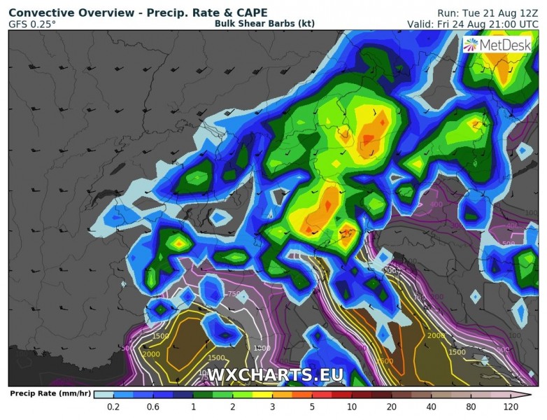
A strong mid-level jet will overspread the region. Depending on the strength of the southerly Scirocco winds developing ahead of the front, strong deep-layer shear and conditions supportive for multicell and supercell thunderstorms are likely to develop.
As the trough pushes across the Alps secondary cyclogenesis takes place over north Italy. The cutoff cyclone persists over north Italy/Adriatic, slowly pushing southeastwards by early next week.
In addition to organized thunderstorms, with likely threats for torrential rainfall, severe straight line winds and large hail, persistent convective/orographic rainfall is likely to occur along the southern flank of the Alps and western flank of the Dinarides. Totals over 200 mm over the weekend are likely. Local flash flooding is expected.
The cold front will be accompanied by a sharp drop in temperatures. While the region is currently enjoying temperatures in 30-35 °C range, daytime highs will likely only reach up to 19-20 °C on Sunday, slightly improving on Monday.
