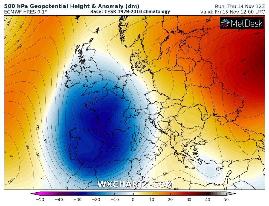
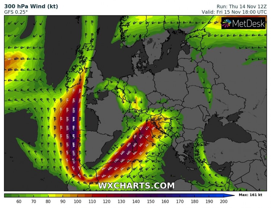
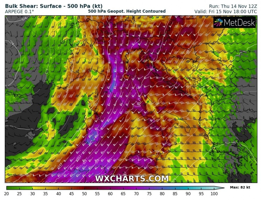
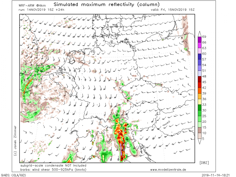
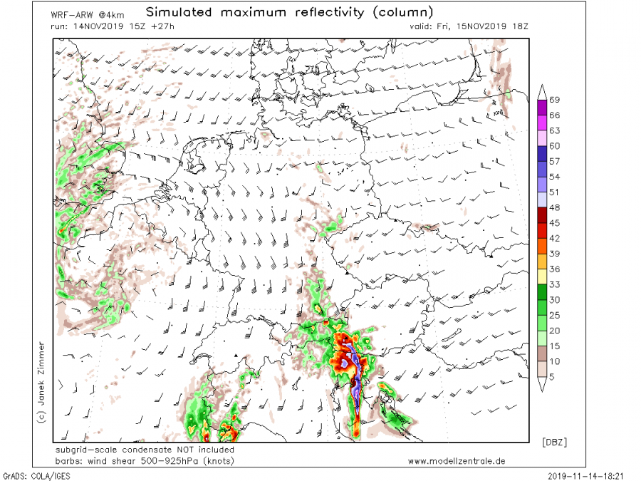
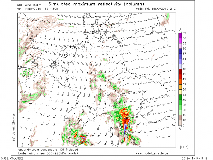
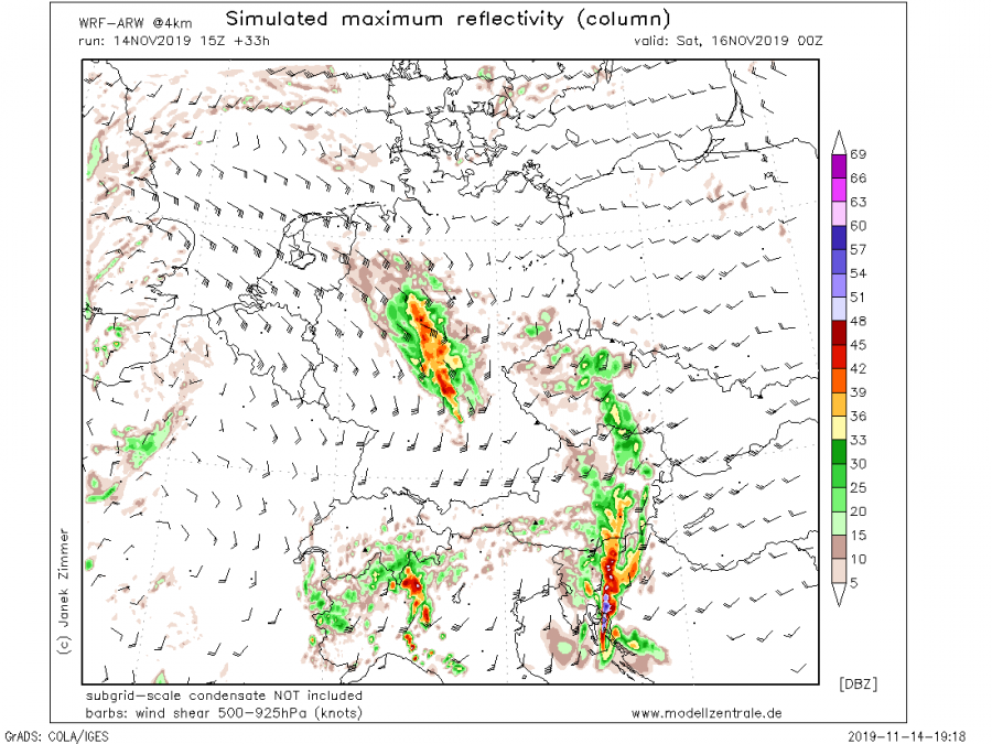
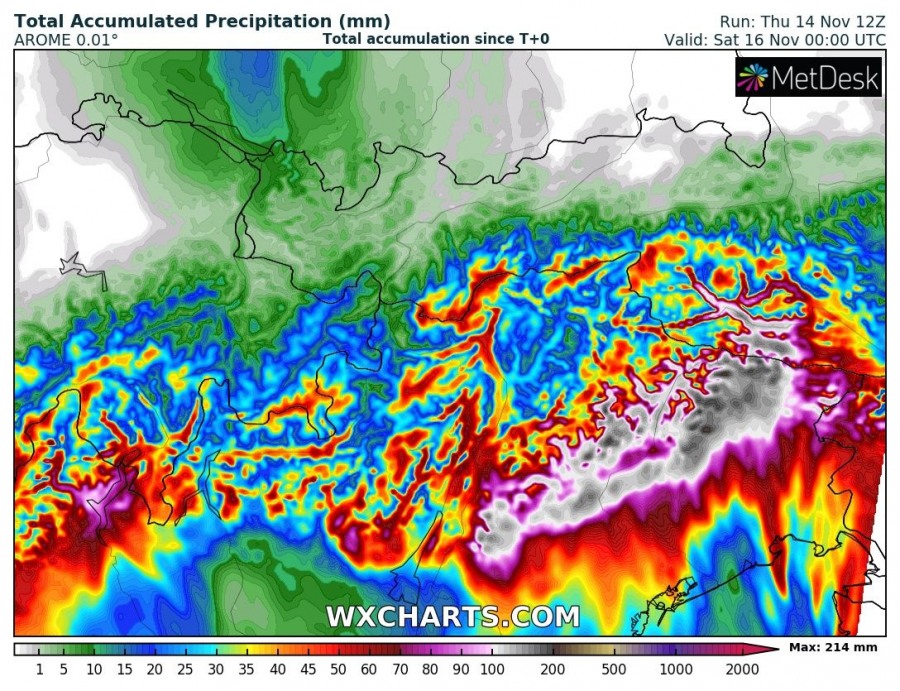
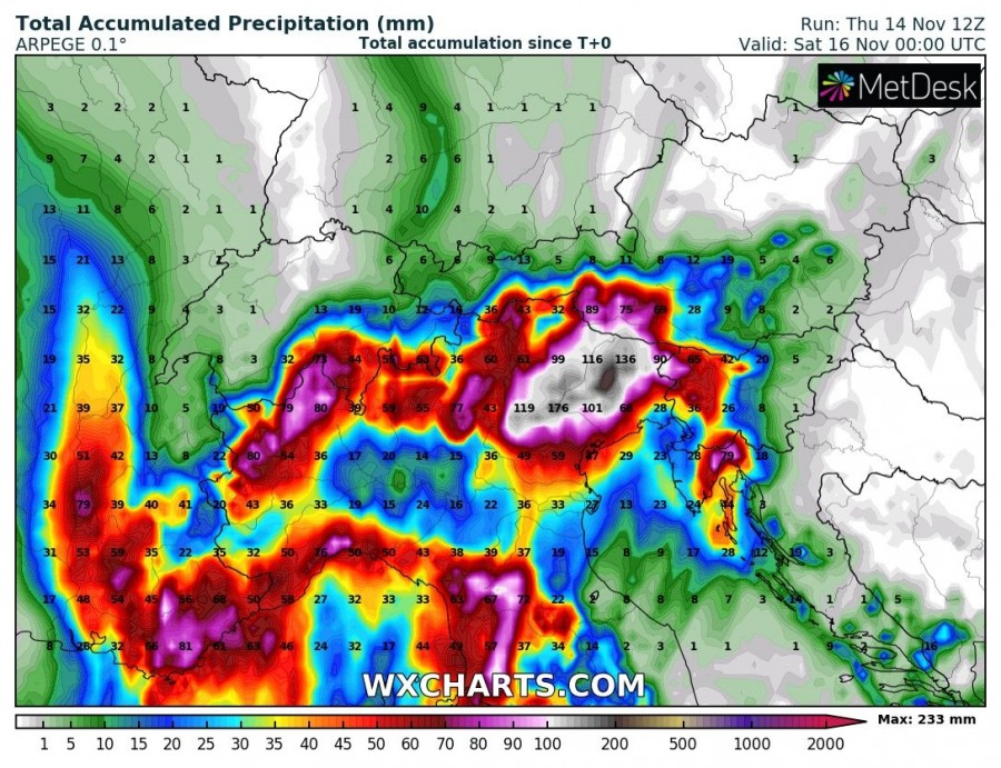
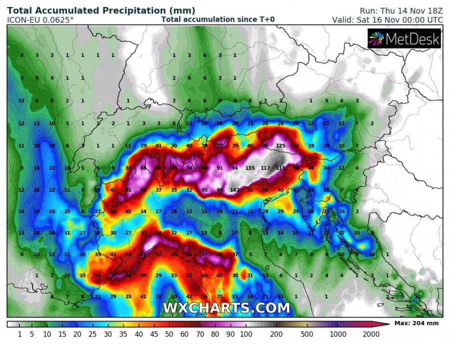
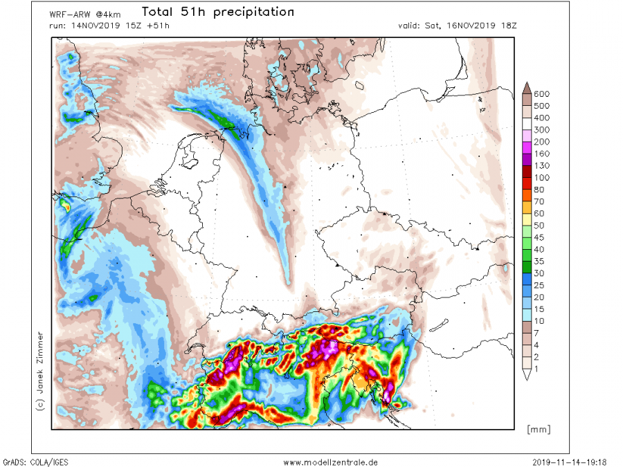
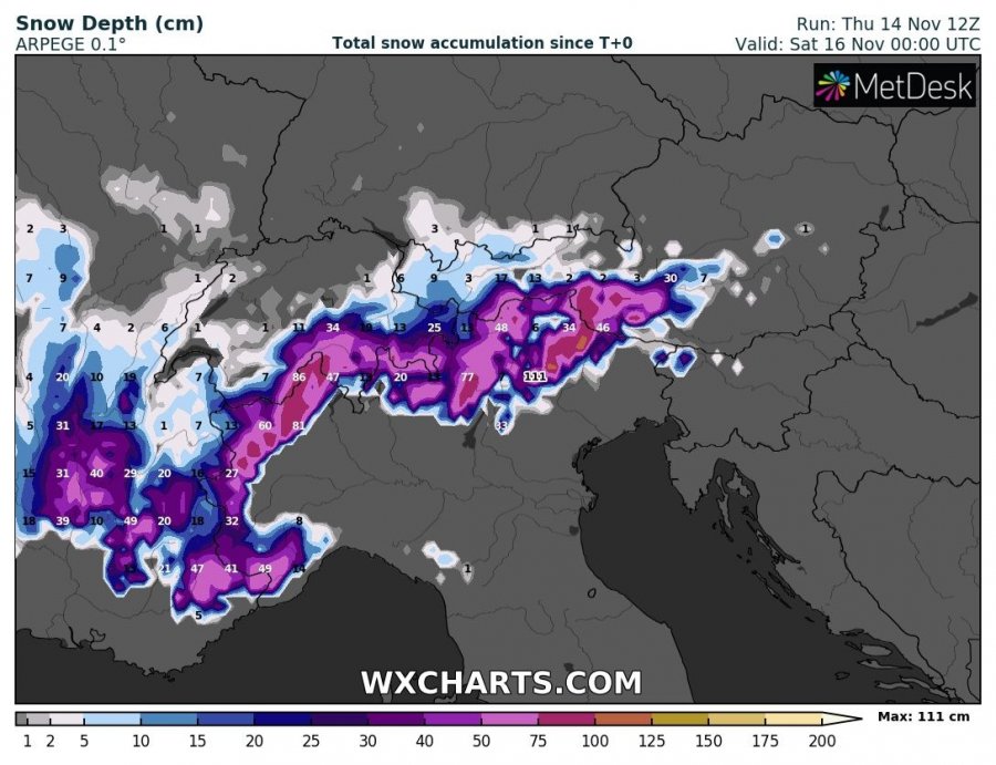
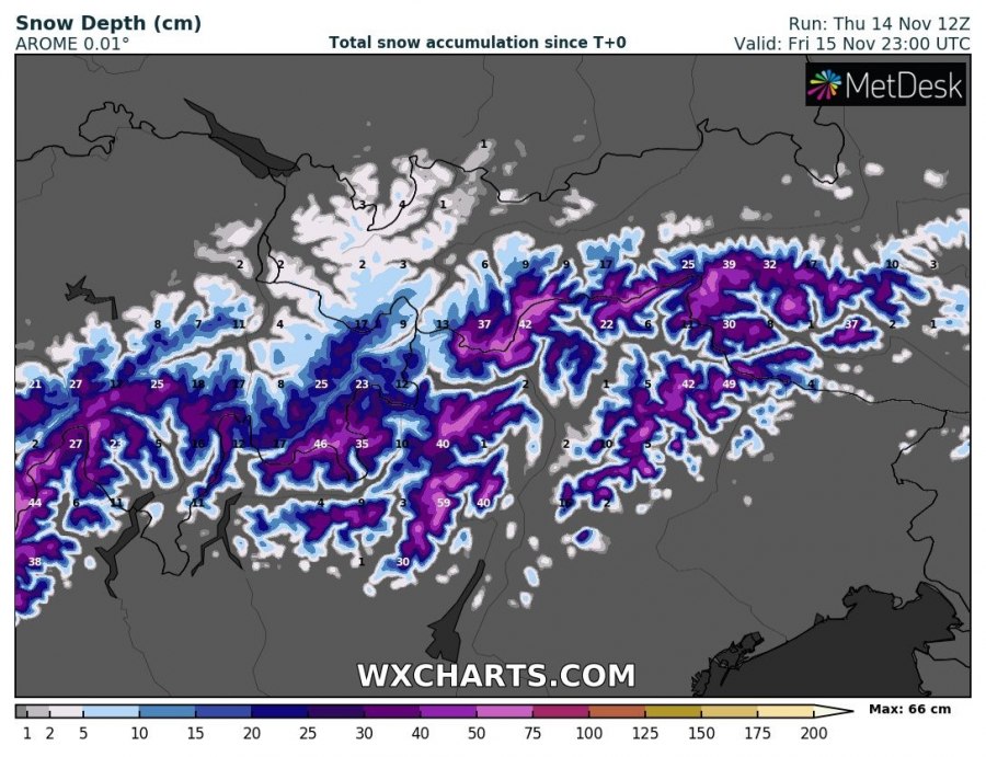
A frontal system, associated with the large upper trough / low over WSW Europe continues east across the N Mediterranean region on Friday, Nov 15th and strongly enhances the severe threat for dangerous storms. Excessive and intense convective rainfall is expected along the front, as severe storms seem possible over the N Adriatic region. Strong southerlies will introduce intense and persisting orographic precipitation into the Alps as well. And indeed snowfall into the higher elevations.
A very large upper trough sits over the WSW Europe and gradually expanding / moving into central Europe on Friday. A powerful SW-erly jet stream advects high amounts of moisture and warm airmass towards the Alps and also provides favorable wind profiles for strong shear.
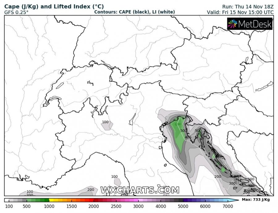
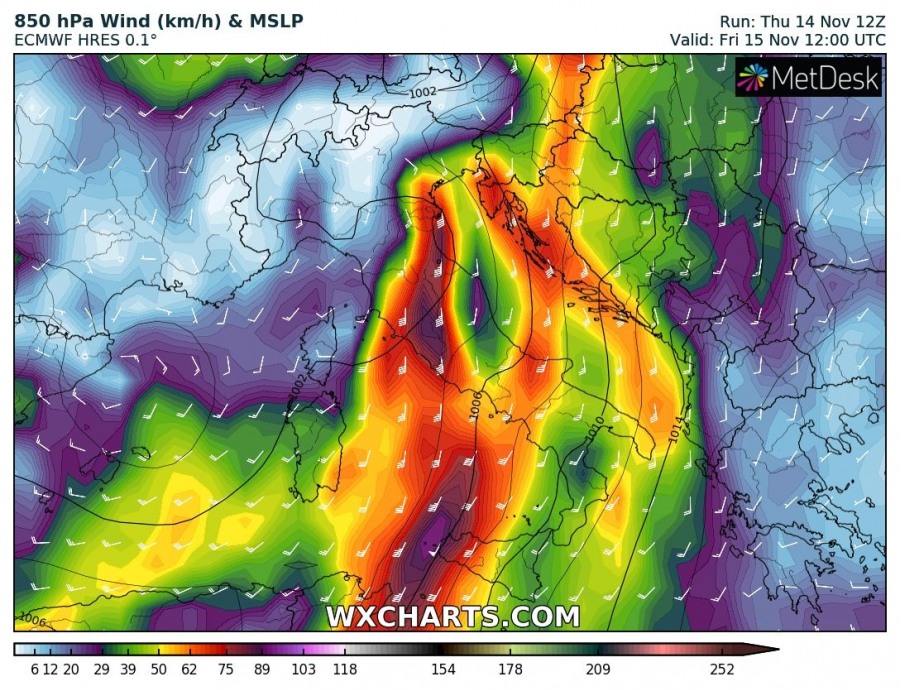
Strong southerly winds across the Adriatic sea will advect warmer temperatures and higher dewpoints to support at least marginal instability along and just ahead of the surface front, with increasing deep-layer shear and helicity. The environment will become conducive for a frontal line of storms moving across the N Adriatic region into W Slovenia and NW Croatia.
It appears increasingly likely a line of storms along the surface front could also include embedded rotating storms, capable of producing severe winds, torrential rainfall and possibly even tornadoes. Wind shear will be particularly strong across the warm sector and pose threat for damaging winds and even tornadoes if indeed enough instability combines with strong low-level helicity. Front intensifies over the delta Po region in the afternoon and accelerates towards the Istra peninsula and Kvarner region (Croatia) in the evening hours.
Total rainfall should locally reach up to 150-200 mm, possibly even more where a combination of orographic and convective precipitation will be maximized. Precisely over the NE Italian Alps. Local flash floods will be possible, especially as the soil is already highly saturated from the previous excessive rainfall events this month.
Over the Alps, quite a lot of snow is also expected above 1500-1800 m ASL, locally 50-75 cm seem possible until late Friday night.
Stay alert for dangerous weather conditions. Rising Adriatic sea waters are also expected again, likely result in some flooding over Venice, the Slovenian coast or Trieste.
See also – the same system produced dangerous storms and huge amounts of rain / snow over SE France and W Alps today, Friday Nov 14th
Interested in our calendar? We are proud to present and promote the best weather photographers in Europe – see details:
