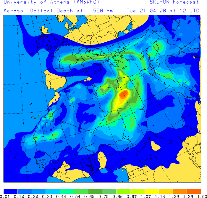
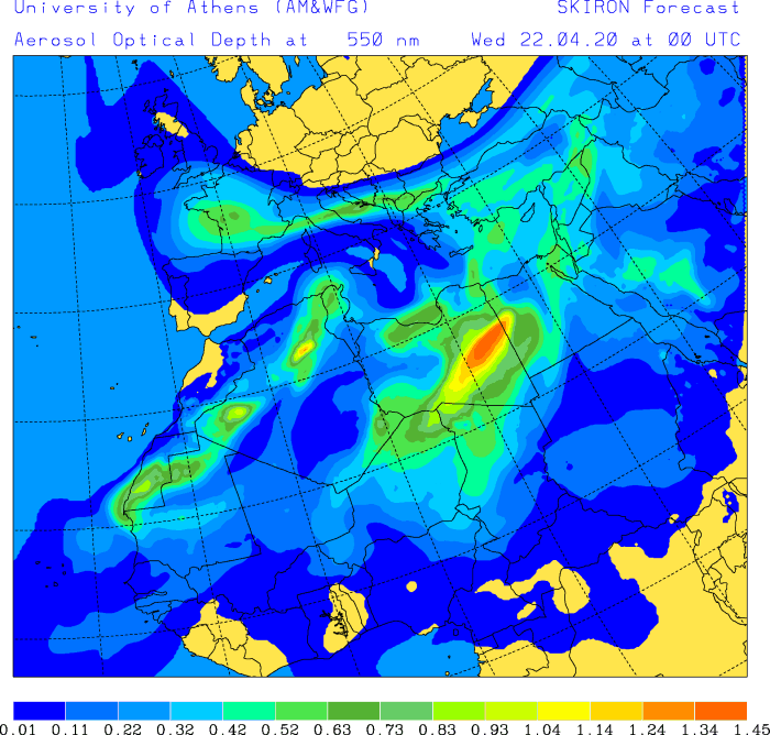
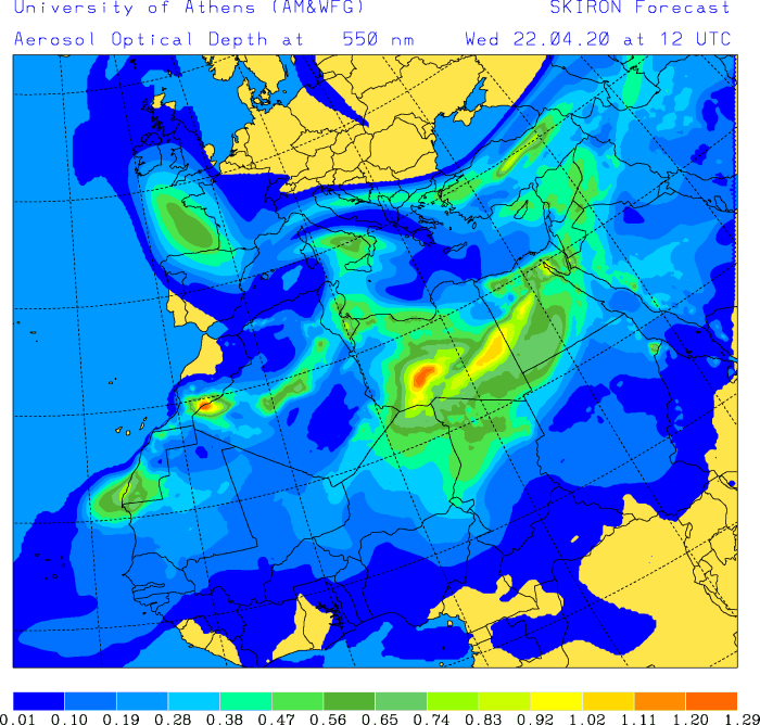
The ongoing progressive pattern over southern Europe and the Mediterranean against the extensive and powerful upper ridge over northern Europe and Arctic region, will result in reversed flow in between. This flow is favoring an advection of Saharan dust load from the the North Africa into the Mediterranean, central Europe and now also towards France, reaching England and Ireland on Wednesday.
Here is tonight’s position of the upper ridge and lows over Europe, the yellow arrows represent the flow. One can see the air mass and its related dust load over the Mediterranean curves northwestwards over the Alps towards western Europe:
Attached are the dust load maps by SKIRON model, indicating the dust particles are spreading across central Europe today and expanding westward into southern France. With the more southeasterly flow tonight, the advection should spread the dust also towards western Europe. Saharan dust will therefore reach England and Ireland on Wednesday (tomorrow):
Tuesday 00z
Tuesday 12z
Wednesday 00z
Wednesday 12z
Thursday 00z
See also related events with the ongoing pattern; excessive rainfall over the Mediterranean region, extreme warmth over the Arctic region and upper lows analysis over southern Europe:
Deadly tornadoes and severe weather outbreak across parts of Mississippi and Alabama today, Apr 12th


