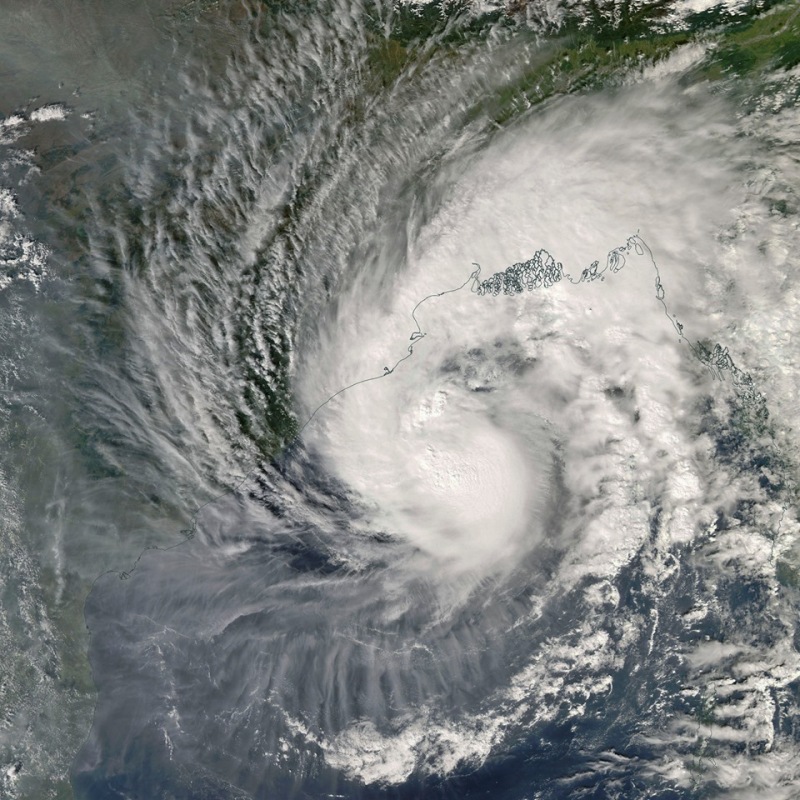
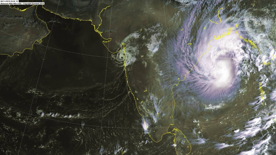
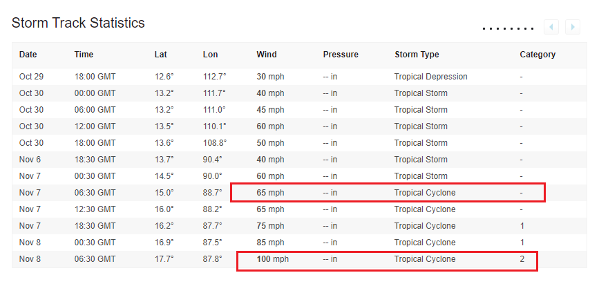
A tropical cyclone Matmo has been intensifying overnight and is stronger than expected yesterday. It is now a Category 2 cyclone, packing maximum sustained winds of 85 knots / 100 mph / 160 km/h with a central pressure around 970 mbar. Matmo continues moving north across the Bay of Bengal and becoming a significantly dangerous threat for the NE India and S Bangladesh this weekend – should deliver destructive floods in the region! Matmo is the 6th tropical cyclone of the 2019 North Indian Ocean season to date. This set a new record of the most hurricanes for a full North Indian Ocean season on record (since 1972) – breaking the old record of 5 hurricanes set in 1998.
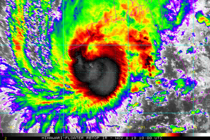
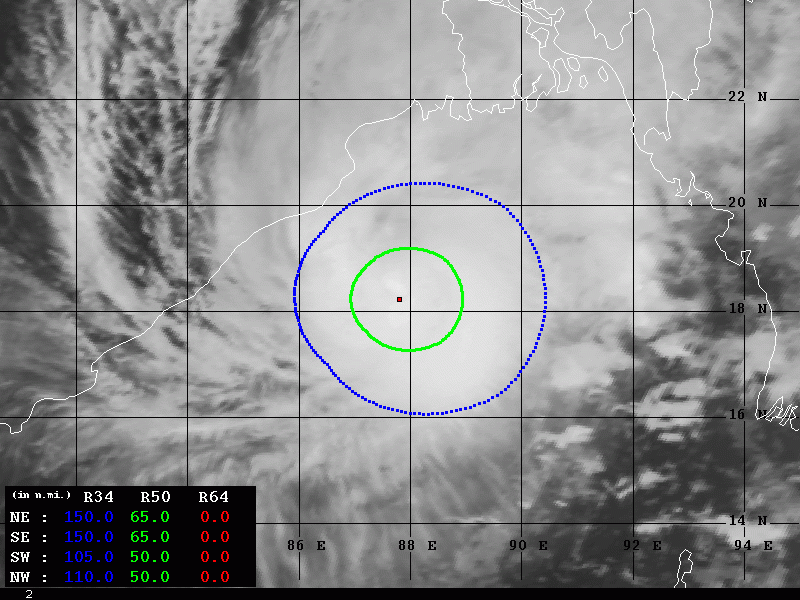
Satellite imagery reveal and impressive upper-level outflow pattern across the NW, SW and SE quadrants. While some drier air is present across the NE quadrant, the improving deep convection could also boost the intensity if this quadrant outflow develops a better pattern. 50kt radii expand 50-65 miles around the center in all quadrants.
https://twitter.com/HurricaneiOS/status/1192726748988882944
#Tropical #Bay_of_Begal #Matmo #Bulbul #BulBulCyclone MIMIC last 24 animation to 08/06Z pic.twitter.com/R747uTqUbj
— Mike Trigger (@T2mike) November 8, 2019
#Cyclone #Matmo has now reached #hurricane strength – the 6th of the 2019 North Indian Ocean cyclone season to date. This is the most hurricanes for a full North Indian Ocean season on record (since 1972) – breaking the old record of 5 hurricanes set in 1998. pic.twitter.com/z2c3OpgiHx
— Philip Klotzbach (@philklotzbach) November 7, 2019
Matmo actually went through a rapid intensification in the past 24 hours as it intensified from 65 mph into 100 mph. Surprisedly all the models have been less aggressive with forecasting its strength today, indicating a Category 2 strength was unlikely.
Note: Rapid intensification is a meteorological situation where a tropical cyclone intensifies significantly through a short period of time. The rapid intensification means an increase in the maximum sustained winds of a tropical cyclone of at least 30 knots / 35 mph / 55 km/h in a 24-hour period.
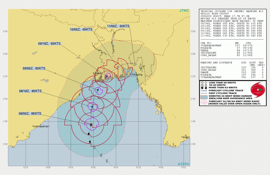
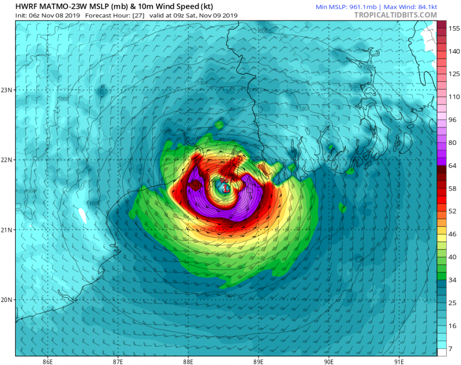
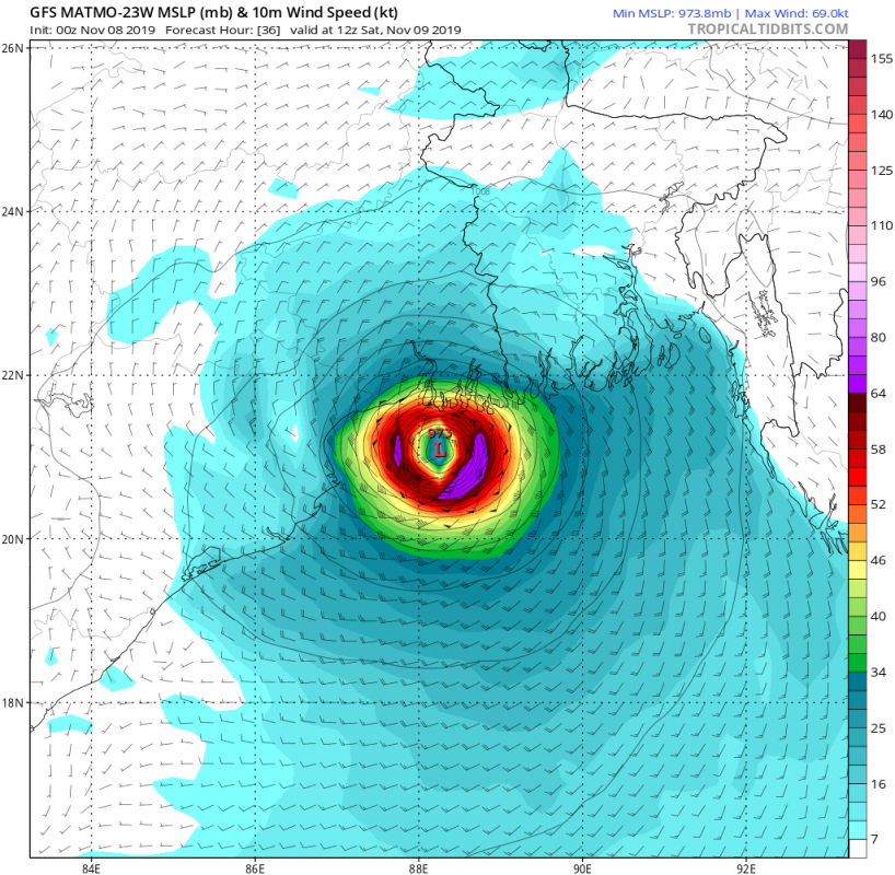
Matmo is now moving north/northeast and is expected to make landfall in extreme ENE India (in the delta SE of Kolkata, the capital West Bengal Indian state) overnight to Sunday this weekend. Cyclone will then continue across delta into southern Bangladesh. Both GFS and HWRF models are actually in very good agreement regarding its potential future track.
Stay tuned for further updates prior to landfall in NE India / S Bangladesh & stay alert for dangerous weather conditions developing!
See also – previous discussion:
Interested in our calendar? We are proud to present and promote the best weather photographers in Europe – see details:
