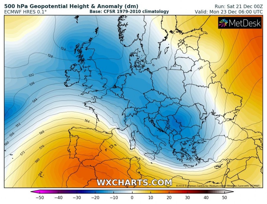
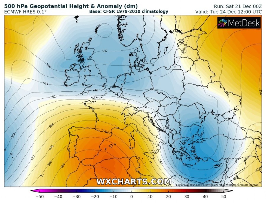
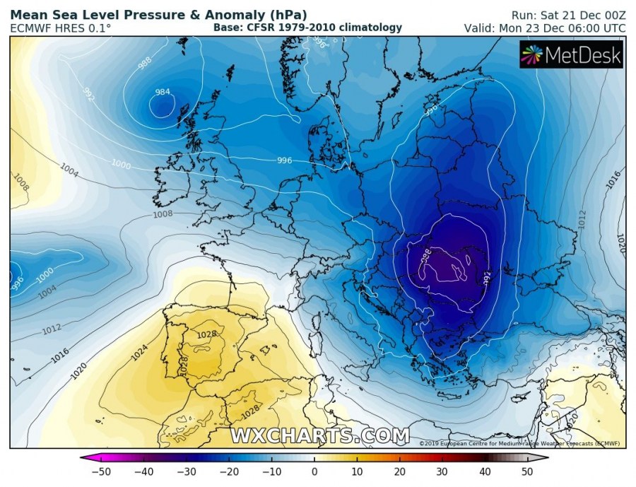
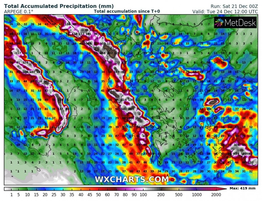
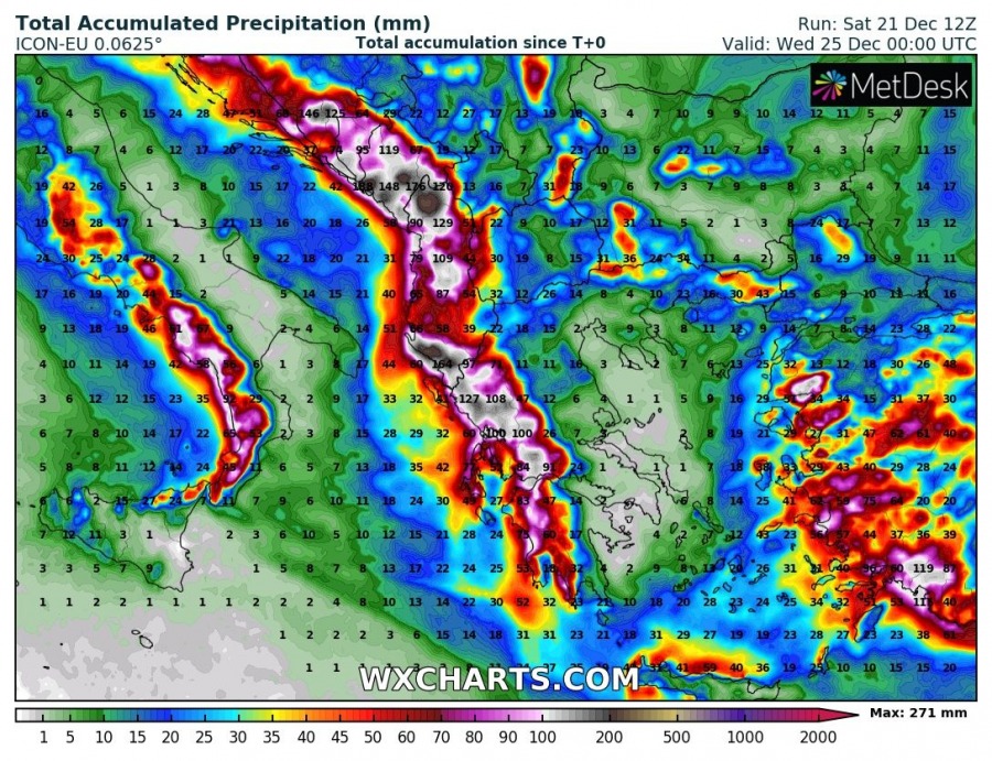
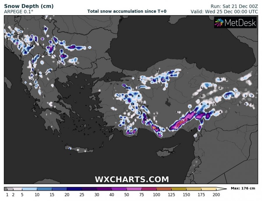
Associated with the large trough moving across central Europe and the north Mediterranean this weekend, a surface cyclone and frontal system deliver unsettled weather conditions also into Greece and Turkey in the coming days. An upper low ejects from the main trough and slows down over the SE Europe and results in high rainfall sums with significantly enhanced flooding potential. Higher elevations of south Turkey should also receive a lot of snow!
The pattern over Europe through the next few days reveals a strengthening upper ridge across the SW Europe while the upper trough continues east across central Europe and the Mediterranean. Trough gradually transforms into an upper low and ejects into the SE Europe and strengthens on Monday. An associated surface low results in strong warm advection towards the Black Sea region and unstable airmass develops across the Aegean Sea and the eastern Mediterranean.
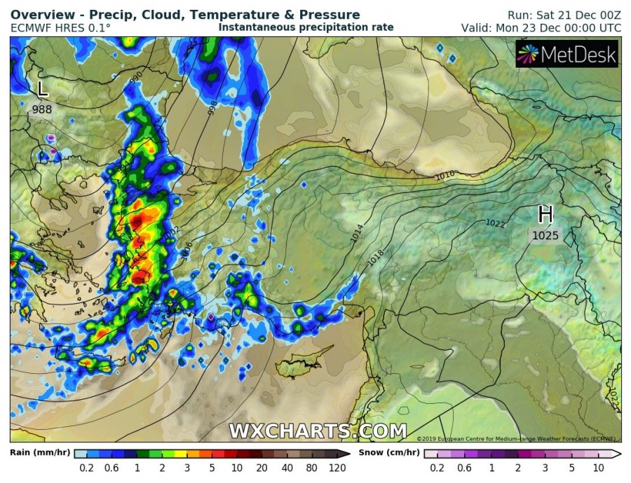
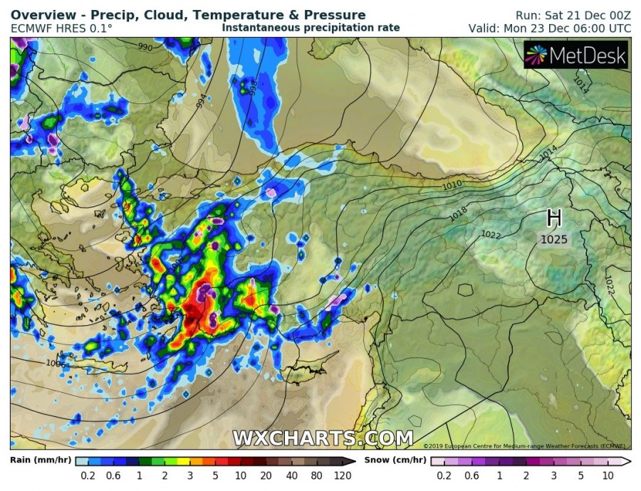
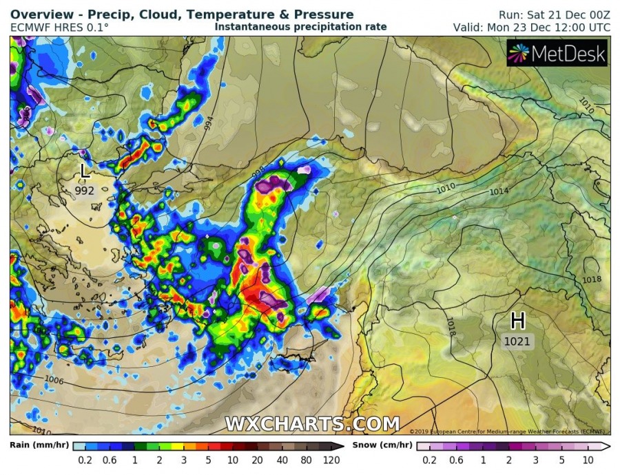
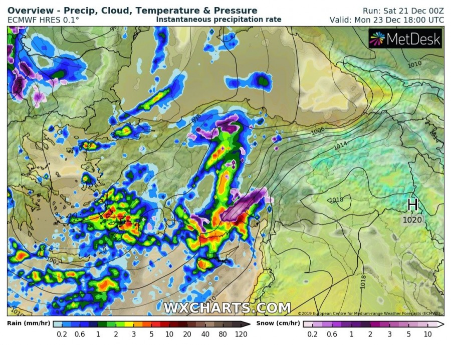
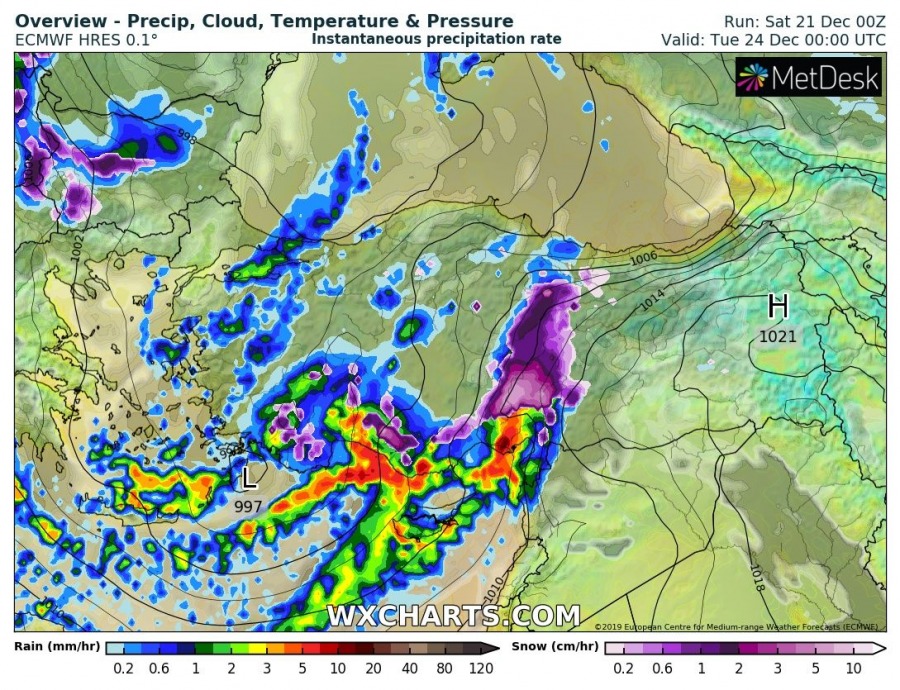
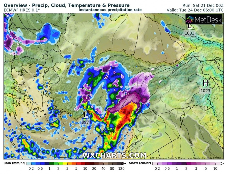
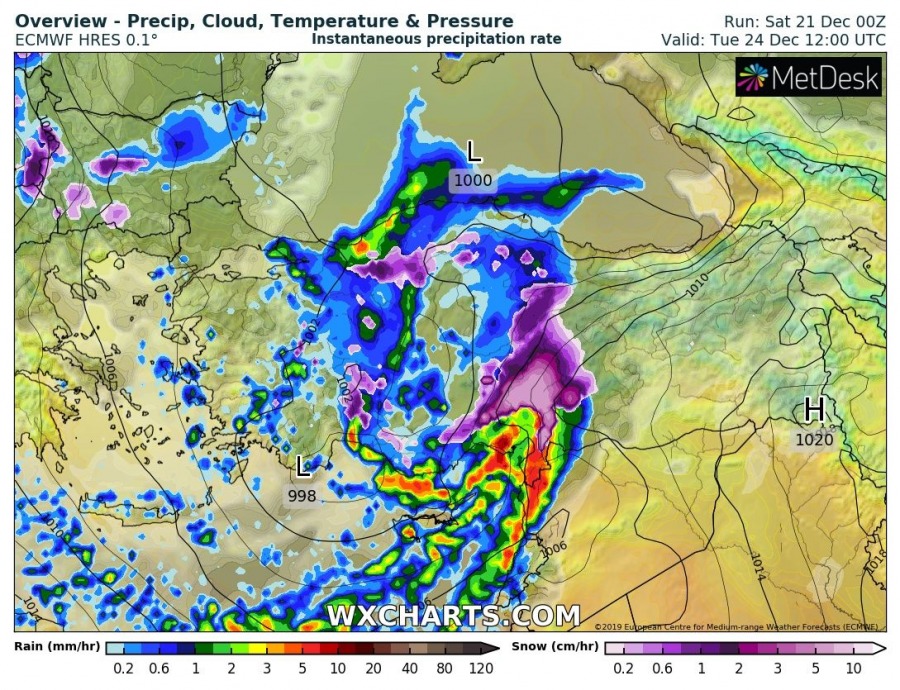
Here is a 6-hour sequence of the frontal system moving from Greece from Sunday night through Monday into Turkey, slowing down by Tuesday and continue with intense rainfall with storms organized in lines. Persistent strong SW flow will support intense orographic rainfall ahead of the main front.
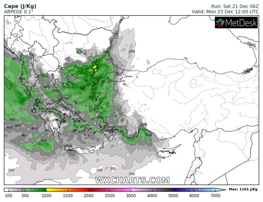
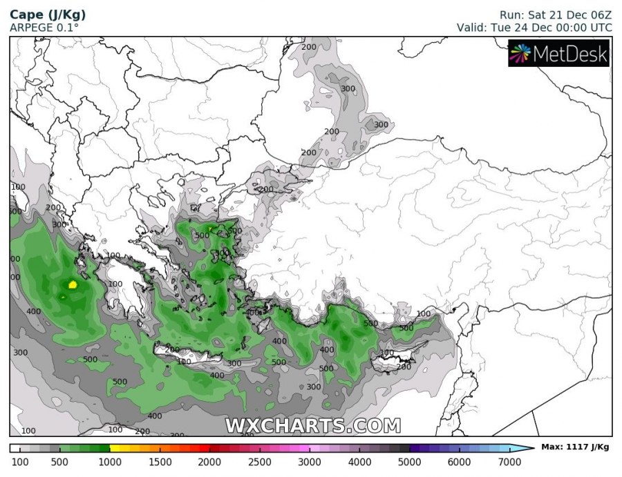
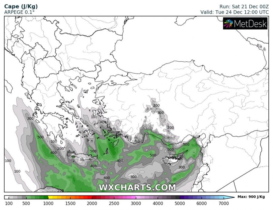
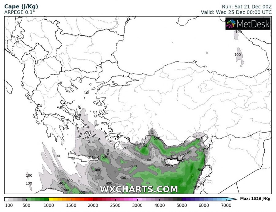
Unstable airmass will spread across the Ionian Sea, Aegean sea and the whole eastern Mediterranean, from both strong low-level warm advection and cooling mid-levels. 400-800 J/kg will locally be available, supporting convective storms with severe winds and torrential rainfall threat. Shear and enhanced helicity along the south Turkish coast could also support tornadic storms along the leading cold front.
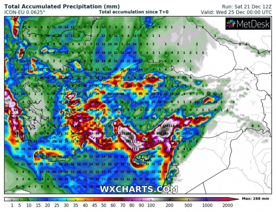
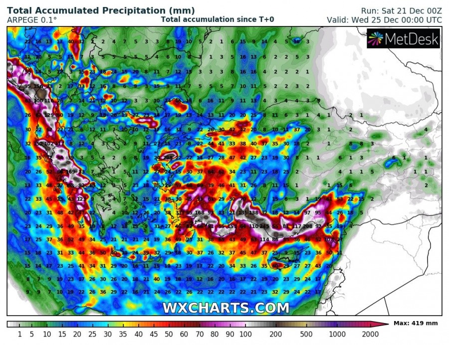
Persistent intense orographic rainfall, combined with occasional convective lines and storms, will push rainfall sums into 250-400+ mm within 72 hr period. That is an extreme amount for southern Turkey and will likely lead to significant flooding in some areas, potentially destructive flash floods along the southern Turkish coast!
Rainfall sums across south Italy and south Balkans – the highest amounts are expected across Montenegro, up to around 400 mm of rain, we can easily see the rain sums are located along the mountain ranges due to mainly orographic rainfall expected. A lot of rain is expected across the southern Apennines, western Greece and Albania.
A lot of snow is also likely in the high mountains across southern Turkey, likely result in 100-150 cm of fresh snow by Wednesday there. Avalanche threat will enhance significantly! Some snow is also expected across the higher terrain of SSW Balkan countries.
Stay alert for dangerous conditions through the coming days, flooding potential will increase and could potentially develop life-threatening conditions if significant flooding occurs.
See also:
Interested in our calendar? We are proud to present and promote the best weather photographers in Europe – see details:
