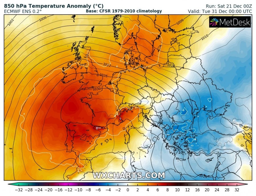
There has been a lot of requests and questions for us what will the weather be around the New Year and at the end of December? Forecasting 5-10 days in advance is called medium-range forecasting, so we use such models as GFS or ECMWF to simulate the potential behaviour of the weather patterns, no matter the continent. Trends are being monitored and latest thoughts are – weather for the end of 2019 into the start of the new year 2020 will likely bring stable and warmer weather across the western half of Europe and colder weather into the eastern half of Europe. Snow chances will then be limited to eastern Europe and the Balkans only.
So, what does the naming “model” actually mean, as we often use it in our discussions? A model or Numerical weather prediction (NWP) uses mathematical models of the atmosphere and oceans to predict the weather based on current weather conditions. There are two main global models, the European ECMWF model and the American GFS model.
The Global Forecast System (GFS) is a global numerical weather prediction system containing a global computer model and variational analysis run by the United States’ National Weather Service (NWS). Read more: Global Forecast System
The European Centre for Medium-Range Weather Forecasts (ECMWF) is an independent intergovernmental organisation supported by most of the nations of Europe and is based at Shinfield Park, Reading, United Kingdom. ECMWF aims to provide accurate medium-range global weather forecasts out to 15 days and seasonal forecasts out to 12 months. Read more: European Centre for Medium-Range Weather Forecasts
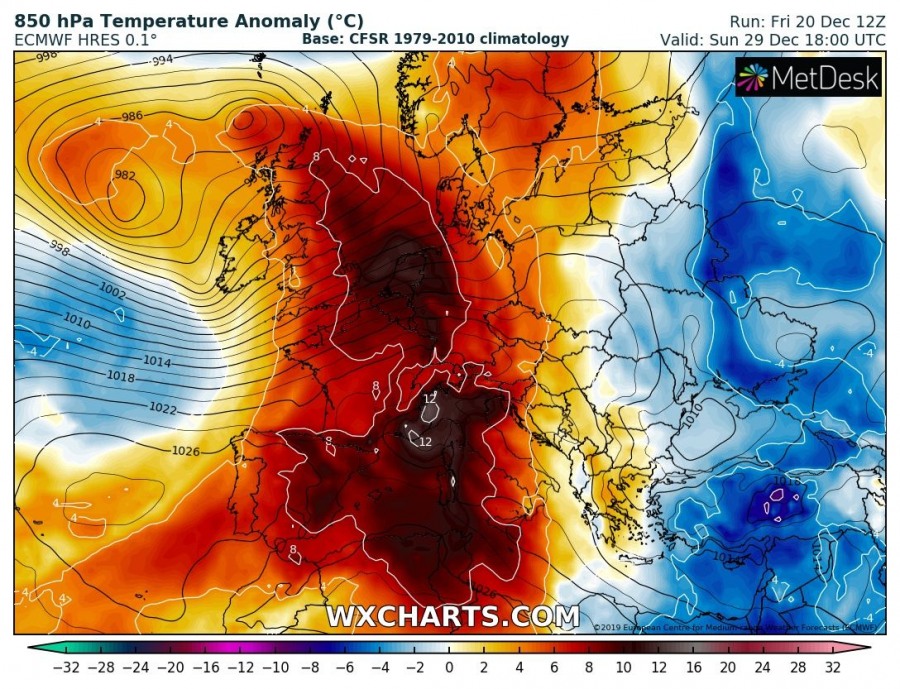
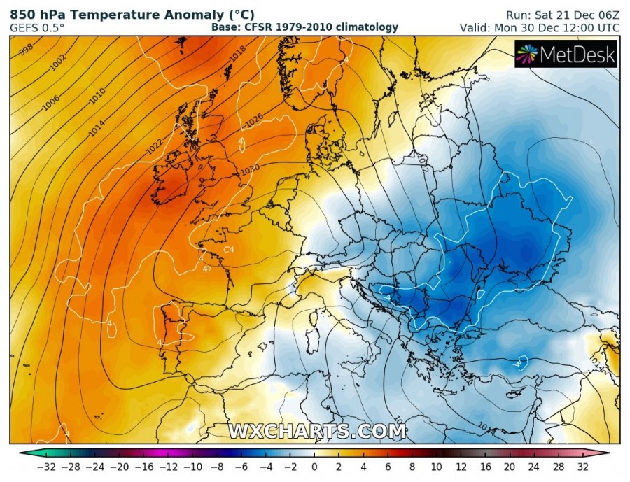
Yesterday, both models were hinting a completely opposite pattern for the end of December – deterministic run by ECMWF model was simulating very warm weather across the western half of Europe and colder across the east, while the GFS was simulating the cold outbreak into west-central Europe and warmer to the east. So how would you forecast 7 days in advance? With such model simulations, it’s literally impossible to even hint the trends. But, at such range, forecasts can change faster and significantly! Let’s compare both models for the next week – the picture is clear, they’re more or less completely flipped.
ECMWF model forecast for Dec 29/30th
A strong warm advection into WSW, central Europe and the Mediterranean, while cold weather across eastern Europe.
GFS model forecast for Dec 29/30th
A cold outbreak into the west-central and SW Europe, but warmer across the ESE Europe.
However, today’s picture is a bit clearer, but still, a lot can change. Looking over the ensemble (averaging) forecasts from both models, we can see they’re actually in better agreement regarding the temperature trends for the last days of December. Both are trending towards cold eastern half and warmer across the western half – that is leaning more towards the European model ECMWF solution we discussed earlier.
As we can see, forecasting the trends in the mid/long-range can still bring quite a challenge at times and it is very important to look after the ensemble model forecasts as well. That’s how you get the average or numerous model (deterministic) runs merged together, revealing a better picture of the weather patterns.
We are monitoring the pattern evolution further in the coming days – stay tuned!
See also – dynamic pattern is ongoing across Europe this weekend:
Interested in our calendar? We are proud to present and promote the best weather photographers in Europe – see details:


