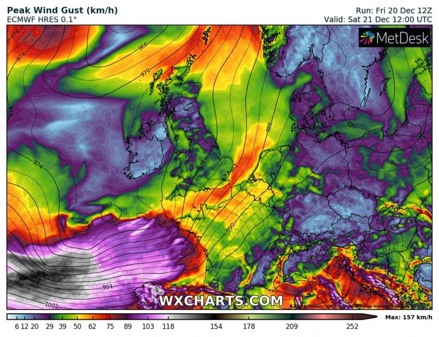
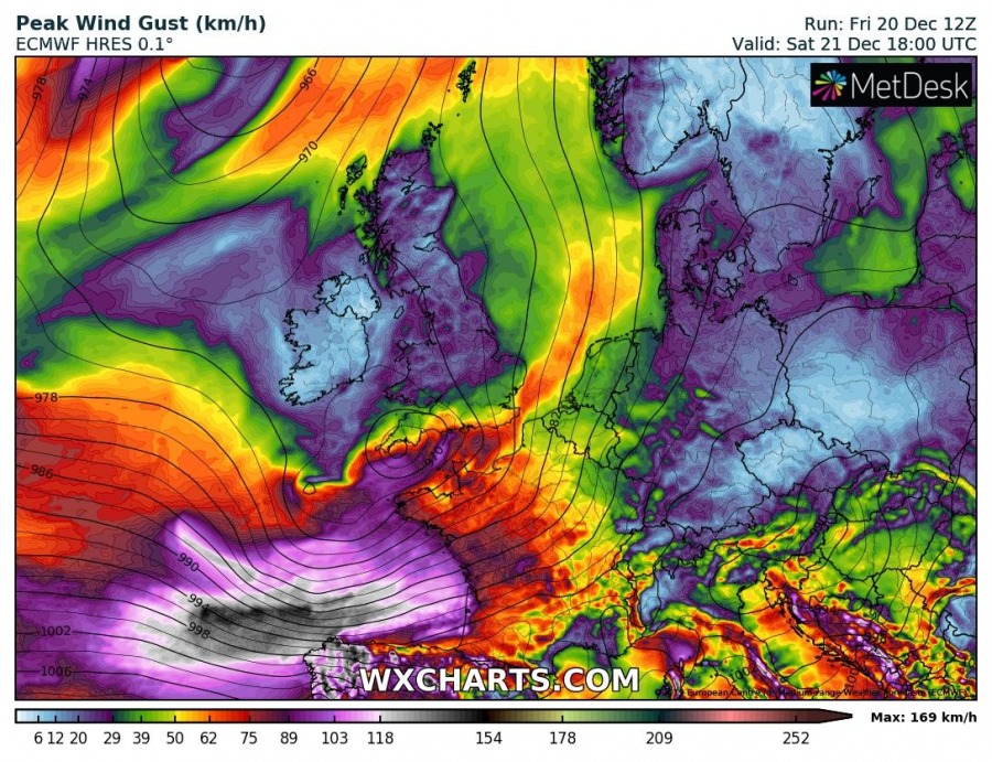
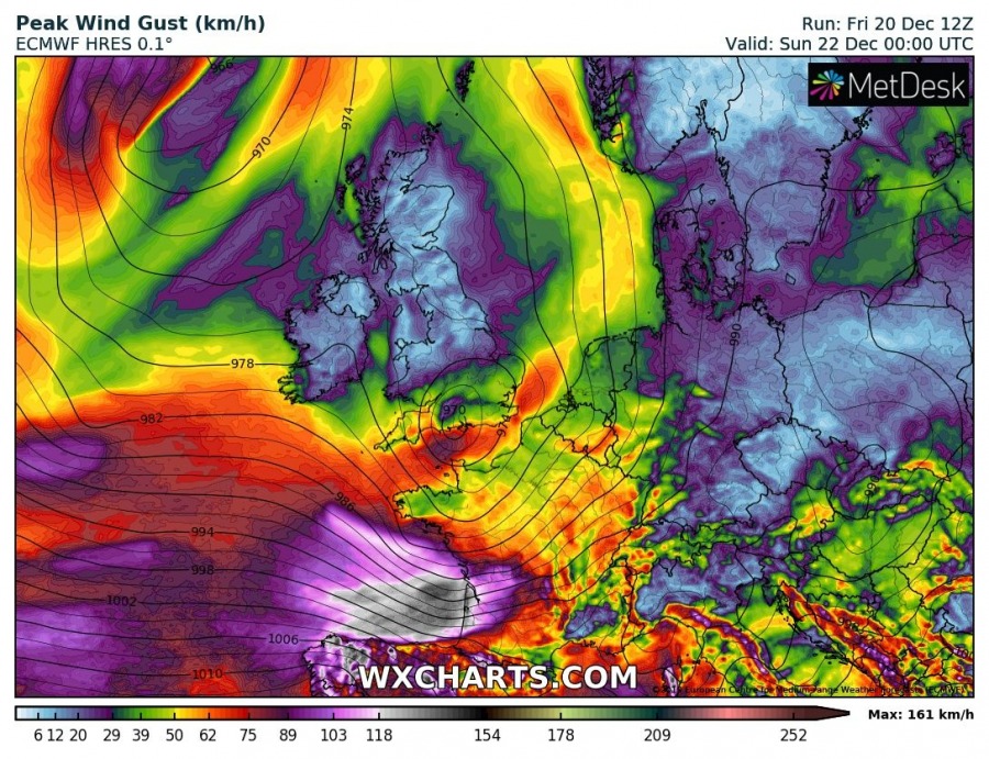
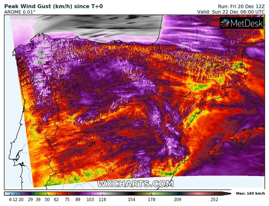
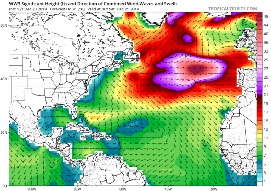
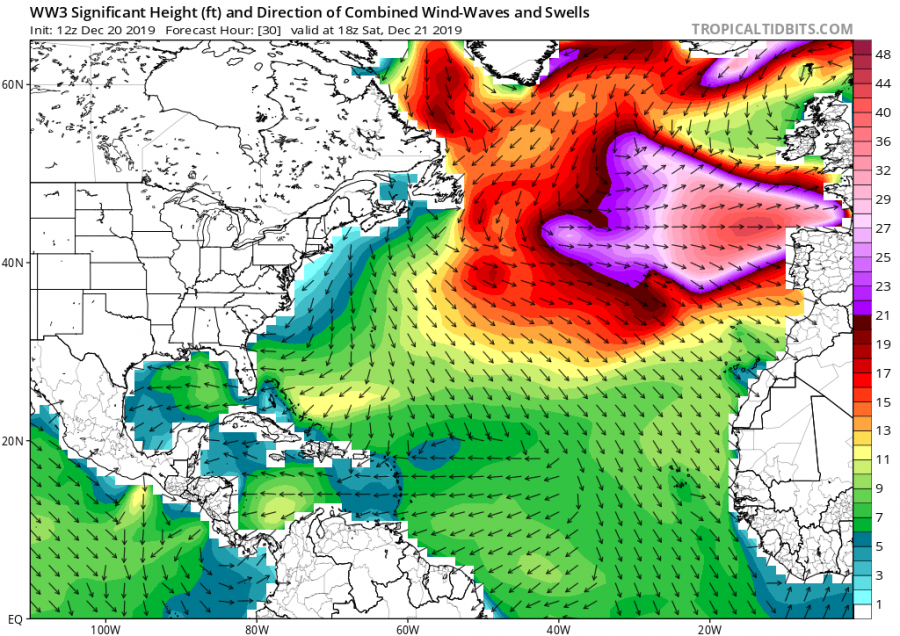
Yet another deep cyclone develops over the North Atlantic, resulting in secondary cyclogenesis over the Bay of Biscay this weekend. An intense windstorm develops, delivering extremely severe winds up to 160 km/h along the cyclone’s track across the north Iberia and towards WSW France. Major waves up to around 10 meters are expected along the coasts as well.
The pattern over Europe reveals a very large and deep trough established across the North Atlantic and western Europe while ridging to the east is gradually falling apart. To the south of the trough, a powerful westerly – near 200 knots – jet stream is placed.
Attached is the 6-hour sequence of cyclogenesis towards the Bay of Biscay, taking place on Saturday morning to the north of Azores. Powerful westerly flow will rapidly translate the cyclone further east through the daytime hours while the system will continue deepening along its track. An intense windstorm develops to its south, bringing severe to extremely severe wind gusts into NW Iberia in the evening hours. Cyclone moves across the Bay of Biscay towards the English Channel overnight to Sunday while an associated windstorm with severe gusts continues across northern Spain and towards the WSW France. Peak gusts around 120-160 km/h are locally possible, even higher over the mountain peaks.
Peak wind gusts swath maps indicate the most severe (locally extremely severe) winds are expected across a broad area south of the cyclone, introducing 120-160 km/h gusts. Possibly even more over the open waters NW of Iberia and indeed across the highest mountains in NW Spain.
Major waves will develop south of the developing cyclone, reaching around 15 meters to the north of Azores on Saturday morning. As cyclone travels east, major waves and swell will spread east-southeast across the Bay of Biscay, western/northern Iberia and western France, reaching 8-12 meters in some areas!
Additionally, westerly flow will introduce a persisting orographic rainfall towards the higher terrain of Spain and Portugal, locally resulting in additional excessive rainfall and therefore rising the flooding potential again. Models are hinting more than 200 mm of rain is possible in some locations through Sunday morning.
Stay alert for dangerous weather conditions with damaging winds and major waves along the coasts of WNW Portugal, NNW Spain and WSW France!
See also:
Interested in our calendar? We are proud to present and promote the best weather photographers in Europe – see details:


