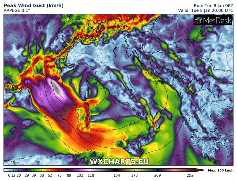
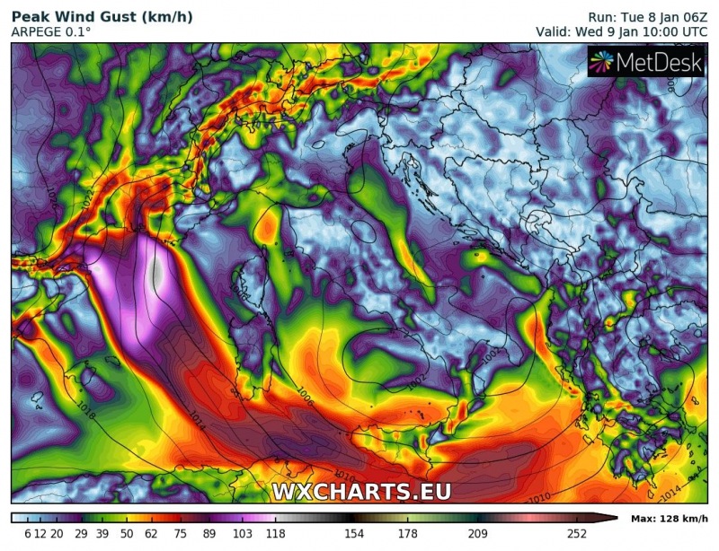
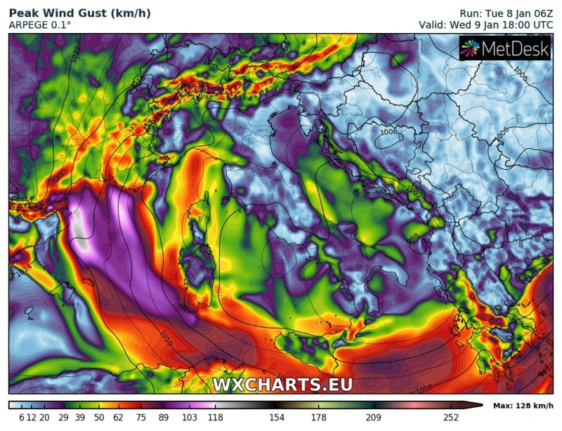
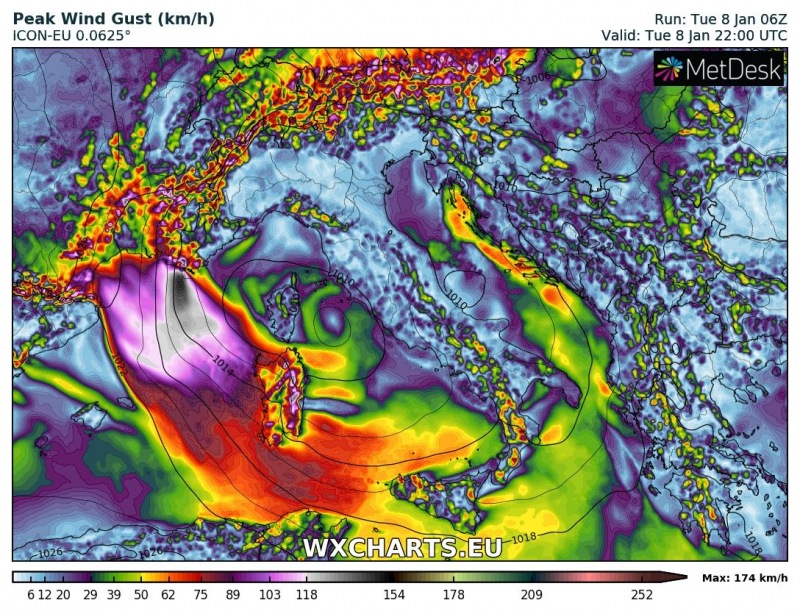
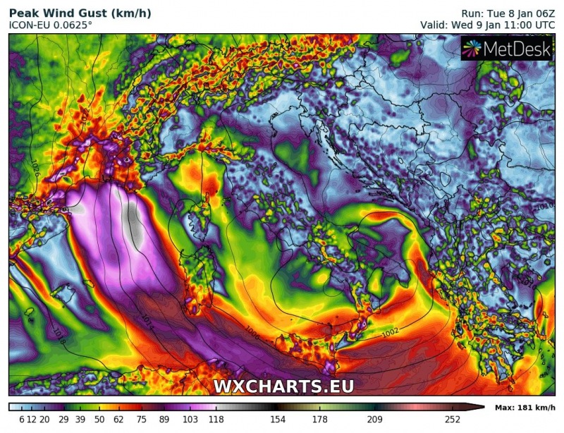
Intense Mistral winds will develop along the southern coast of France and over the northwestern Mediterranean in the wake of the cold front, pushing into the Mediterranean. Peak wind gusts will exceed severe and potentially very severe threshold.
A significant Mistral windstorm builds up in the wake of the cold front and secondary Geona low cyclogenesis over the northern-northwestern Mediterranean. Strong N-NW flow (Mistral) establishes into the N-NW Mediterranean, pushing southwards and then eastwards along the southern sector of the forming Genoa cutoff low. Gusts up to 89-90, possibly 110 km/h along the coast of S France. Up to 110-130 km/h in eastern Sardinia. This low will cause a major precipitation event in southeastern Europe.
Peak wind gusts on Tuesday 20h and Wednesday 10h and total peak wind gusts through Wednesday 18h UTC. ARPEGE model guidance. Map: Wxcharts.eu.
Peak wind gusts on Tuesday 22h and Wednesday 11h and total peak wind gusts through Wednesday 11h UTC. ICON-EU model guidance. Map: Wxcharts.eu.
