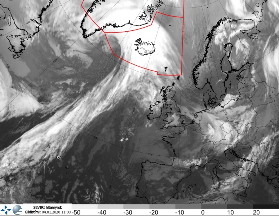
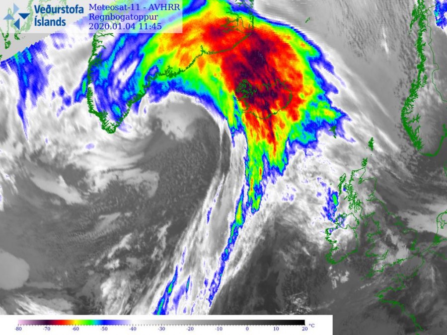
A rapidly intensifying cyclone is ongoing to the northwest of Iceland, resulting in local intense blizzard conditions across the western half of the country. With the arrival of a strong warm front/advection from the west, snow is changing to rain this afternoon. Significantly warmer airmass than yesterday is expected to spread across much of Iceland today.
Our fellow chase partner in Iceland Muhammed Emin Kizilkaya was reporting live from the capital Reykjavik on our Facebook page, see a couple of his reports:
https://www.facebook.com/severeweatherEU/videos/1086921294981183/
https://www.facebook.com/severeweatherEU/videos/1249488451928645/
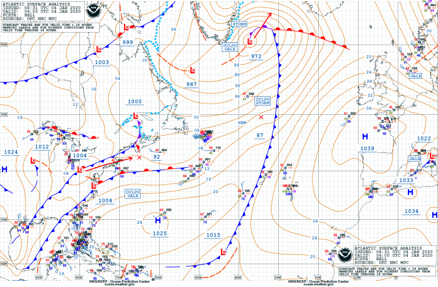
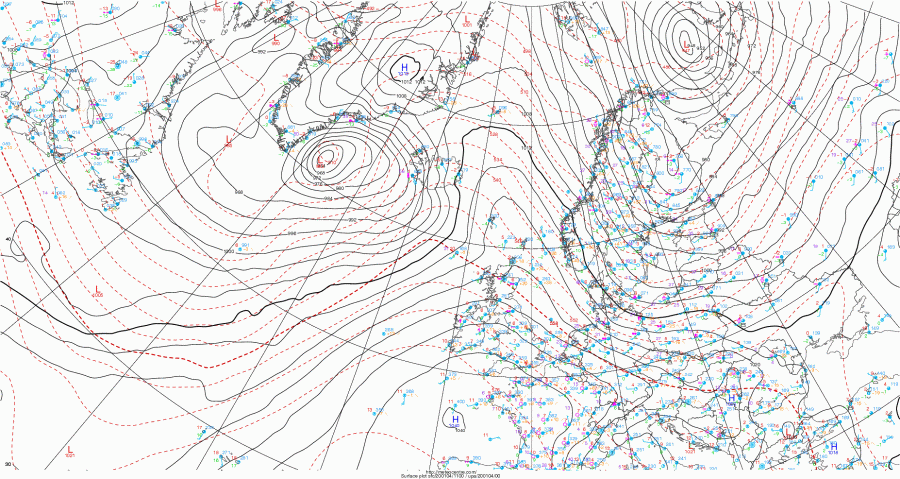
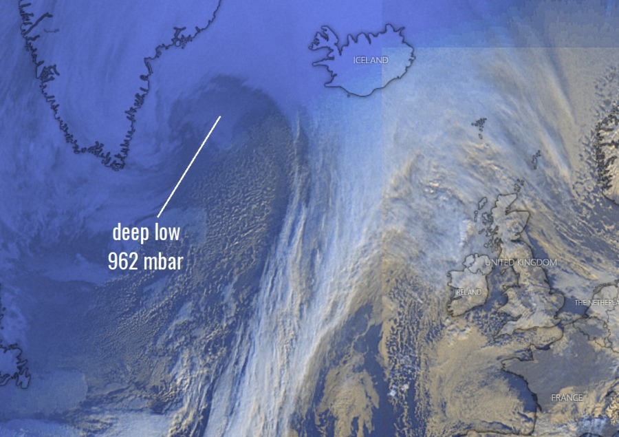
NOAA OPC surface analysis across the north Atlantic at 06 UTC today, Jan 4th – an intense cyclone was centered SE of Greenland with central pressure 972 mbar, moving towards north of Iceland. Developing gale to hurricane-force winds were ongoing on its wake towards the coast of South Greenland. The frontal system is very well visible, pushing the warm front towards Iceland and a very long cold front extending south towards the Azores. A strong surface pressure system is over western Europe. Less than 6 hours later, the surface analysis reveals pressure is already around 962 mbar.
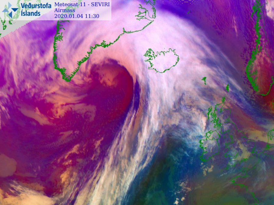
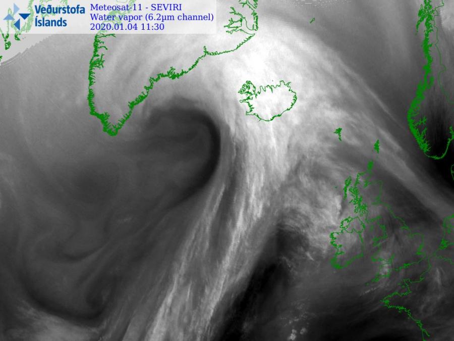
Again, quite spectacular satellite presentation of rapid cyclogenesis near the southern tip of Greenland, the textbook extra-tropical cyclone moving its frontal boundaries towards Iceland.
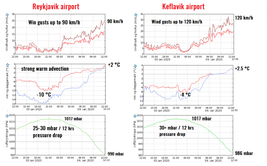
Here is the analysis of surface pressure, temperature and winds on the two airports – Keflavik and Reykjavik. Both are indicating the pressure fall was very rapid, from around 1017 mbar to 986 mbar in Keflavik since midnight – that’s more than 30 mbar drop in 12 hours. Both stations are reporting severe winds, more intense at Keflavik airport – up to around 120 km/h. The airport is closed due to severe winds and strongly reduced visibility. Notice also a quite strong warm advection in both locations, warming from -8 to -10 °C last night to around +2 °C at noon today. Snow is changing to rain now.
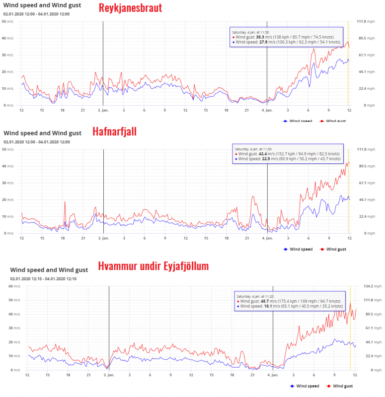
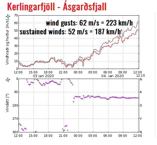
Some other locations, those which are better exposed to accelerating winds in the fjords slopes or higher in the mountains, are reporting 140-180 km/h. The usual very intense location is Kerlingarffjoll, located on the southern side of Vatna glacier, is reporting gusts up to 223 km/h!
Refer to the forecast discussion:
Interested in our calendar? We are proud to present and promote the best weather photographers in Europe – see details:
