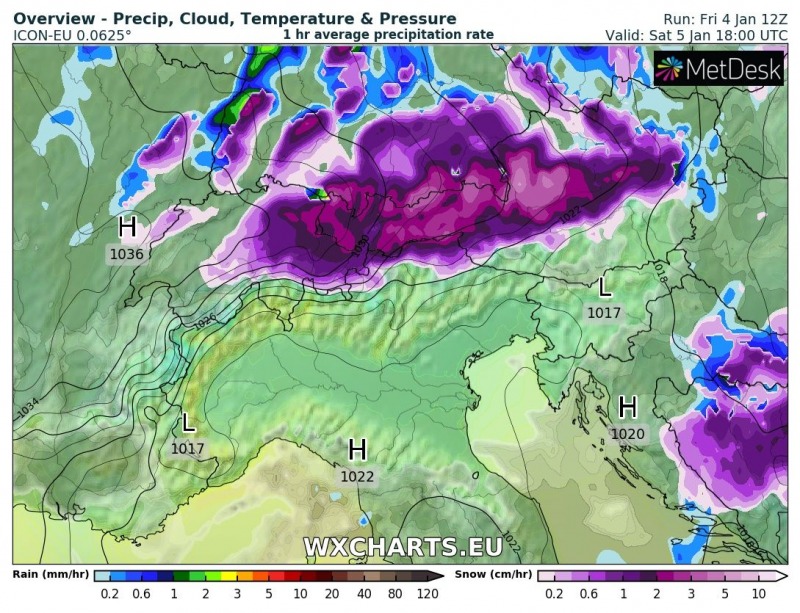
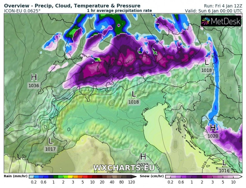
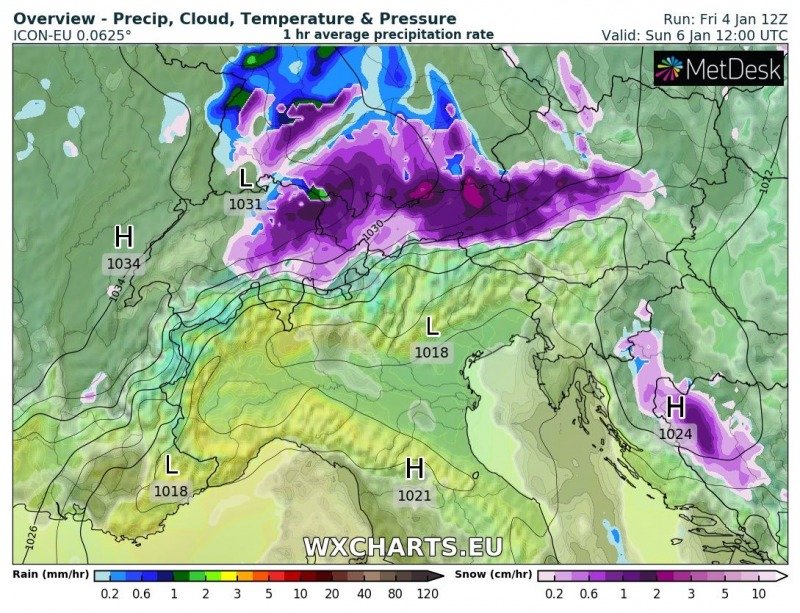
A new period of significant snowfall is developing across the northern Alpine flank as a textbook Stau event takes place this weekend. A persisting strong northerly flow will bring very intense and continuous snowfall until late Sunday, January 6th, locally resulting in more than 100-150 cm of fresh snow across the northern Austria and eastern Switzerland.
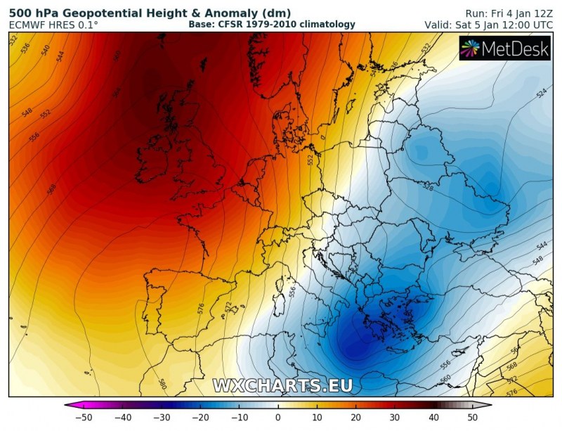
The overall pattern this weekend shows a strong north Atlantic ridge and deep trough over the Balkan peninsula, creating a sharp pressure / temperature gradient in between. This will establish a strong meridional mid-level flow, allowing deep moisture advection towards the Alpine mountain range and result in the orographic snowfall and stau effect.
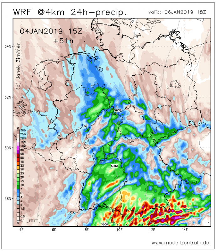
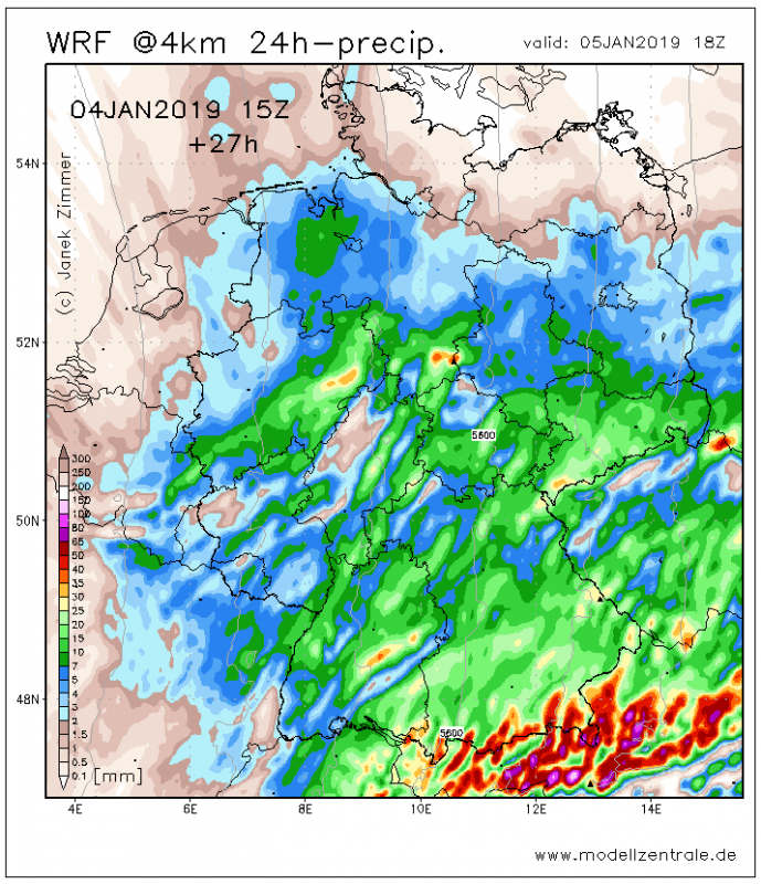
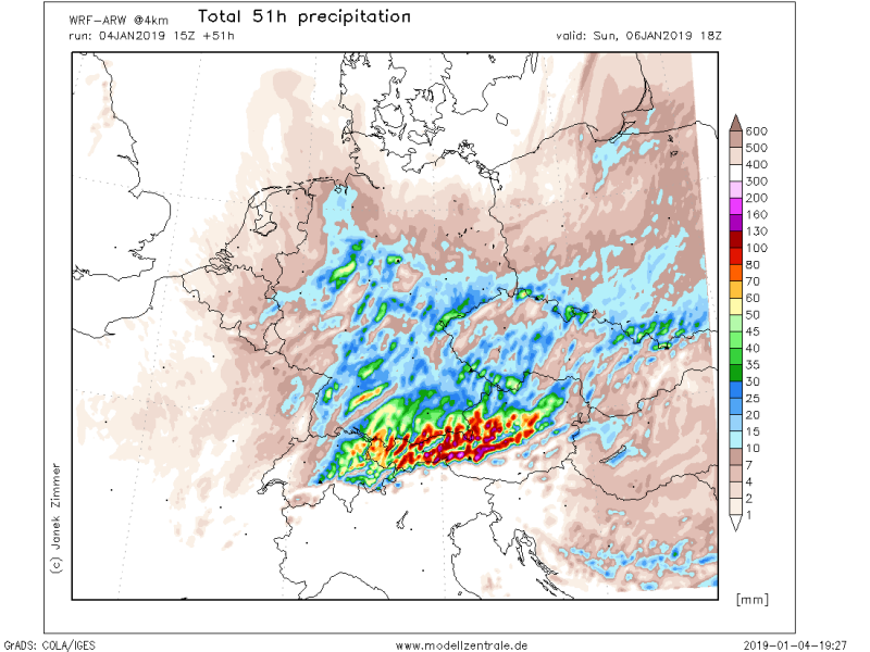
Total 24-hour and 51-hour precipitation sums through Saturday and Sunday, both days could see 50-100 mm of precipitation in some areas. That is 150 cm or more fresh snow in some places, at least. This will result in enhanced danger for snow avalanches across northern Austria and eastern Switzerland – stay alert!
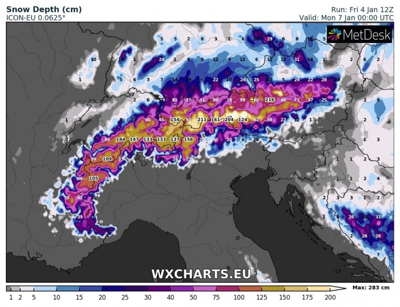
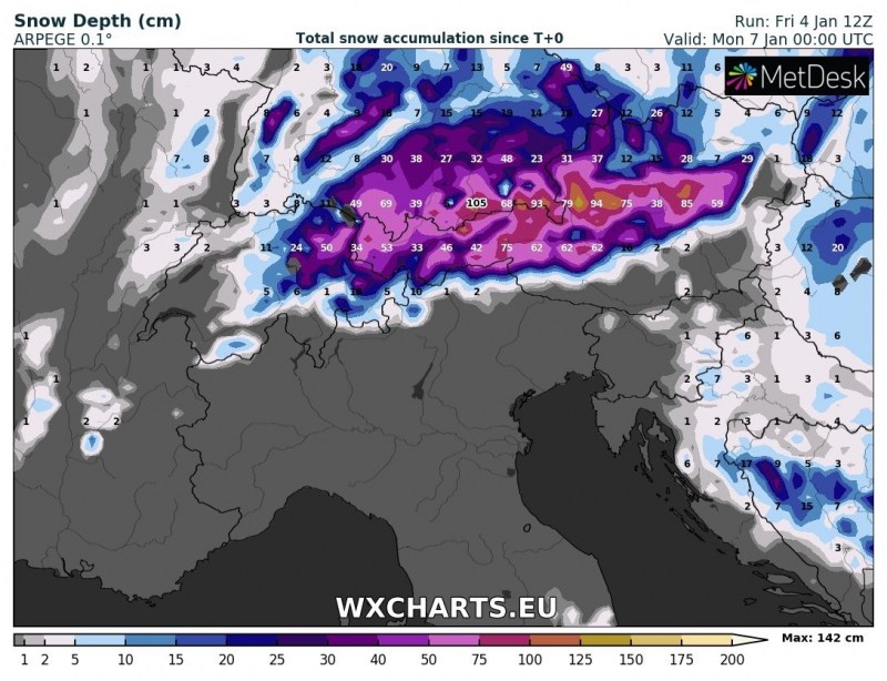
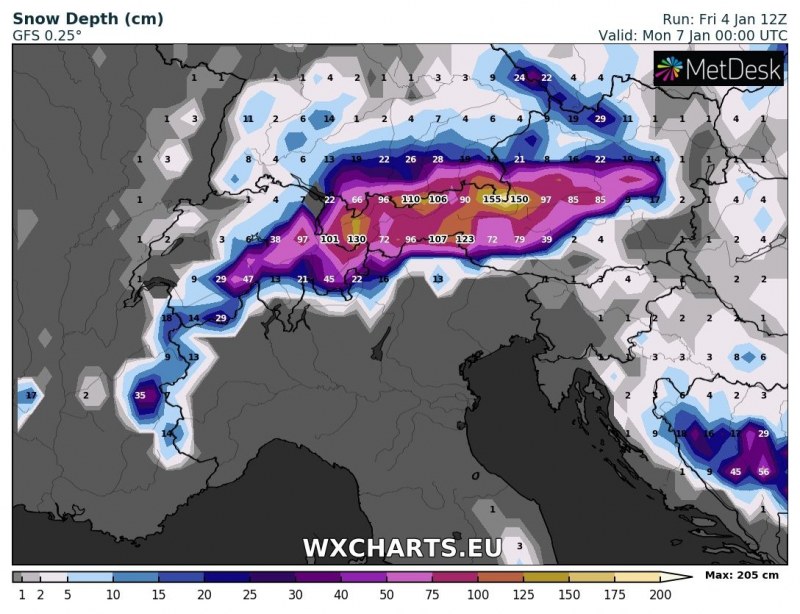
Snow depth until Sunday’s night, based on GFS, ARPEGE and ICON-EU models. All models agree in very deep snow in the higher terrain at the end of weekend, likely locally well in excess of 250-300 cm in total.
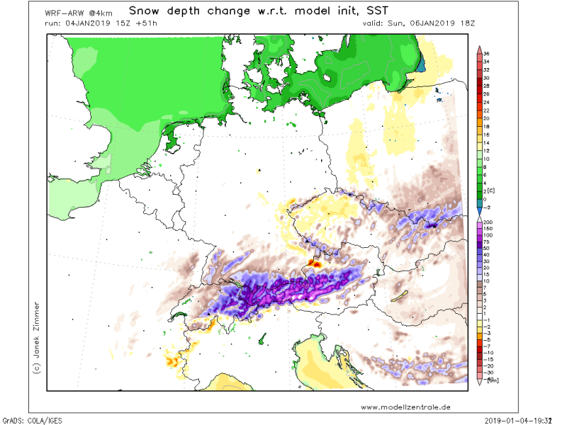
WRF model map of snow depth change through Sunday evening indicating high mountains near the Alpine ridge could reach even more than 200 cm of fresh snow in 51 hours period!
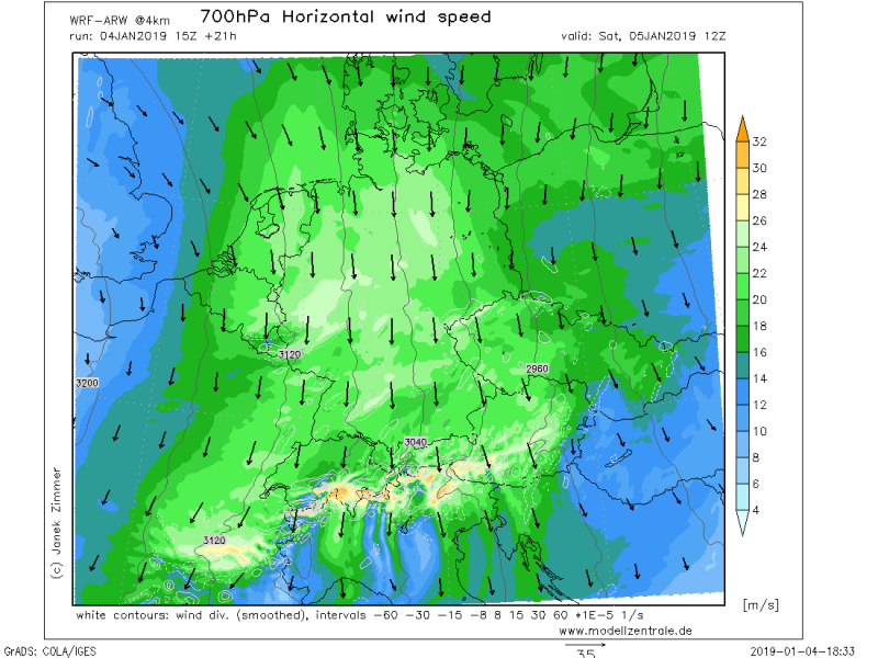
Persisting strong northerly winds in between the ridge to the west and trough to east, will result in advection of moisture into the higher terrain of the Alps and result in intense orographic precipitation. Attached is the 700 mbar height wind map for Saturday afternoon.
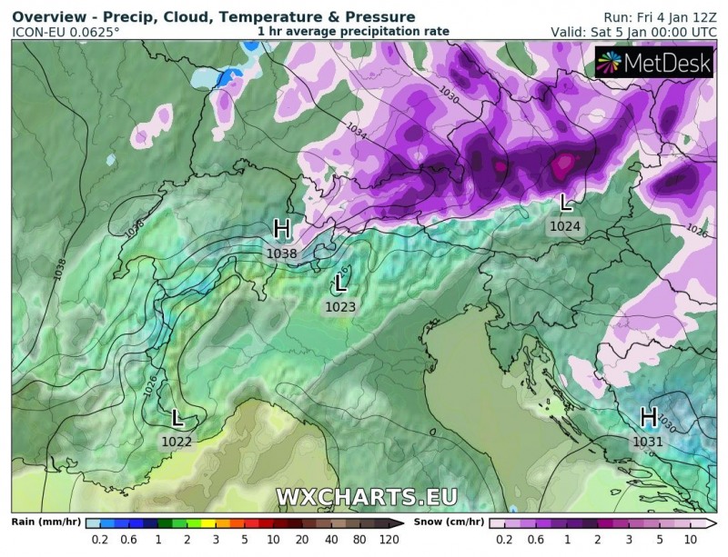
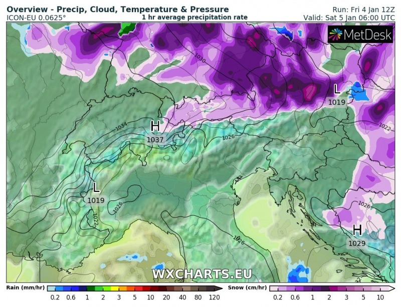
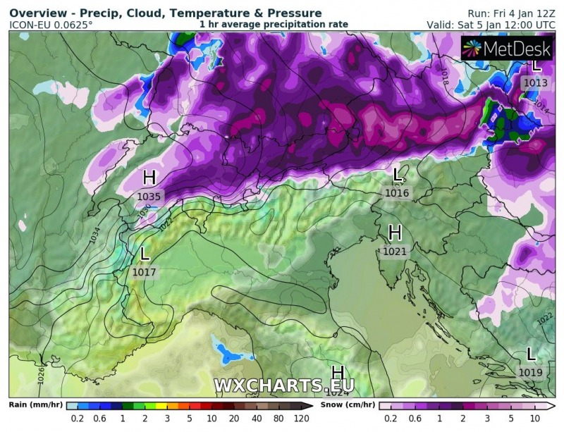
Here is the 6-hour sequence of the snowfall evolution from tonight until Sunday afternoon. The most intense snowfall will occur tomorrow during the daytime hours, through 6-18 UTC period across northern Austria, eastern Switzerland and partly also across the extreme south Germany.
This event will become very dangerous as additional extreme amount of snow is expected over already deep snow in the region. Total snowfall sums could locally exceed 100-150 cm in less than 48 hours. This will significantly enhance snow avalanche threat and high risk will develop – stay alert in this life-threatening weather situation!
