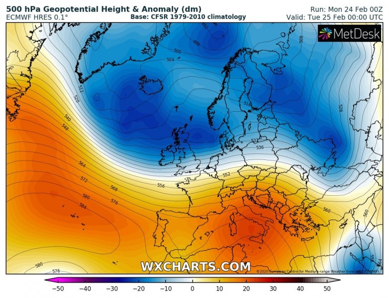
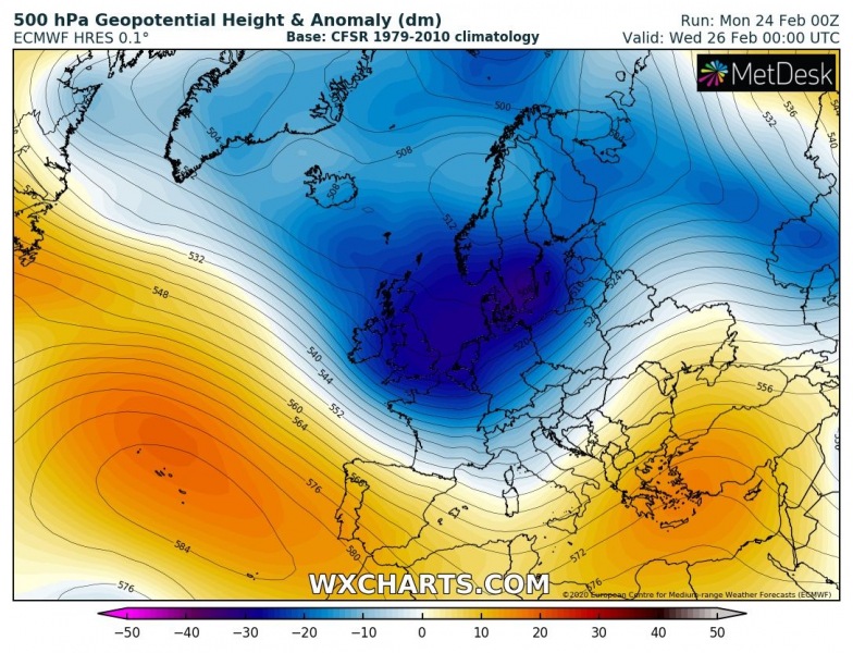
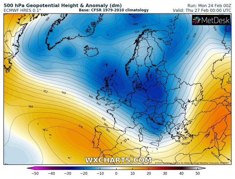
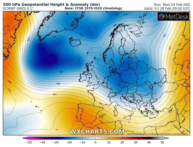
At least some days of colder and locally wintery weather is finally foreseen this week, as a deep Nort Atlantic trough pushes across the European continent. The cold air mass advection will first spread into western Europe, continue into central Europe, the Mediterranean and the Balkans through mid-week. The frontal system will deliver quite some snow locally.
The pattern is changing this week as the upper-level ridging over Europe is collapsing. A deep North-Atlantic trough will spread towards central Europe, partly also over the Mediterranean and the Balkan peninsula.
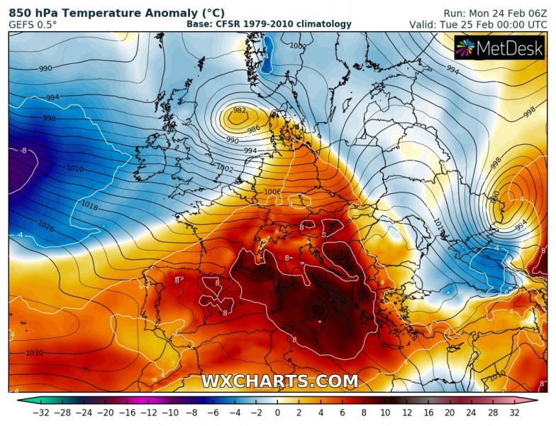
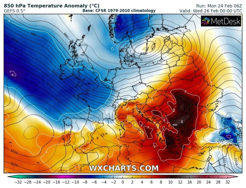
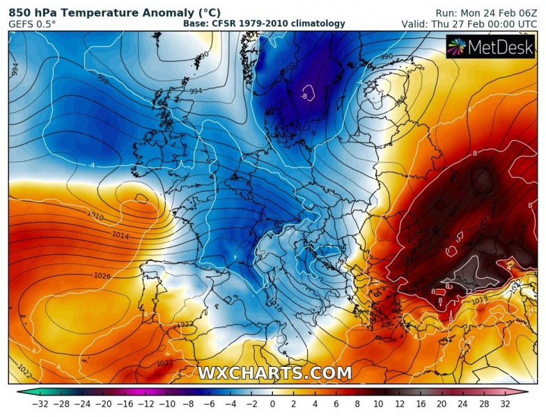
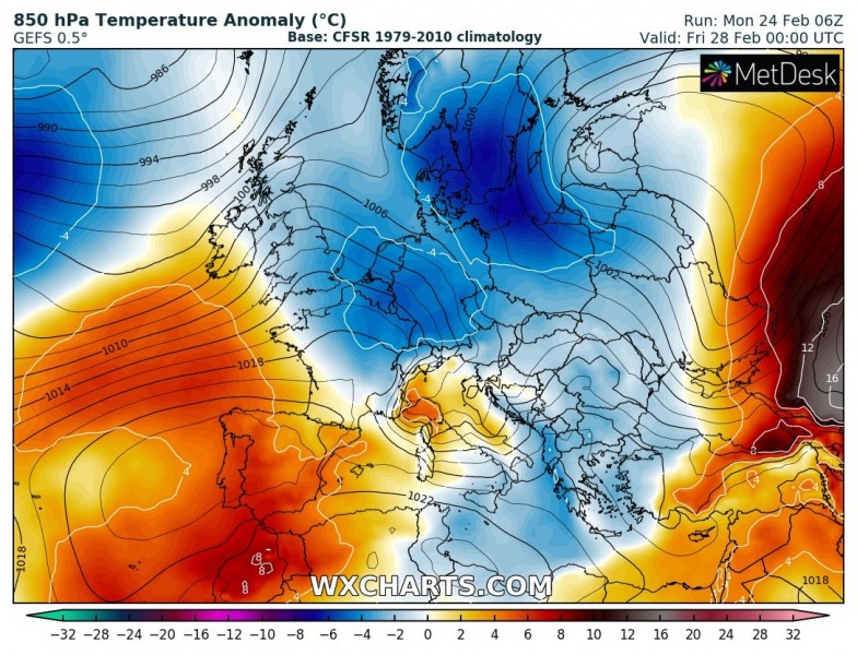
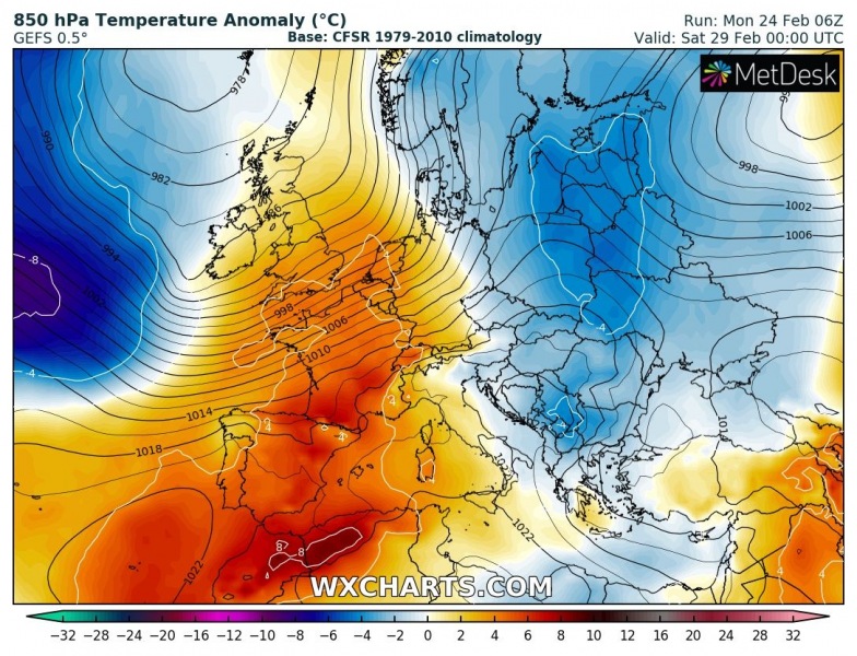
The colder air mass advection is best seen on the 850 mbar temperature anomaly charts, starting tonight over western Europe. Moving across France and Benelux tomorrow, spreading into central Europe, the Mediterranean, and the Balkans on Wednesday night. With the building ridge over Iberia on Thursday, warm advection is likely to push back into the western half of Europe towards the weekend.
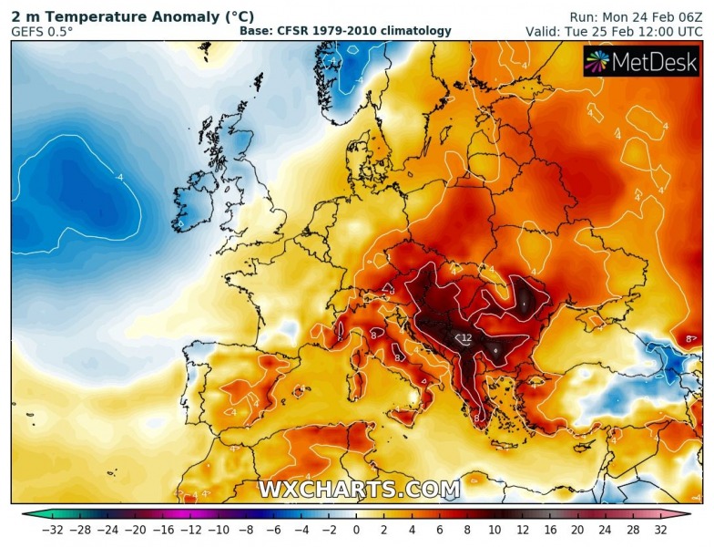
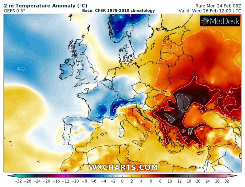
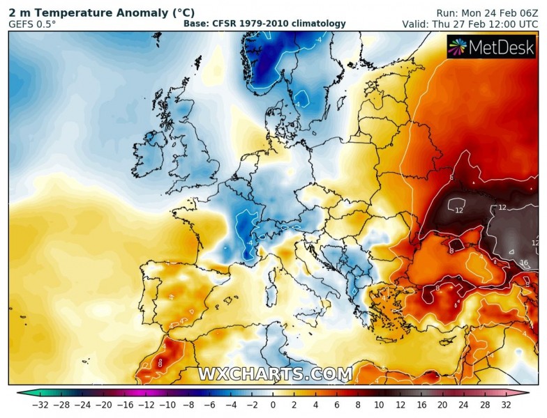
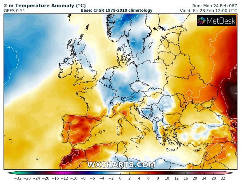
As we can see on the 2-meter temperature anomalies, it will not be particularly cold. But at least it will be colder from the weather we’ve been experiencing lately. While Tuesday (and partly Wednesday) will be still very warm over east-central Europe and the Balkans, colder weather will be spreading into western Europe from the North Atlantic. Reaching central Europe by Wednesday, will cold advection behind the frontal system and the surface cold front. On Thursday, cooler weather also reaches the central Mediterranean and the Balkans.
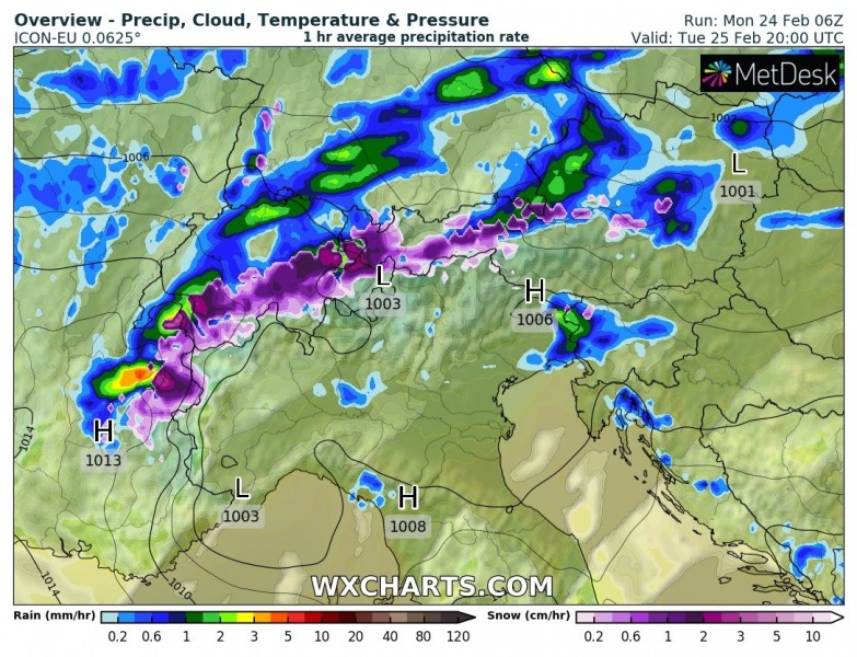
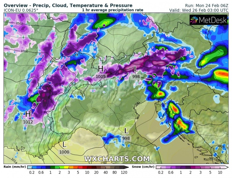
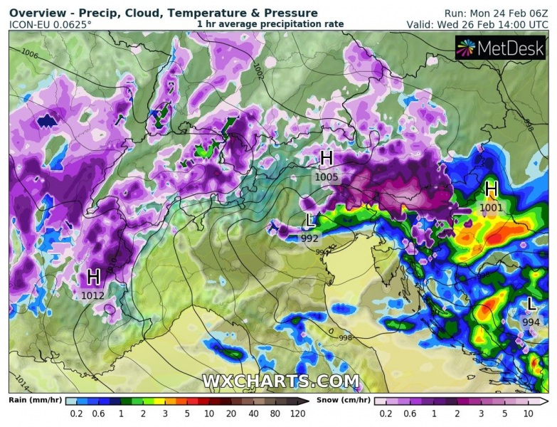
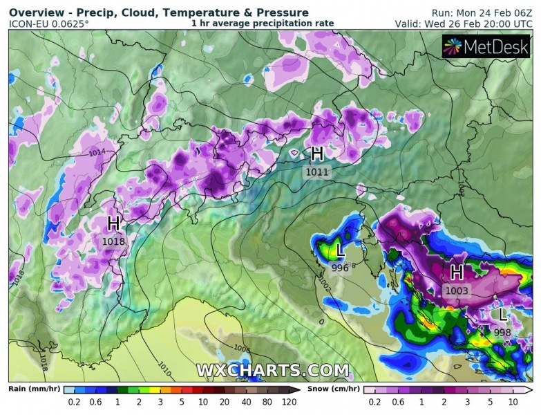
The frontal system will be moving across central Europe from Tuesday night through Wednesday. The rain will be changing to snow gradually from north to south, potentially reaching lowlands in the afternoon and evening hours, more likely over the north and western Balkans with the surface low moving over the Adriatic sea, resulting in cold advection in its wake from the north-northeast. Some instability should also support convective storms near the moving front.
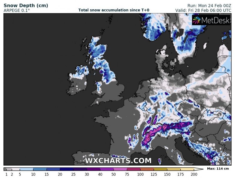
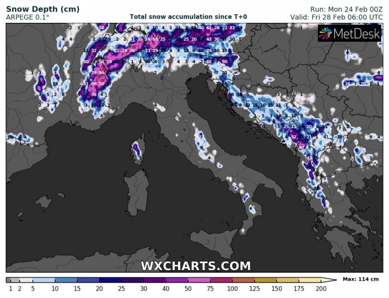
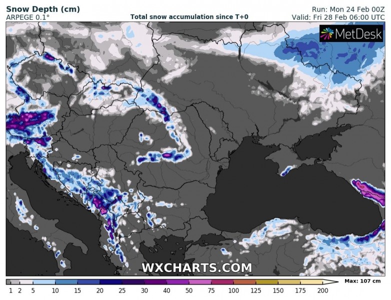
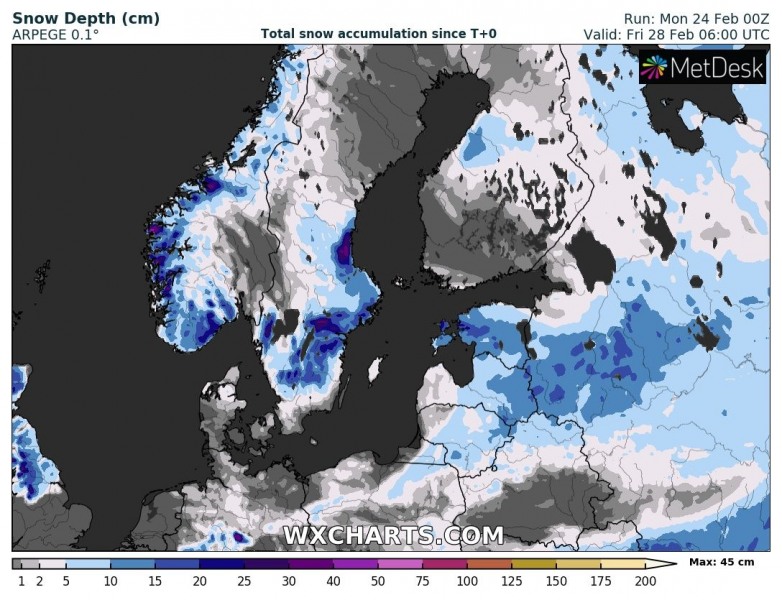
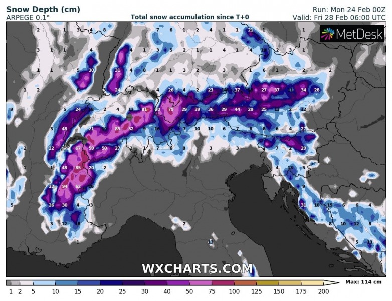
Although the event will not be particularly cold, at least some snow accumulation seems possible across parts of Europe with this wave and the frontal system moving through the mid-week. Attached are maps for various parts of Europe:
Stay tuned for updates!
See also – before the frontal system arrives, the very warm air mass will be experienced over the Mediterranean and the Balkans:
