Who has enough of this unusually warm weather for mid-autumn and who is ready for winter? As mentioned yesterday – *Pattern shift* Weather pattern shift underway, will bring cold air to USA and Europe next week! Snow cover across hemisphere expands rapidly! – It appears likely we are facing the first serious cold Arctic outbreak of this autumn next week! While it is extremely warm currently with near-record breaking temperatures, much colder airmass will spread across east-central Europe as pattern flip develops sometime mid-next week!
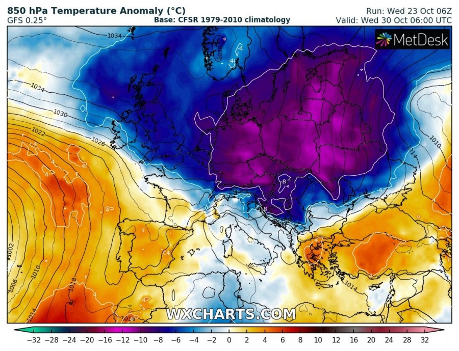
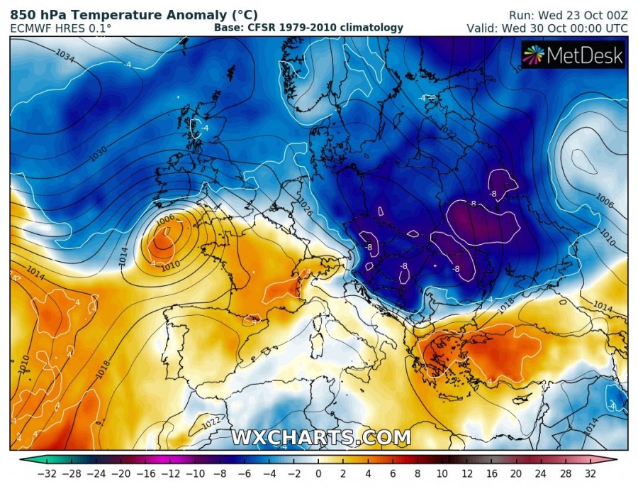
Both global models ECMWF and GFS are actually in quite good agreement regarding the potentially significant pattern change, the question remains the exact date. The latest runs suggest the Arctic outbreak is increasingly likely into eastern Europe and the Balkan peninsula sometime between Tuesday and Thursday! Here is GFS vs. ECMWF side-by-side comparison on Wednesday, Oct 30th:
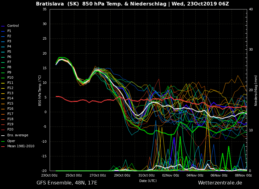
The significant pattern change is also perfectly visible on the ensemble meteogram – an example is for Bratislava, Slovakia. The current 850 mbar temperature is around +18 °C which is more than 12 degrees above normal for this time. During the second half of next week, the Arctic cold airmass pushes across eastern Europe and brings anomaly 7-10 °C colder than average – this means the change will be very significant (20-25 °C from the current ones). Average temperatures at 850mb level would be near or even below zero.
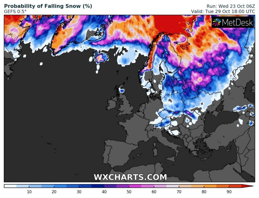
Some snow will be possible too, especially across parts eastern and also central Europe as much colder airmass pushes behind the Arctic front and precipitation could turn into snow in some areas. Indeed, it is still too far ahead to give more details, but trends are being monitored.
We will continue monitoring the evolution of the pattern in the coming days and will keep you updated soon – stay tuned!
See also:


