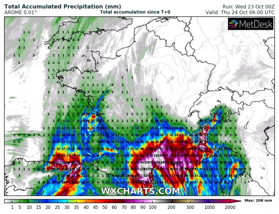
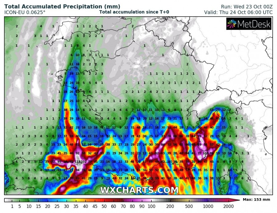
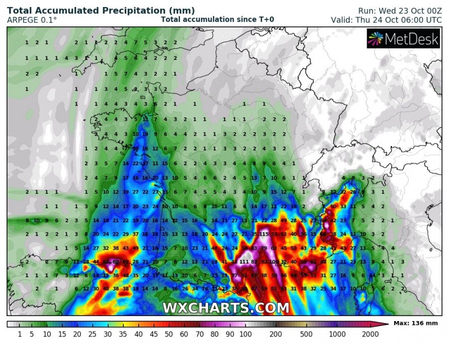
Widespread convective storms are ongoing across the western Mediterranean today, resulting in intense and excessive rainfall into southern France. Activity is gradually spreading east towards NW Italy. Locally up to near 200 mm is possible until tomorrow morning, Thursday, Oct 24th!
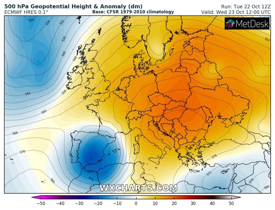
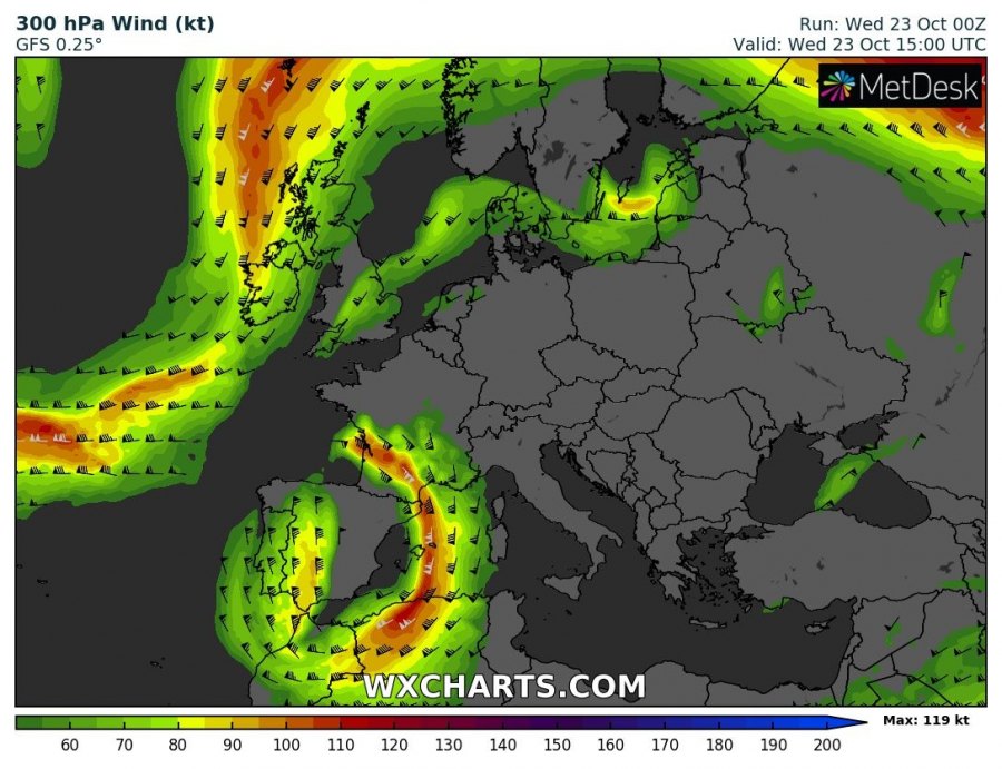
The pattern supporting this activity reveals a strong ridge across E Europe with a deep upper low over the Iberian peninsula, moving into W Mediterranean. Ahead of the low, strong warm / moist advection is ongoing towards France and NW Italy.
Various models ICON-EU, ARPEGE and AROME and hinting up to near 200 mm of rainfall across S France and NW Italy within the next 18-24 hours. A combination of convective and orographic precipitation should lead to high rainfall sums. Severe storms could also support tornadoes and severe winds.
Stay alert for dangerous conditions!
