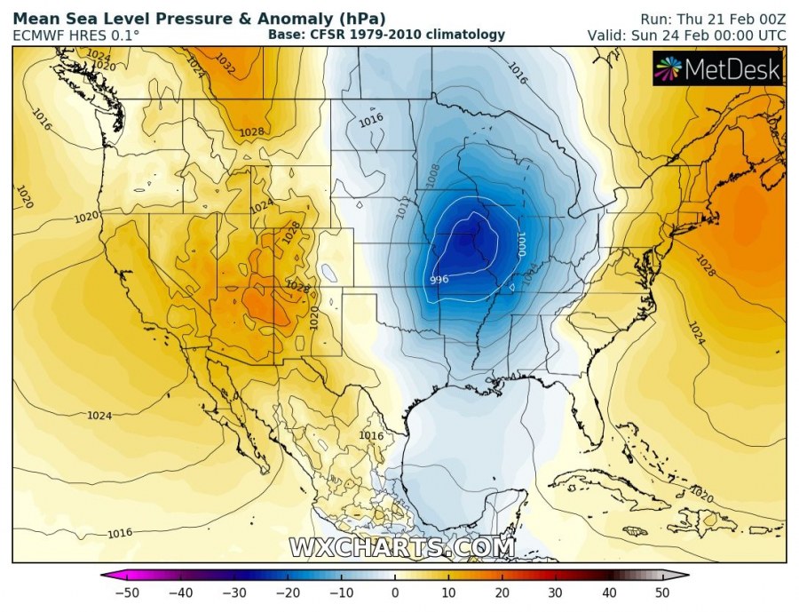
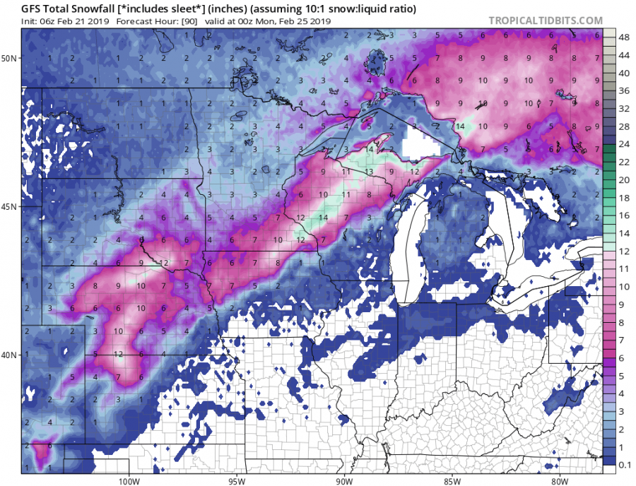
A pretty dynamic winter weather continues across the United States this week. A very intense cyclone will bring excessive snowfall across the Great Plains and Midwest, but also severe storms across the SE US.
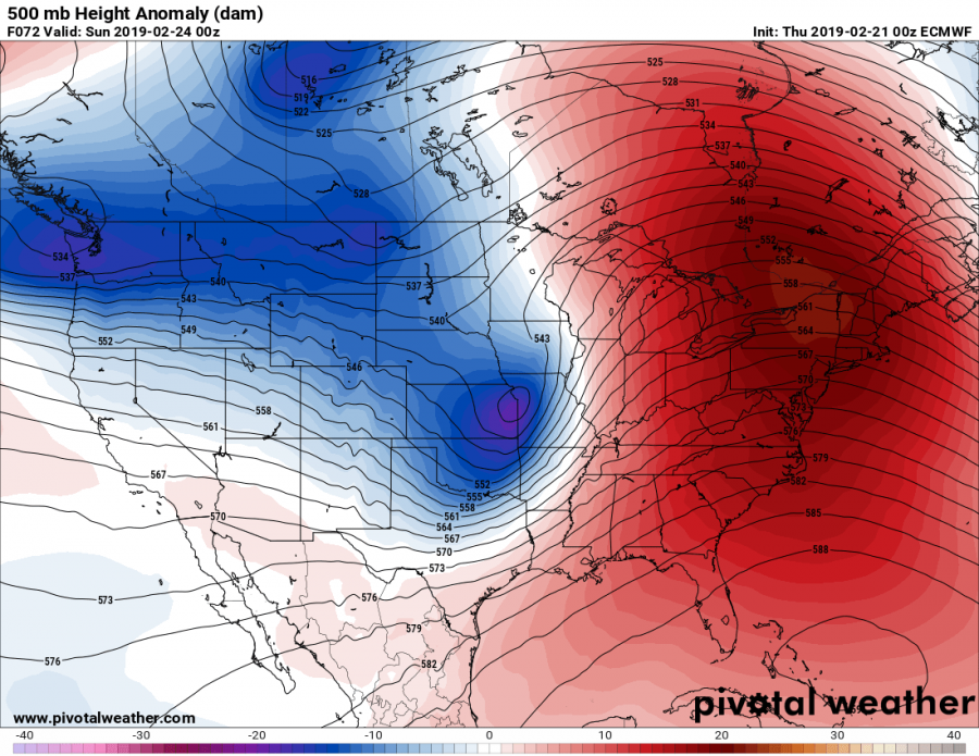
Looking over the 500 mbar chart we can see a deep trough pushed across the Great Plains with a deep surface cyclone, moving towards the Great Lakes region. This will result is a robust environment for heavy snowfall on the rear side of the low.
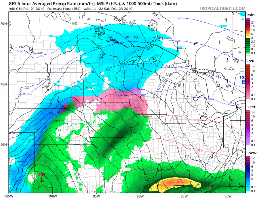
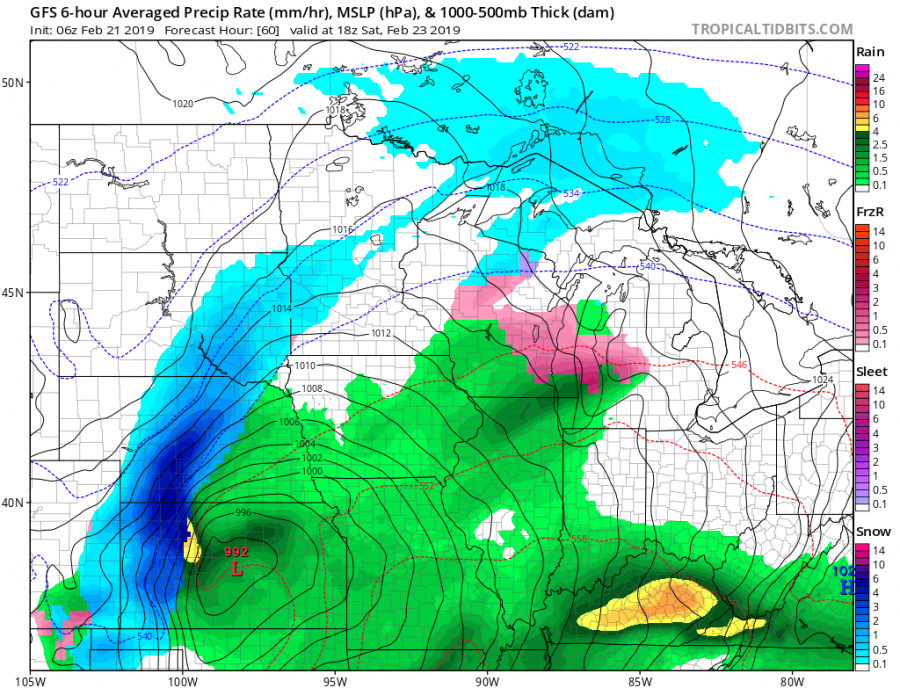
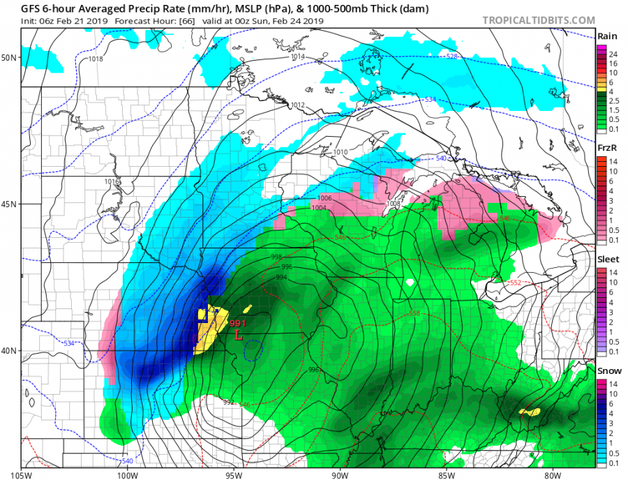
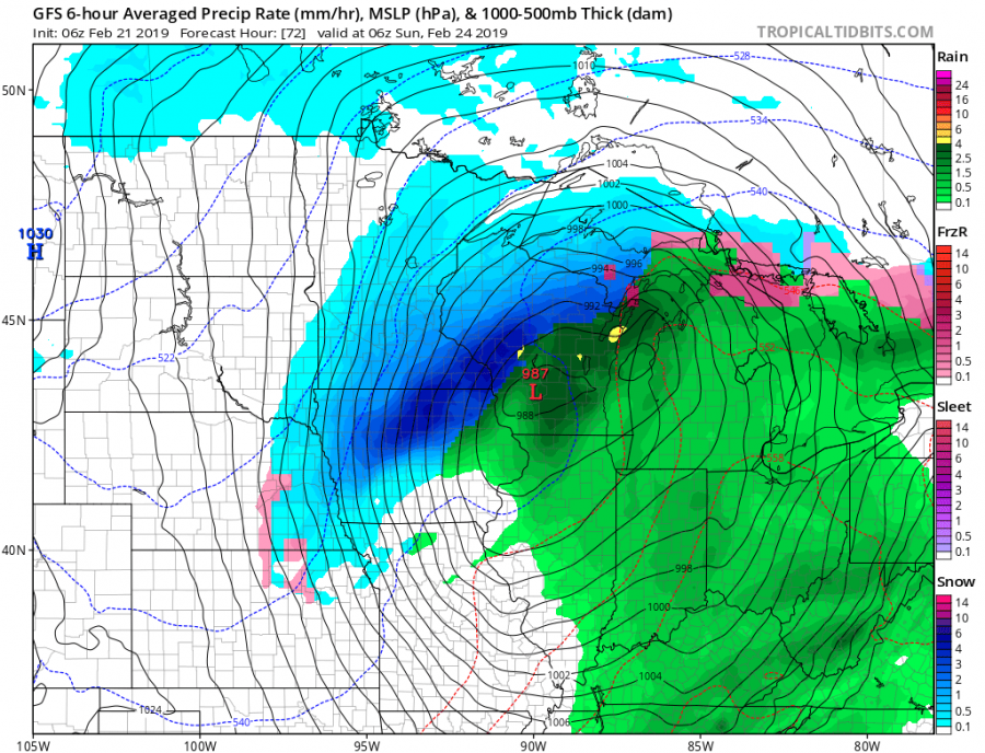
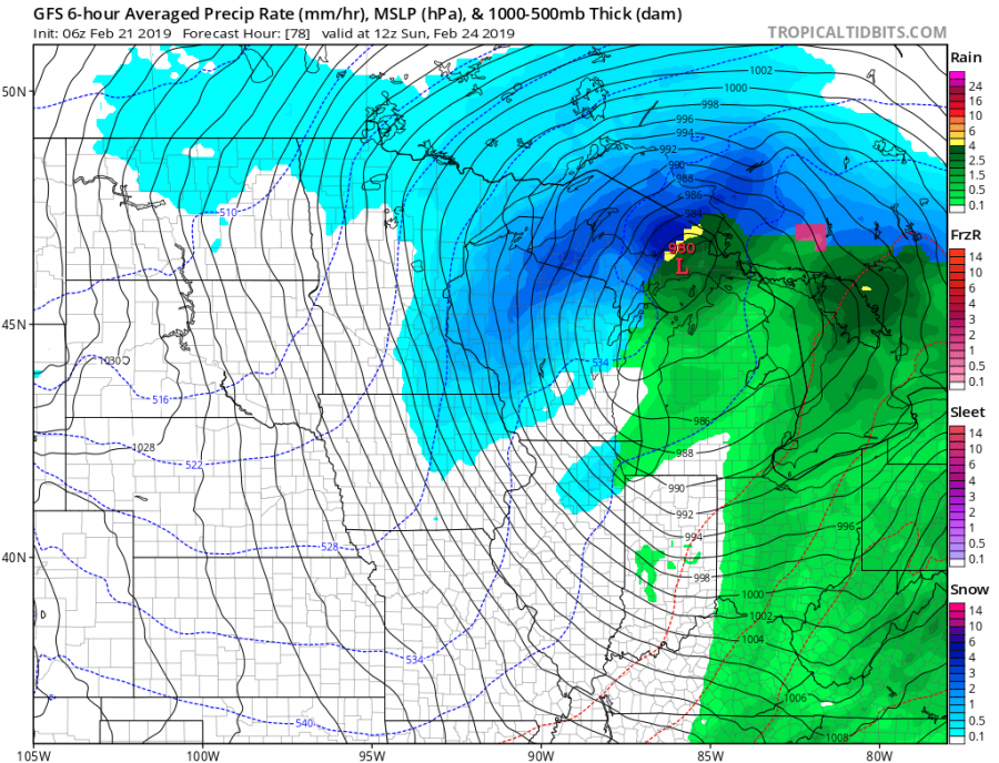
Here is a 6-hour sequence of the cyclone’s track from SW Kansas across Iowa towards Wisconsin. Notice a very intense rainfall near the centre and intense snowfall on the wake side. Severe blizzard conditions will develop there as well. Some freezing rain will also be possible in the narrow corridor near the warm front far ahead of the system, but nothing too severe to expect.
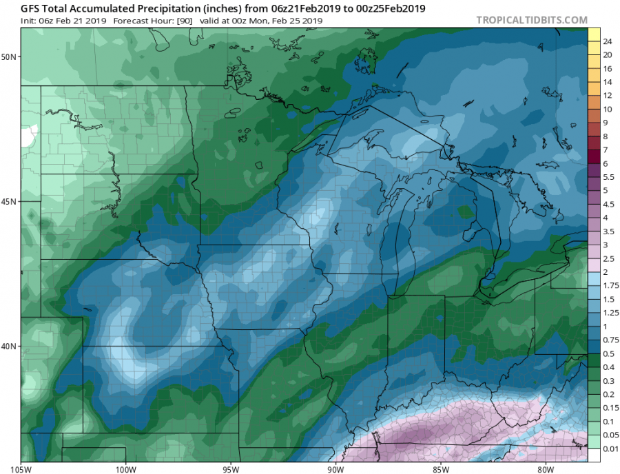
Models are hinting 1.5-3″ of total rainfall along the cyclone’s path and locally 10-15 inches (25-40 cm) of snow.
See also:
