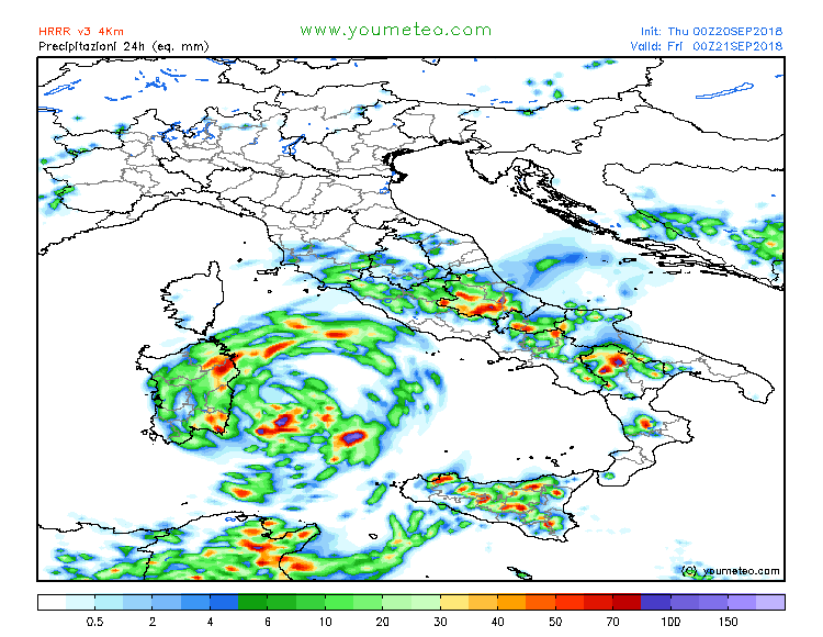
Latest model guidance, together with radar and satellite imagery is now in very good agreement on the developing tropical-like cyclone over the Tyrrhenian sea – a Medicane! Deep convection in ongoing around the centre of the cyclone and tightening pressure gradient is visible. The Medicane is expected to become better organized and more intense within the next 48 hours while it moves along the SE coast of Sardinia towards Tunisia.
Today’s morning radar and satellite analysis: notice the pronounced cirrus clouds outflow across the SW quadrant of the cyclone, as well as interesting behaviour of the convective bands around the sistem.
Visible satellite animation of a developing deep cyclone in the Tyrrhenian sea this morning. A lot of deep convection is visible ongoing around the center low. This activity is expected to continue through the day and lead into and a development of a Medicane @SAT24_WEATHER pic.twitter.com/Gf3zFHFp02
— severe-weather.EU (@severeweatherEU) September 20, 2018
We're closely monitoring an ongoing cyclogenesis (formation of Medicane still possible within the next 36 hours) in the Tyrrhenian sea. Textbook structure of deep convection can be seen both on radar and satellite animation. Animatino by Youmeteohttps://t.co/wJ9BVchj0I pic.twitter.com/oI4UufUeAO
— severe-weather.EU (@severeweatherEU) September 20, 2018
08 UTC or 10am CET pressure analysis across the Mediterranean. The cyclone is centered just east of Sardinia, currently at around 1014 mbar.
Models simulate a well-defined center of the cyclone east of Sardinia today, expected to drift SW tonight and then very slowly move south towards the coast of Tunisia over the weekend.
Interestingy, even 500 mbar maps reveal some signs of a tropical systes, a warm core at this height supports upper level divergence and therefore a good outflow ventilation of the deep convection ongoing below.
Maps provided by www.youmeteo.com and www.meteocief.fr
Comparison of rainfall accumulation per HRRR, MNW-WRF, ICON-EU and ARPEGE models. Mostly all models put eastern part of Sardinia into the zone of enhanced excessive rainfall potential, dangerous flash floods threat remains in place!
Maps provided by www.youmeteo.com and www.meteonetwork.it and www.wxcharts.eu
Stay tuned for further updates on this Medicane later today.


