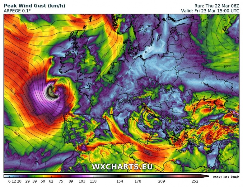
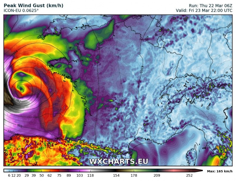
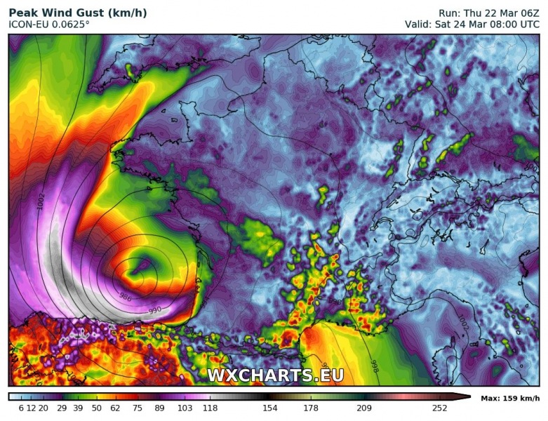
A deep cyclone is expected to develop in the Bay of Biscay tomorrow, March 23. The system will be over open sea while at its strongest, but it is expected to affect northern Spain with winds gusting up to 120-140 km/h, higher at higher elevations along the coastal area.
Map: Wxcharts.eu – ARPEGE model.
The system will form early on Friday morning (March 23), deepening to likely below 980 mbar central pressure by mid afternoon. Peak wind gusts indicated by various models are in 170-200 km/h range, however, these will be far out over the open sea. The system will then move southeastward and affect the coast of Spain late on Friday and early on Saturday. Peak wind gusts will likely reach 120-140 km/h. Higher elevation in the coastal area of northern Spain may see somewhat stronger gusts. Also expect high waves along parts of the coast, reaching 5-8 m late on Friday and on Saturday morning.
Peak wind gusts. Map: Wxcharts.eu – ARPEGE model.
Peak wind gusts. Map: Wxcharts.eu – ICON-EU model.


