The latest long-range forecasts for Spring 2025 show a likely impact of La Niña on the seasonal weather over Europe. A dominant high-pressure system is forecast over the continent and a low over the west/northwest, which is also a common signal for La Niña springs in Europe, as seen in past data.
The meteorological Spring season lasts 3 months and covers the March-April-May period. This is the transition period from Winter to Summer, so a wide range of weather dynamics can be expected.
The oceanic La Niña event is seen to have an unexpected role this season. It is usually hard to find or see any proper La Niña impacts over Europe, but the latest forecasts do show a possible La Niña signature in the weather patterns.
GLOBAL LA NINA IMPACT
One of the important large-scale drivers of this season is the La Niña event in the tropical Pacific Ocean. But while it was getting stronger in the past two months, we only have basic indications of how big of a role it will have for spring 2025 over Europe.
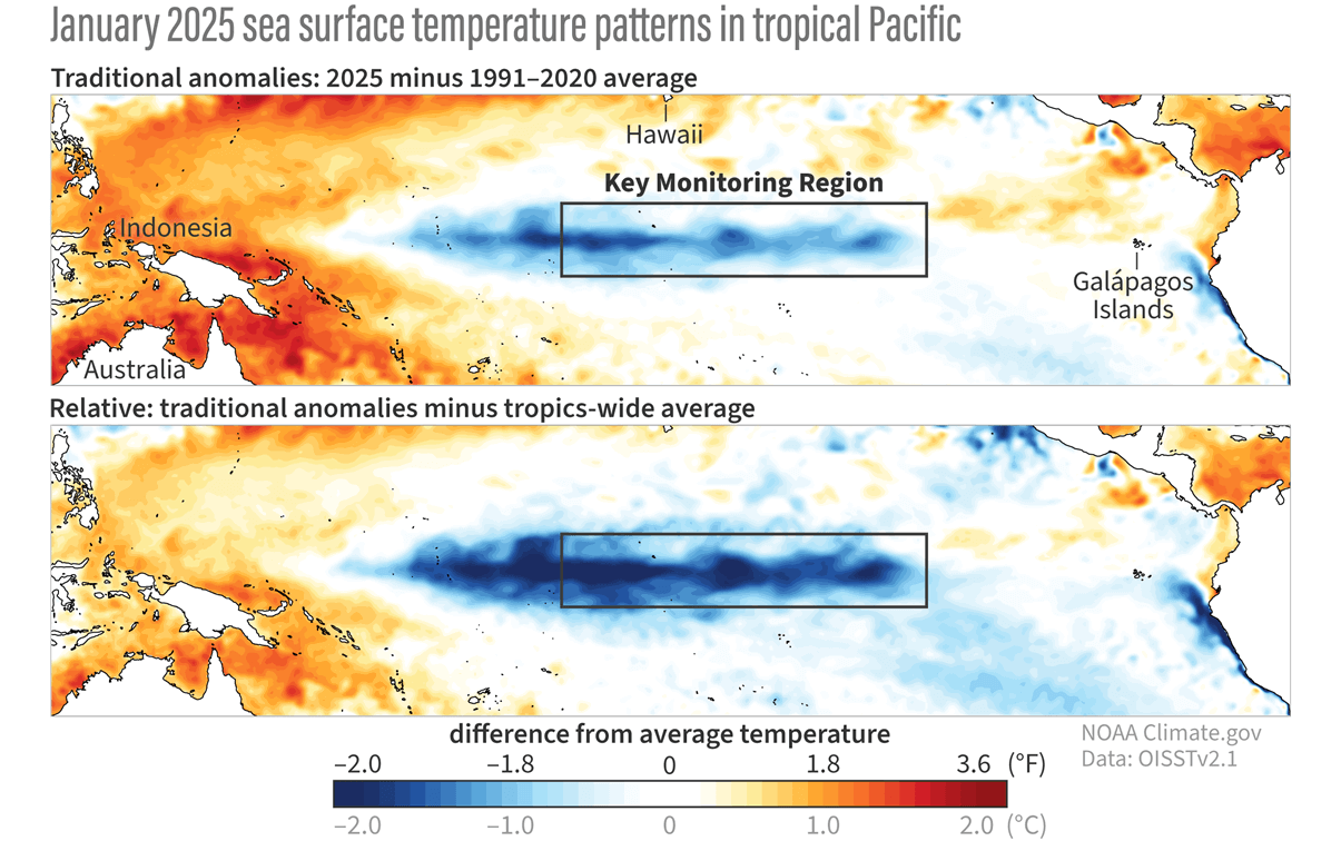
In the image below, you can see the recent ocean temperature anomalies across the Pacific. Notice the colder-than-normal surface waters in the tropical Pacific regions. That is a La Niña event, powered by the trade winds, spanning far across the central and western equatorial Pacific Ocean.
La Niña is just a different name for cold ocean temperatures in the tropical Pacific Ocean. The actual ocean-atmosphere system is called ENSO (El Niño Southern Oscillation). This region alternates between cold and warm phases, having a different global weather impact with each phase.
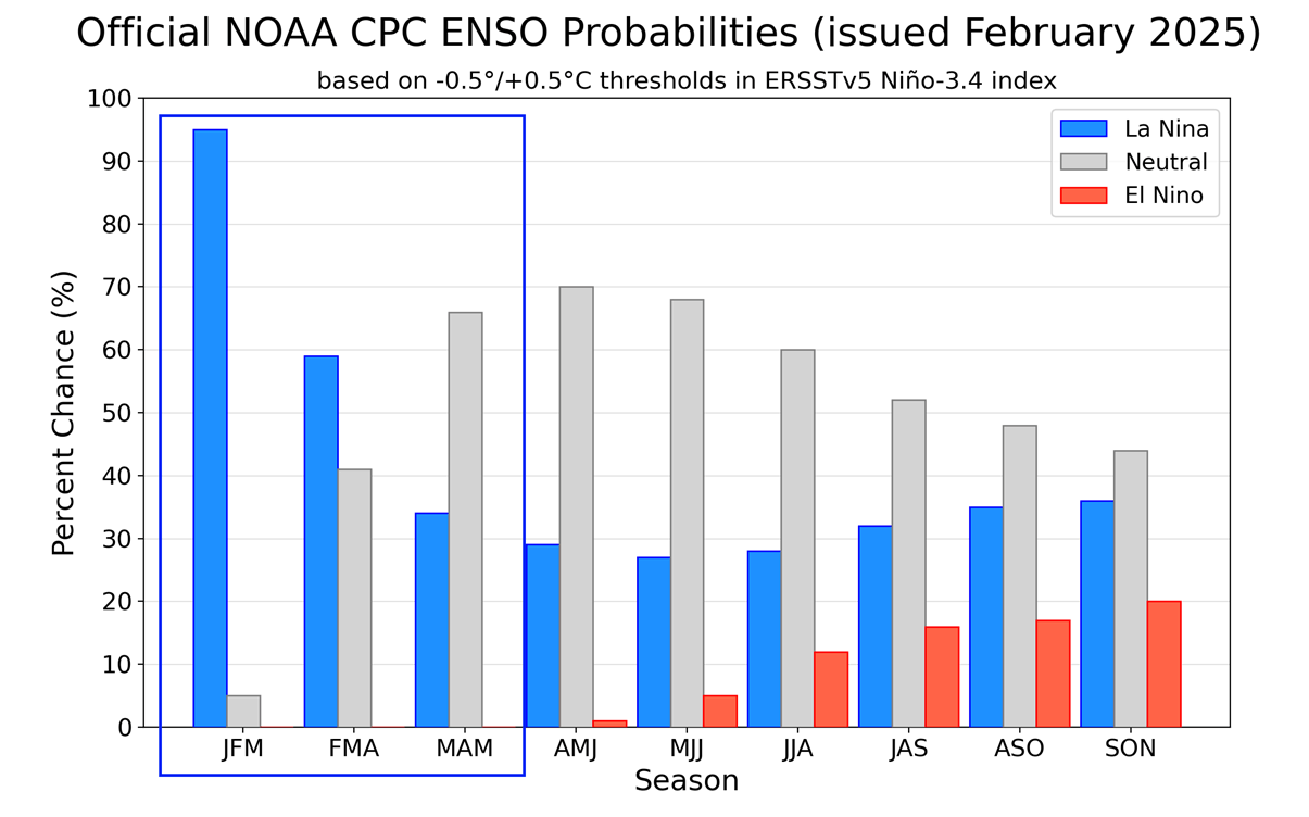
Below is the ENSO phase outlook from CPC, and you can see that the La Niña is forecast to stay at least into early spring. But the atmospheric impact of such large anomalies can last longer, covering the whole spring season of the Northern Hemisphere.
Below is a video of the weekly ocean temperatures in January. You can see the development of a stronger cold anomaly, boosting the current La Niña phase and its global impact.
Before going into the spring forecast, we will also take a quick look at the analysis data to try and find a signal of the La Niña influence on spring in Europe.
Below is the La Niña signal for pressure anomalies in spring. You can see a high-pressure zone building over central Europe and towards the east. A low-pressure zone is present in the North Atlantic and over the western and southwestern parts of Europe.
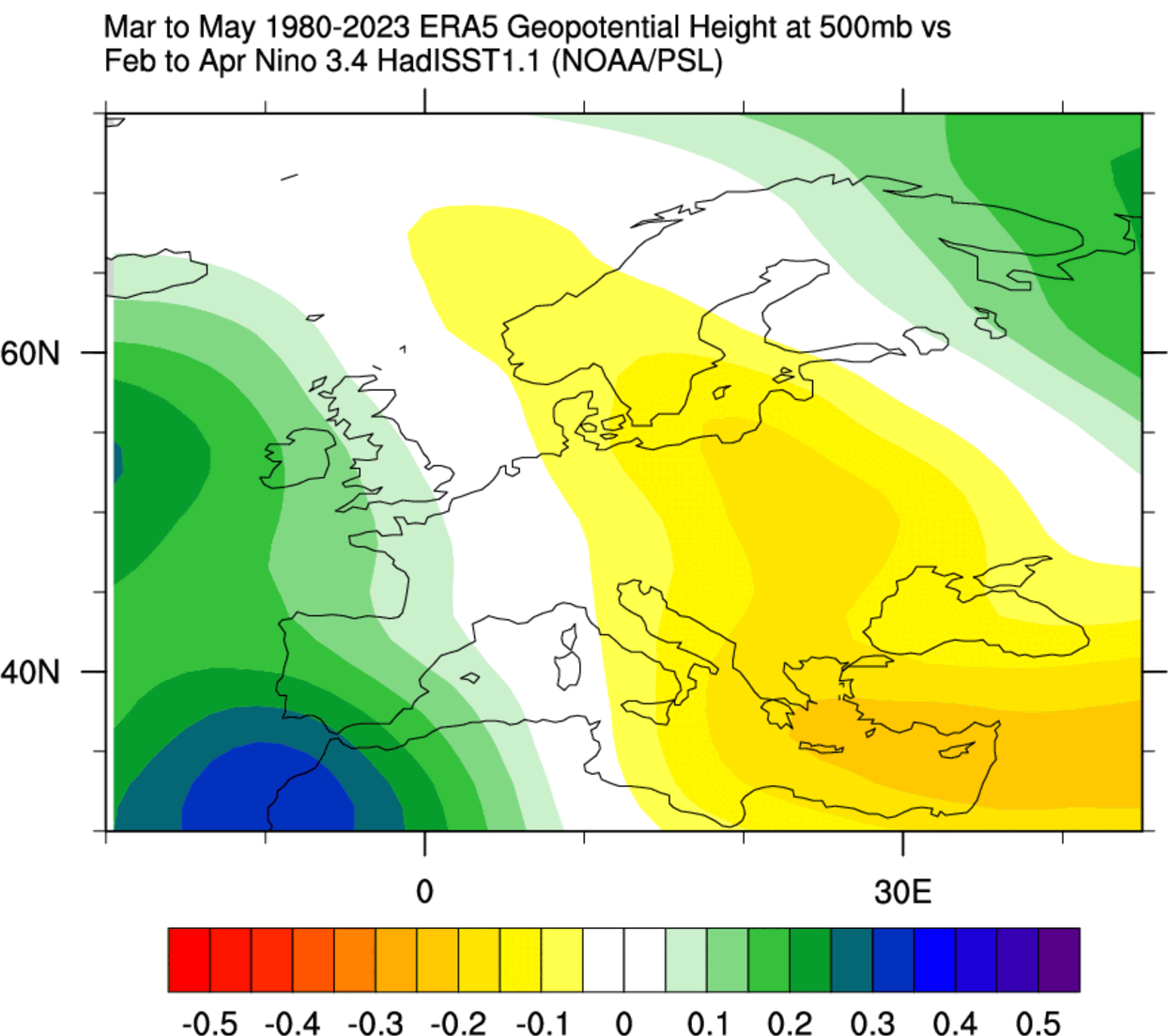
The temperature anomaly shows above-normal temperatures over much of central, western, and southern Europe. Normal to lower temperatures are usually found far north in a La Niña spring, associated with a northerly shift of the jet stream.
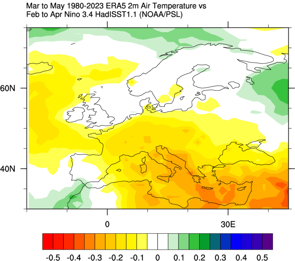
This tells us that La Niña tends to bring warmer and drier springs over parts of central and western Europe. But more precipitation is often found over the southwestern, western and northern parts of Europe and also over the Mediterranean Sea in a La Niña spring.
But it’s time we found out if the latest forecasts hint at any visible La Niña influence.
THE FINAL WINTER MONTH
As March is the first month of meteorological Spring, we will take a closer look at the latest forecast trends. For this, we will use the extended ensemble forecast from ECMWF, and a monthly average.
The ECMWF extended forecast shows mostly higher pressure centered over central and eastern Europe. A low-pressure zone is in the far North Atlantic and over northwestern Europe, looking very similar to the spring La Niña influence that we discussed above.
We can see that even better on the surface pressure forecast, which reveals a large low-pressure area over the North Atlantic and northwestern Europe. A surface high is forecast over the eastern parts.
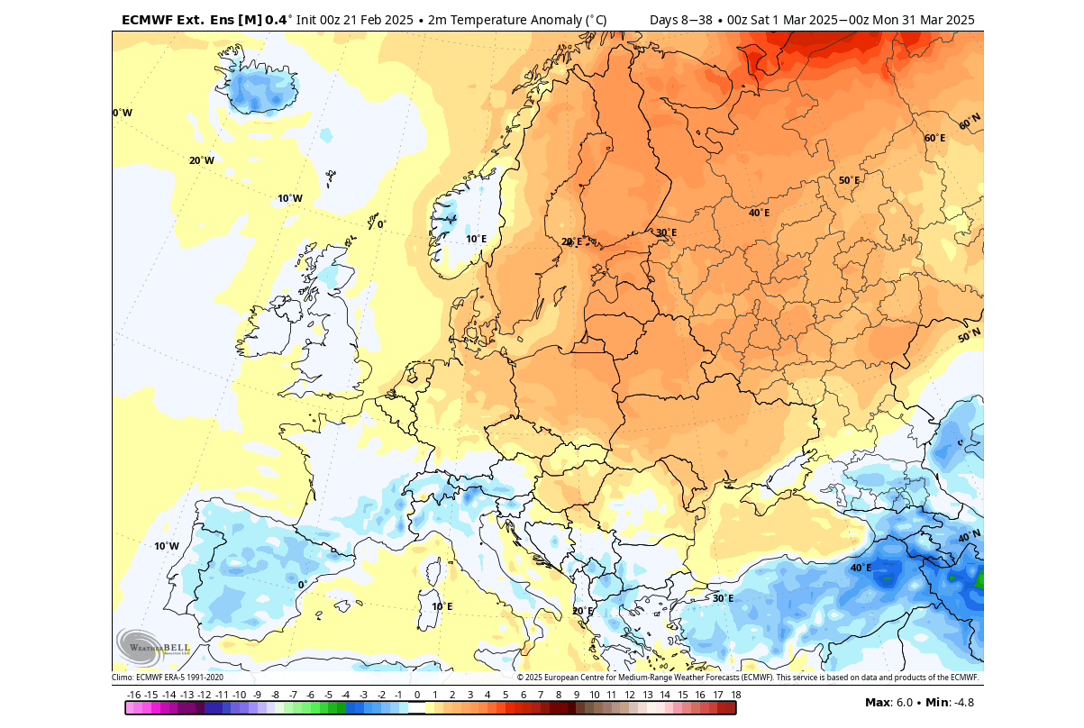
Looking at the surface temperature forecast, we see a warmer pattern for most of the central and northern parts of Europe. This is influenced by the high-pressure zone and a southwestern flow from the low-pressure area in the Atlantic. We do see a tendency for normal to below-normal temperatures over the southwestern and parts of central Europe and the southeast.
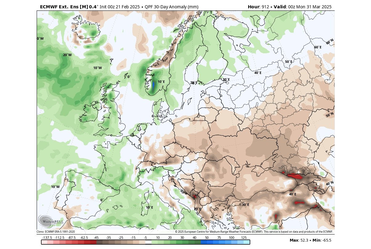
In the next image below, you can see less precipitation is forecast over much of central Europe and towards the east for March. Again, this is due to the high-pressure area influence. But you can see more precipitation over the southern, western, and northern parts, influenced by the low-pressure zone from the North Atlantic and over the western Mediterranean.
But what can we expect from the Spring season as a whole?
EUROPE SPRING 2025 – FINAL FORECAST
For this forecast, we focused on the two main (or most used) seasonal models: the ECMWF and UKMO.
All these forecasts show an average picture over three meteorological Spring months (March-April-May) and show the prevailing weather patterns.
Even if the models were completely accurate, it does not mean such weather conditions would last three months straight. Instead, it only suggests how the prevailing weather patterns might look over the season.
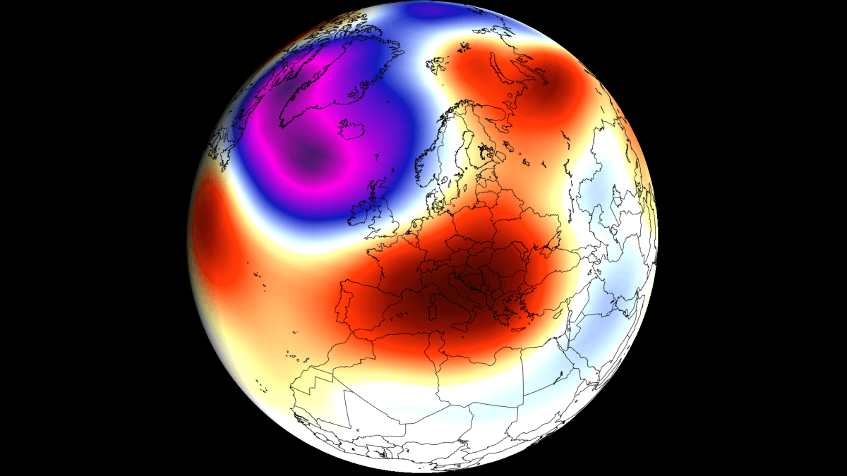
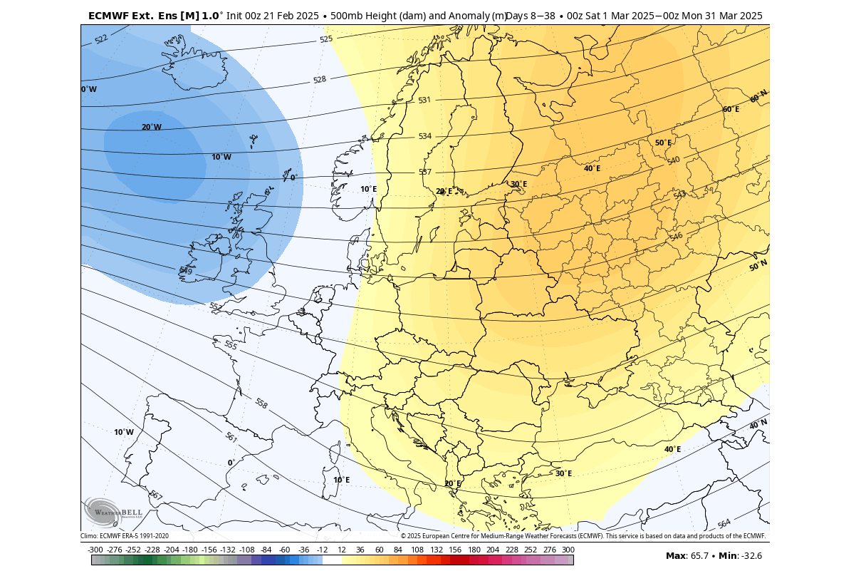
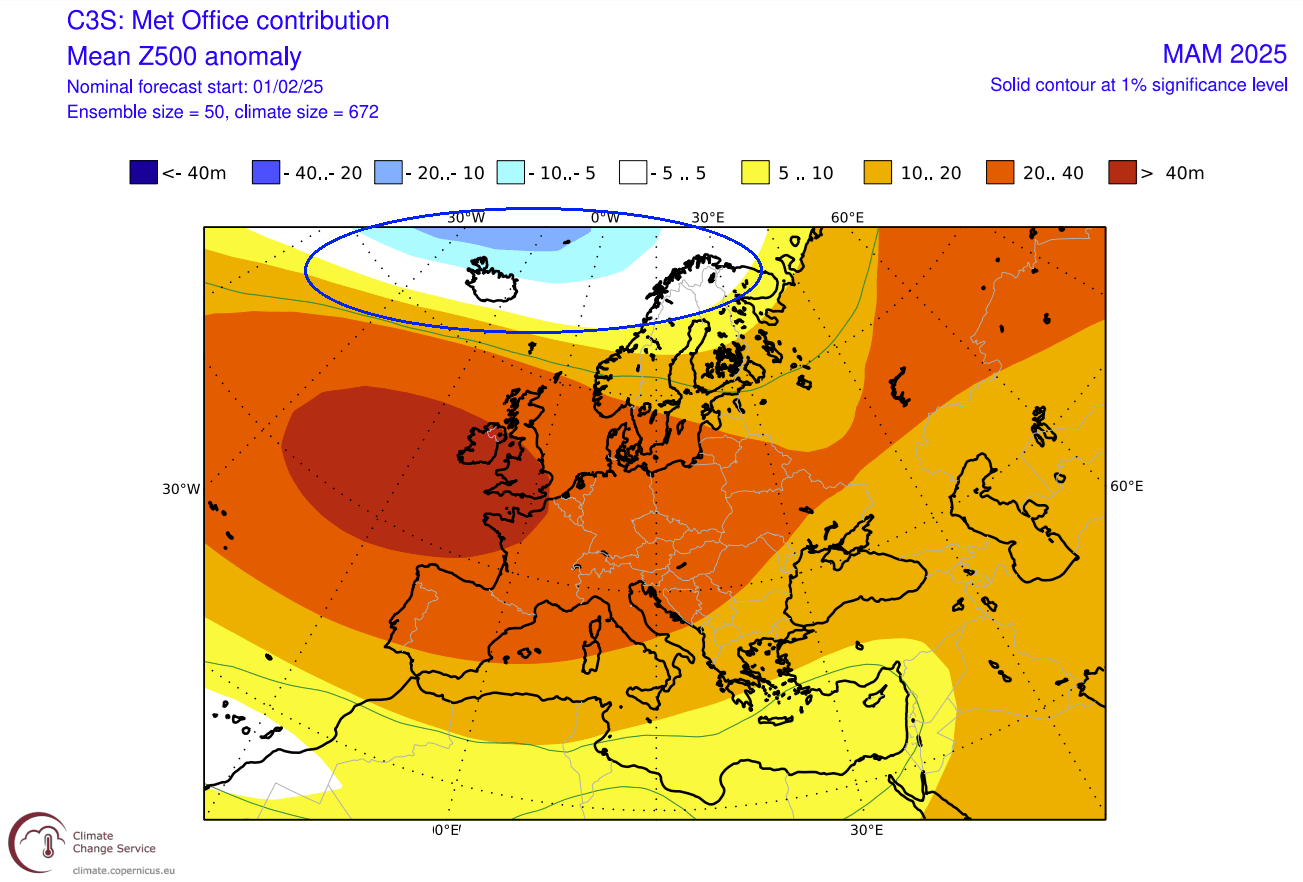
The pressure pattern forecast from ECMWF below shows a general high-pressure signal over Europe. This forecast is pretty strongly averaged, as it is a 3-month average at a longer lead time (3-6 months). A high-pressure anomaly over Europe is typical in a La Niña spring, so there is a possibility that this pattern is somewhat related to its global influence.
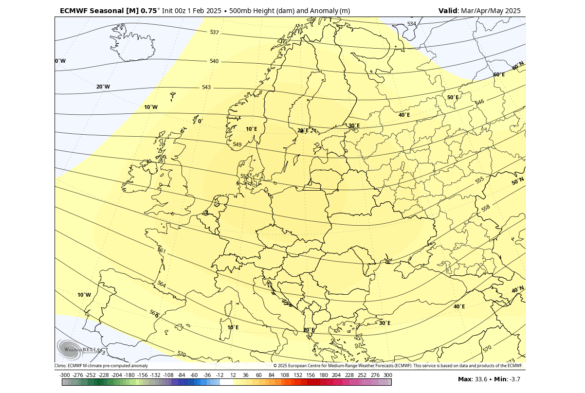
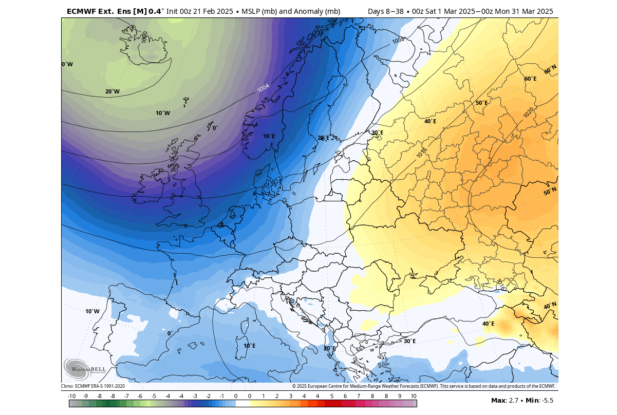
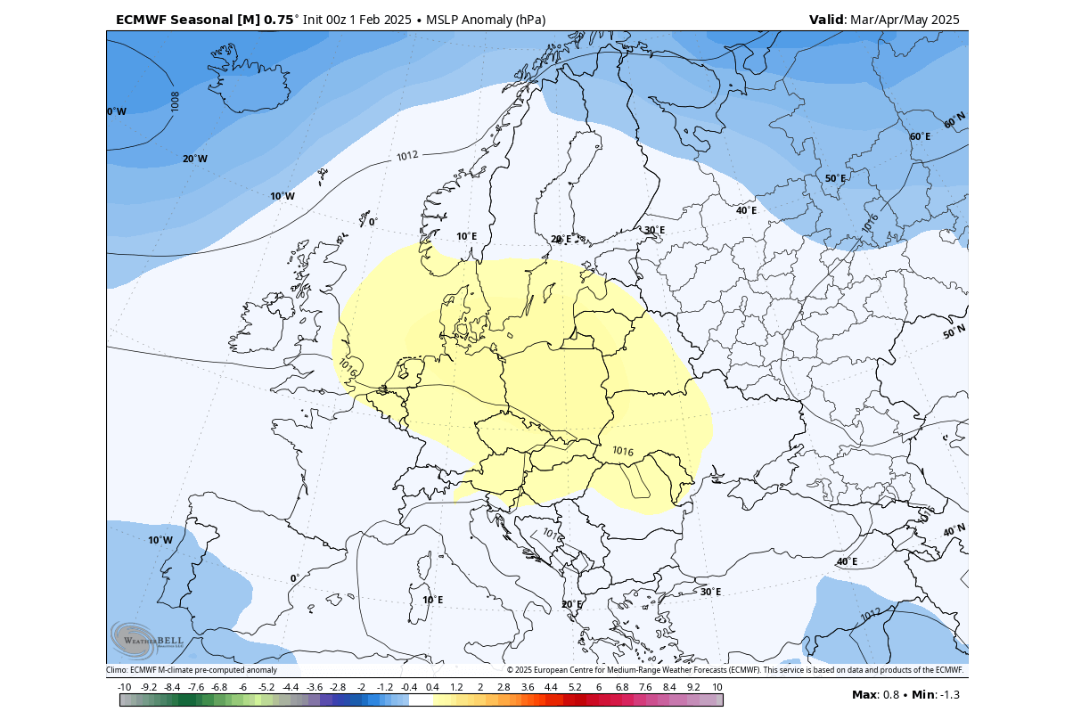
We can also look at the surface pressure (MSLP) anomaly, which shows the high-pressure area over central Europe slightly offset to the north. Low-pressure areas are found to the southwest, southeast, and, of course, over the northern parts.
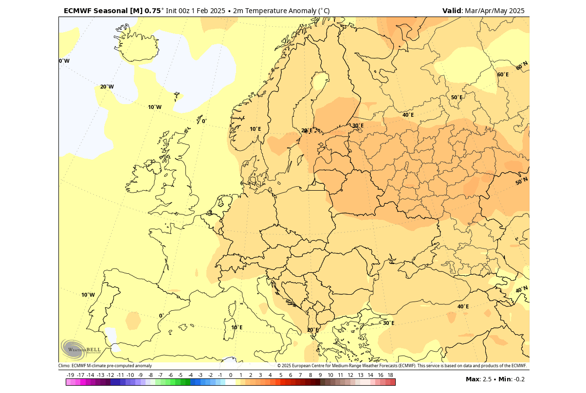
As a result, warmer temperature anomalies and milder conditions are more likely in the west-central, central, and towards the east. Central and western regions can likely see occasional Atlantic fronts from the west/northwest under the influence of the low-pressure zones over the Northern Atlantic.
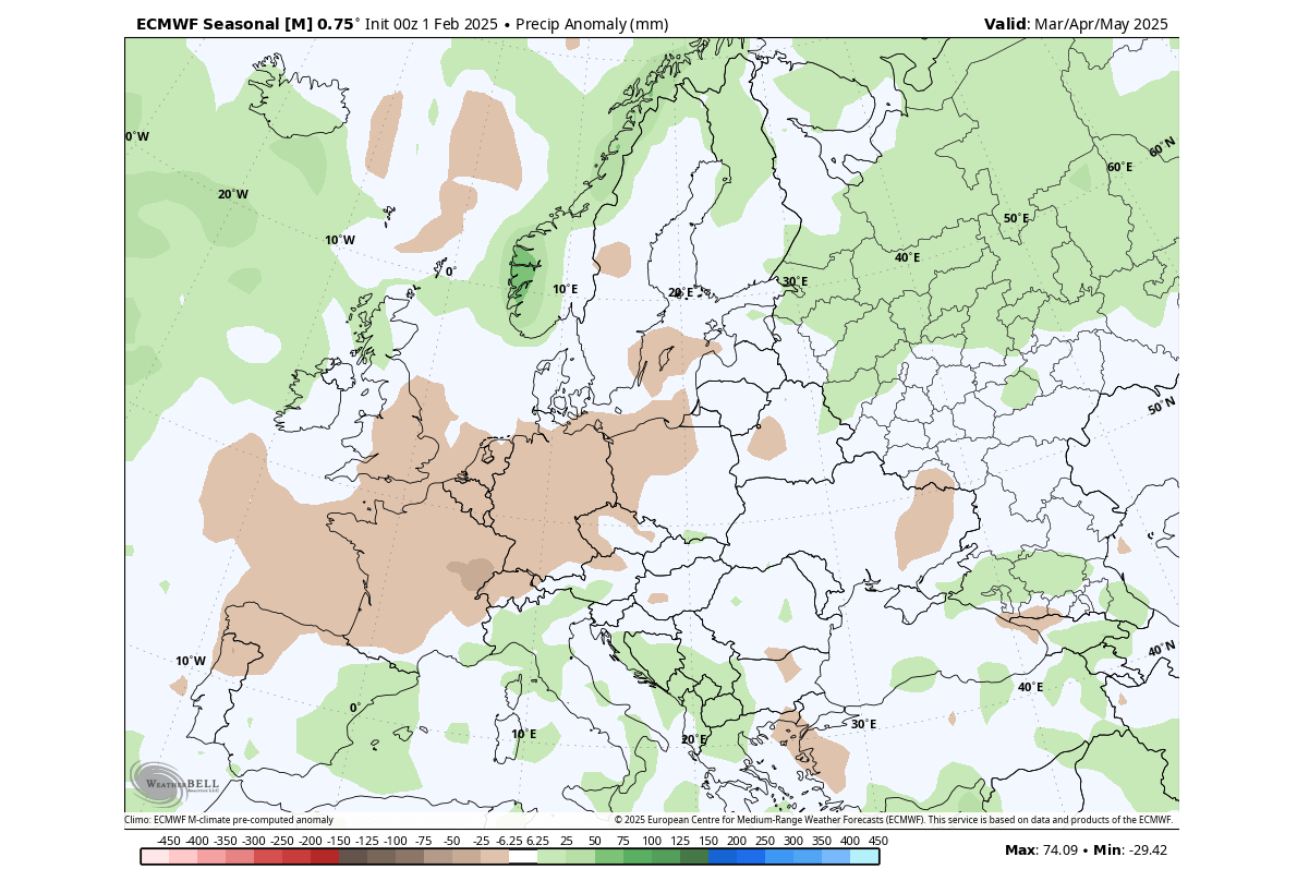
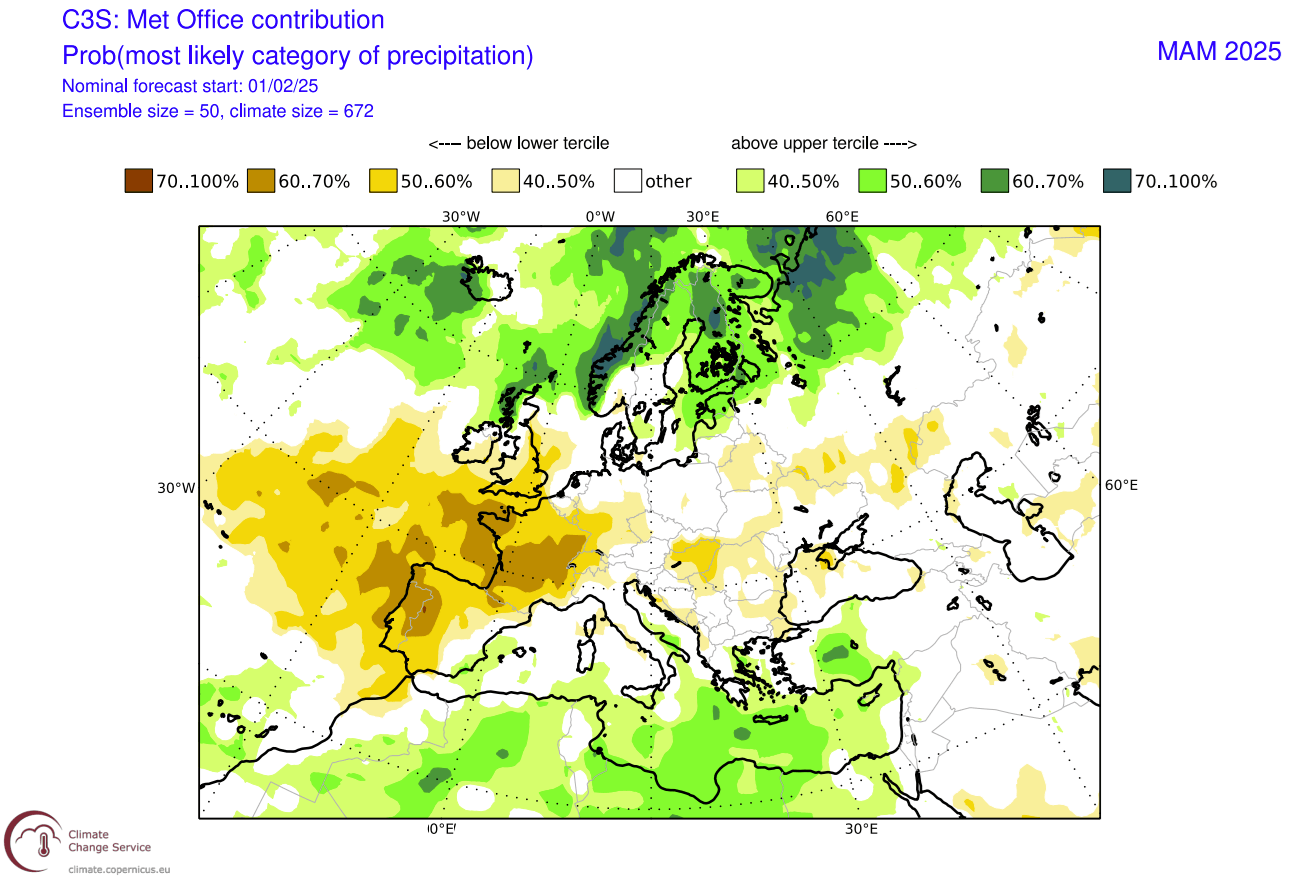
Precipitation-wise, Europe is forecast to have more precipitation over southwestern, central, and northern parts. This is expected from the forecasted lower surface pressure area over southwestern Europe and a broader low-pressure zone over the North Atlantic for the northern parts.
In combination with colder temperatures, that also affects the snowfall potential in early spring.
While spring is generally known as the start of the warmer part of the year, there are still snowfall events, especially in March. But, according to the latest March-May 2025 snowfall forecast, most of the continent has below-normal snowfall.
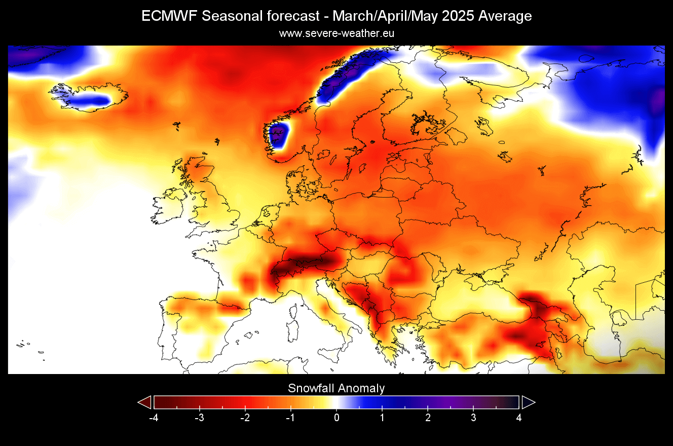
Of course, this does not mean there will be zero snowfall; it just means that it’s less common than the average for the past 30 years. A single cold front with proper cold air can bring a large amount of snowfall across the central parts of Europe, and that likely won’t show up on a monthly average.
SPRING SEASON FORECAST FROM UKMO
In addition to ECMWF forecasts, we often use the UKMO model from the United Kingdom Met Office.
The UKMO model shows a slightly different forecast than the ECMWF. It shows a high-pressure zone centered over western Europe and a low-pressure area signal over the far North Atlantic. The high-pressure zone also extends to the east, covering most of Europe.
The temperature forecast shows mostly warmer-than-normal conditions over much of the continent, especially in the northern and northeastern regions. This is not far from the ECMWF forecast and also shows a hint of a more westerly flow into the western and northwestern parts of Europe with a visibly weaker anomaly.

Looking at the precipitation forecast, we see mostly drier conditions over parts of central and western Europe. That is mostly expected, given the high-pressure forecast from this model. But northern and southern Europe show more precipitation in spring, indicating the influence of the low-pressure zone to the north and a lower-pressure zone over the Mediterranean Sea.
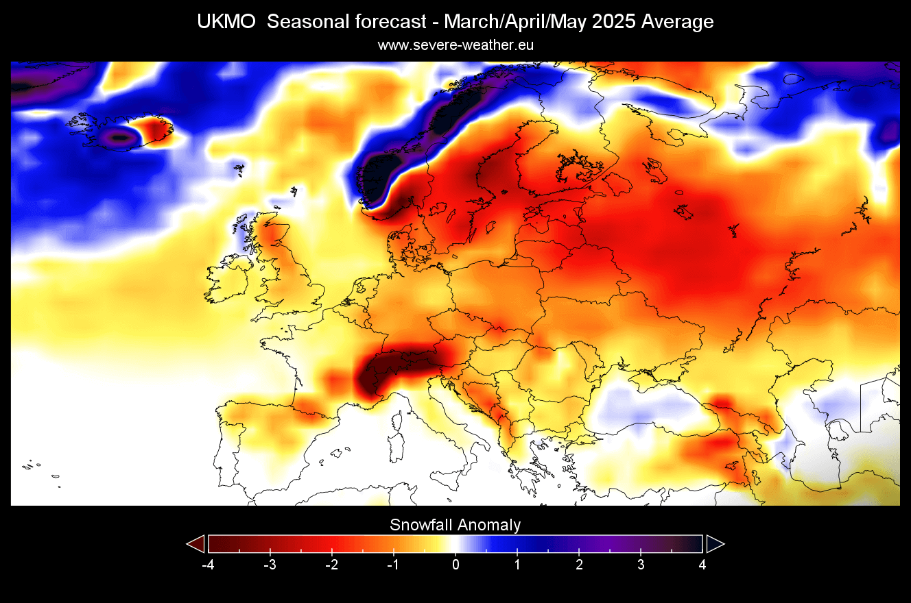
We can also look at the UKMO snowfall forecast, which is weaker and lower-than-normal for the season. But this is to be expected with above-normal temperatures and a dominant high-pressure system over the continent. More spring snowfall is forecast over northwestern Scandinavia, where the temperatures are still low enough, and a low-pressure region brings plenty of precipitation.
We will keep you updated on the developing weather trends in the coming seasons, so bookmark our page. Also, if you have seen this article in the Google App (Discover) feed, click the like button (♥) there to see more of our forecasts and our latest articles on weather and nature in general.
The main forecast images in this article are from Weatherbell maps using a commercial license.
Don’t miss: