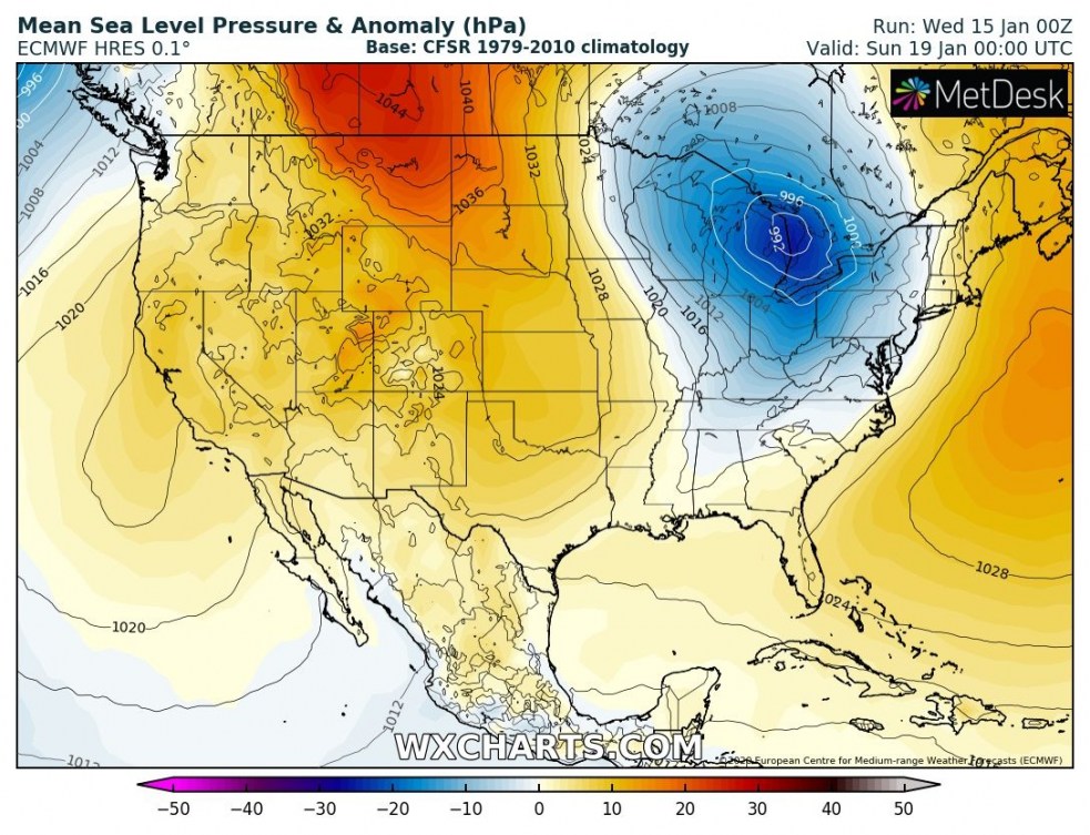
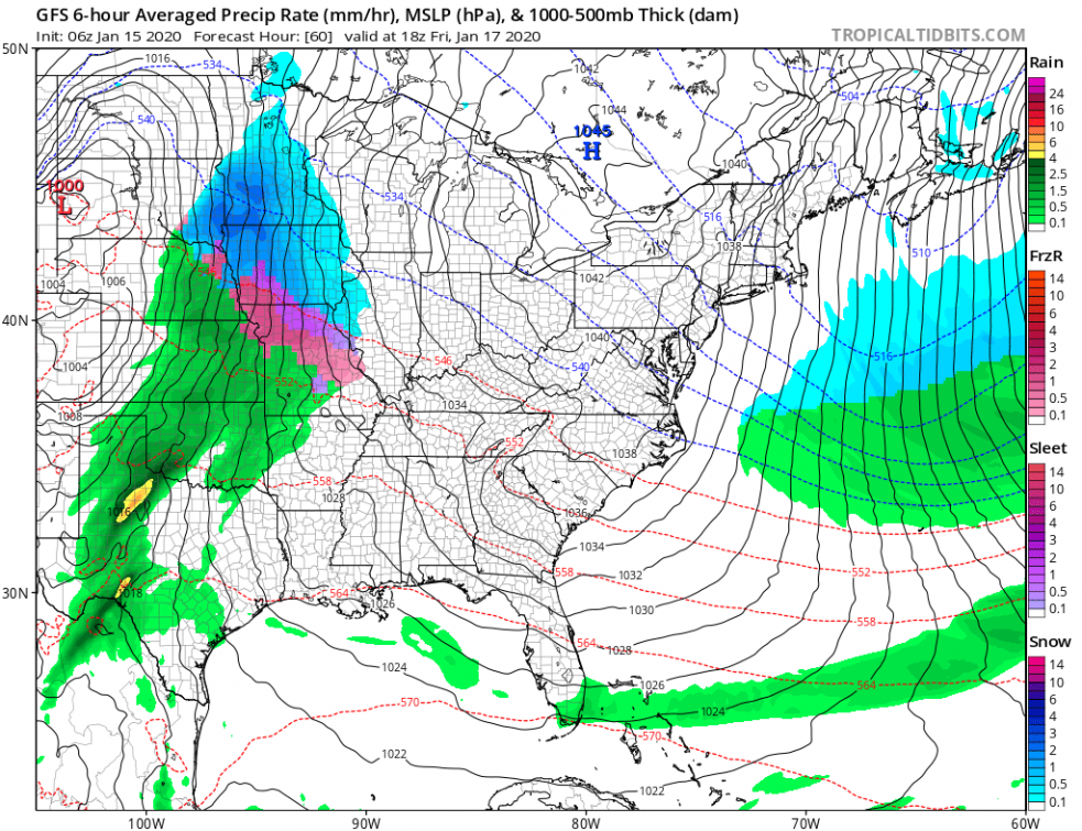
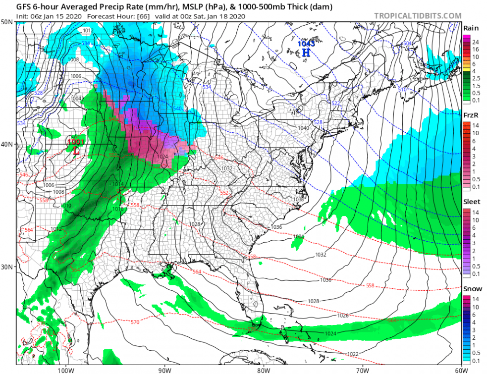
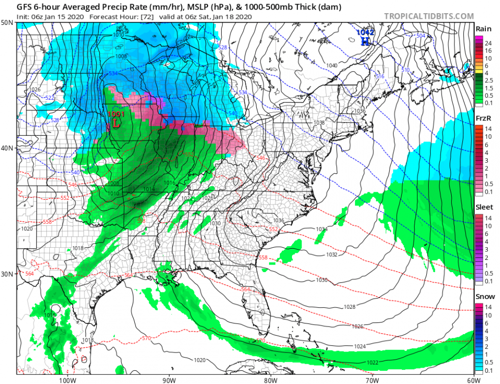
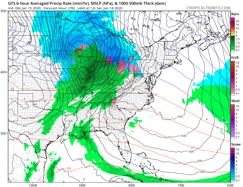
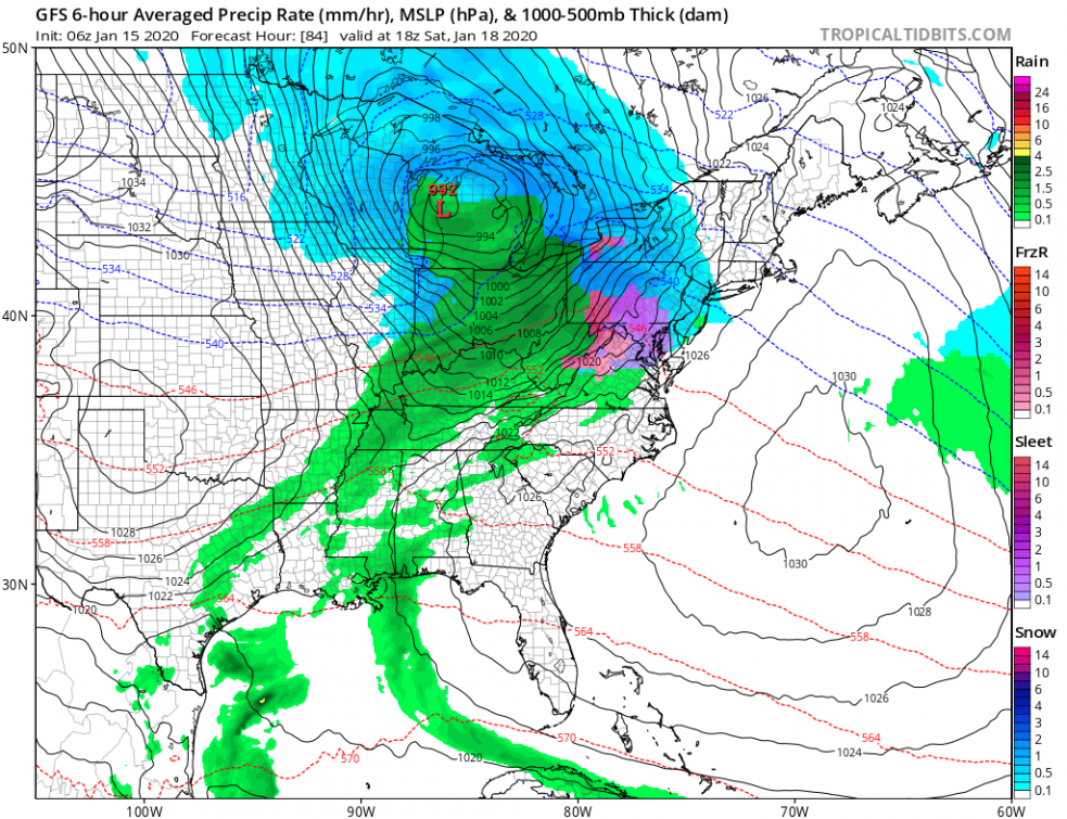
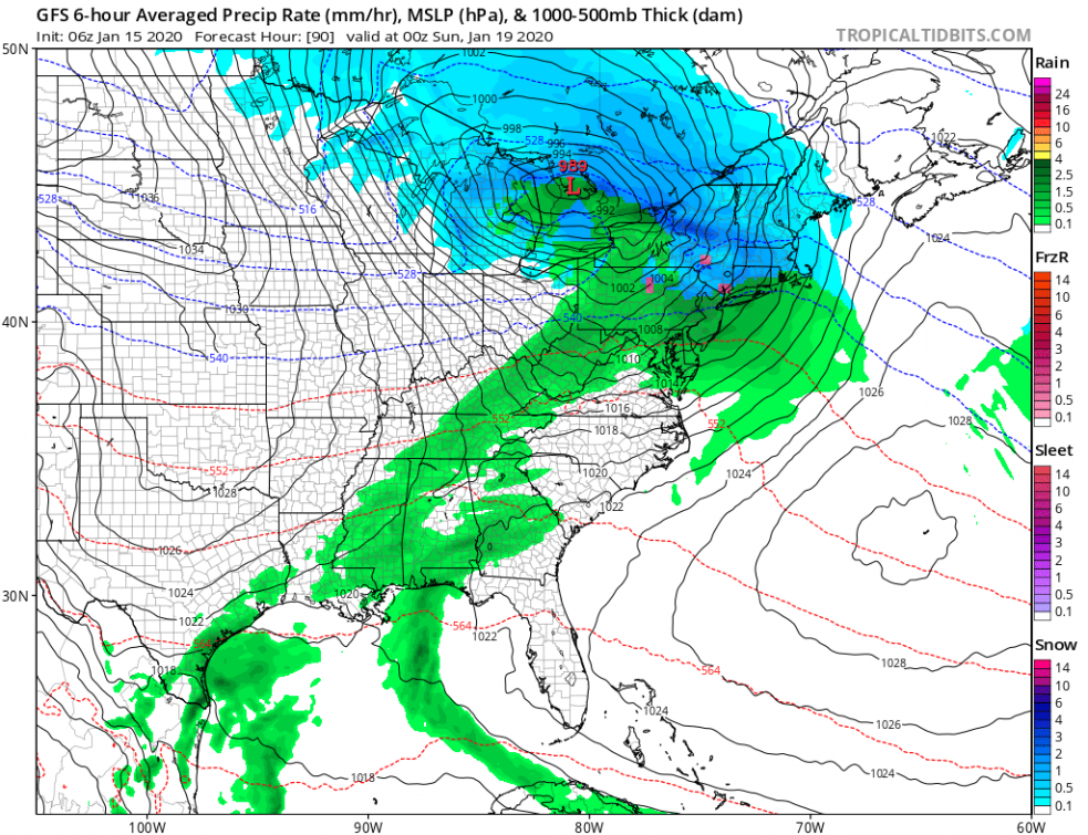
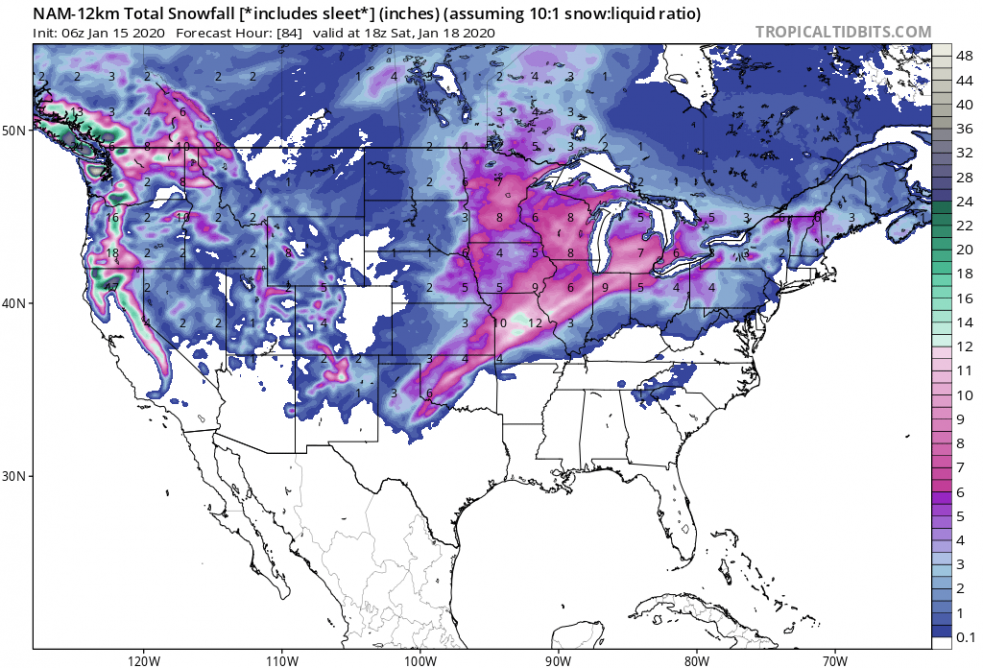
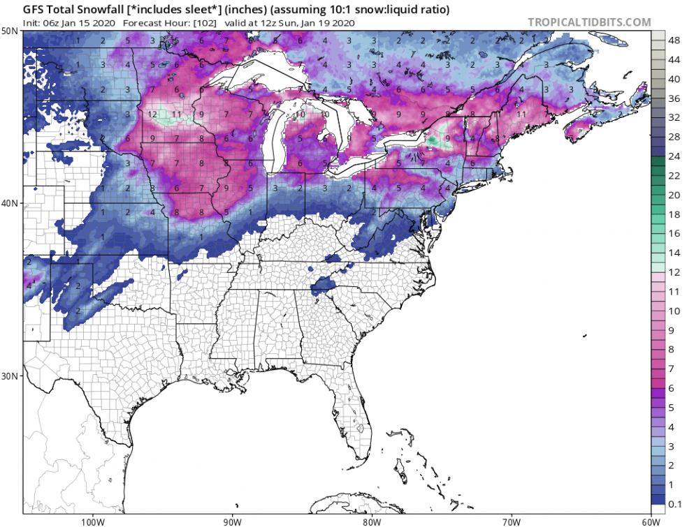
A potentially powerful winter storm is expected to cross the United States this weekend. A deep trough with a pronounced surface cyclone is approaching from the North Pacific, while a strong polar jet-stream will push the system across the CONUS. Locally, significant snow accumulations are expected in parts of the upper Midwest, Great Lakes and Northeast. Parts of Ohio valley could also see a good amount of ice accumulation as well. Blizzard conditions will significantly worsen driving conditions in some areas.
*********************************************
*********************************************
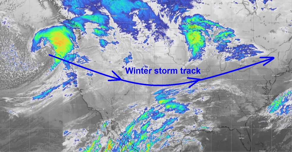
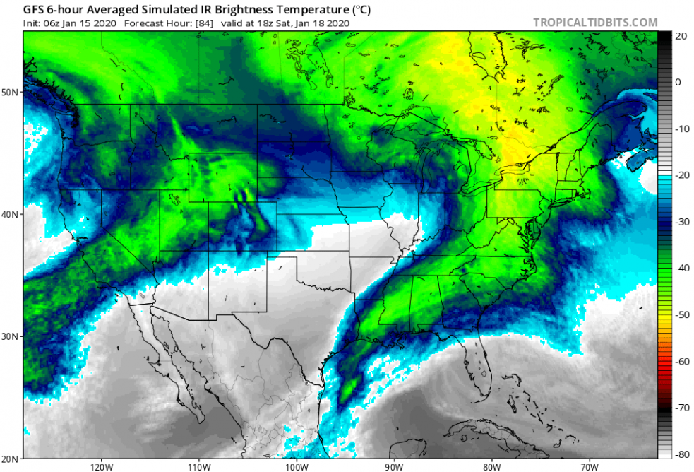
This morning’s Infrared satellite reveals a deep cyclone approaching the Northwest US from the North Pacific, entering the CONUS today. Its potential track will cross the Rockies, Midwest and continue towards Great Lakes and Northeast US.
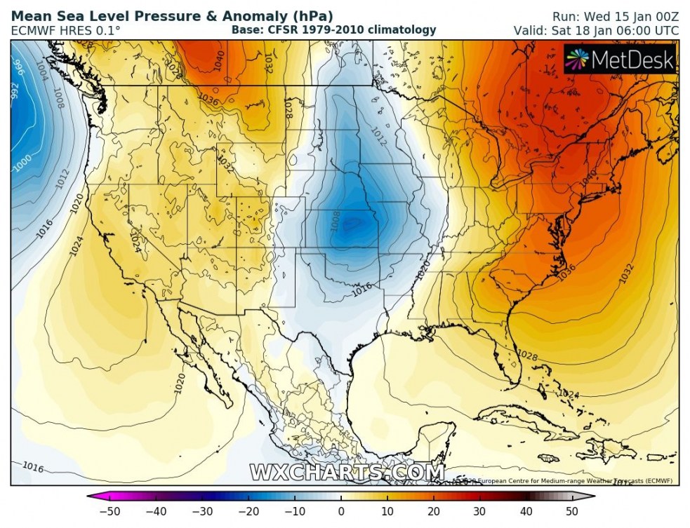
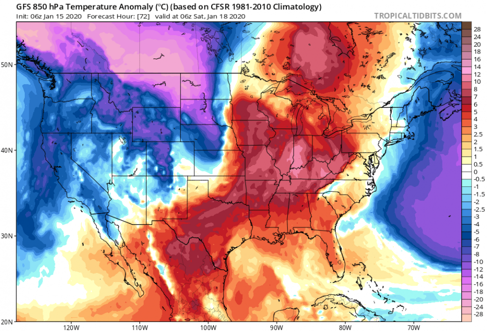
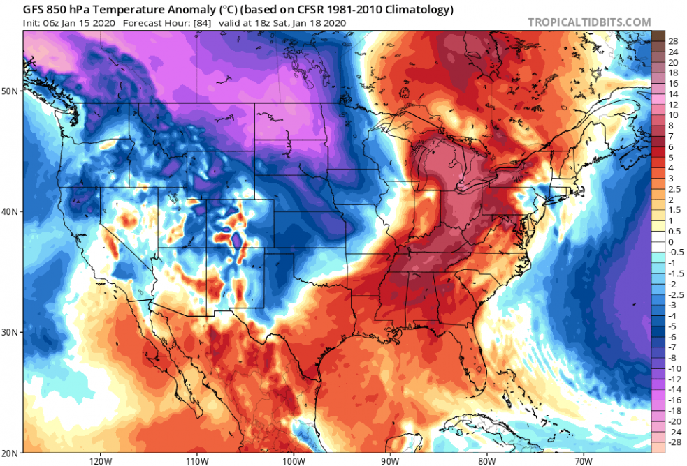
The system will be pretty big, covering a large part of the United States this weekend. The warm advection ahead of it will be quite strong, and so will be the cold advection in its wake. Resulting in heavy snowfall and blizzard.
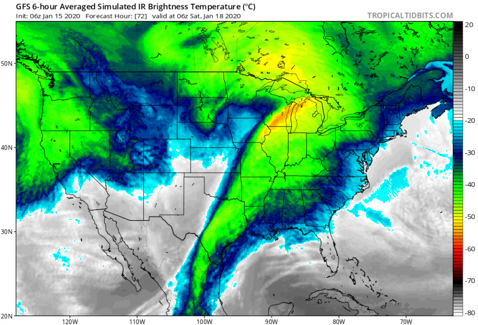
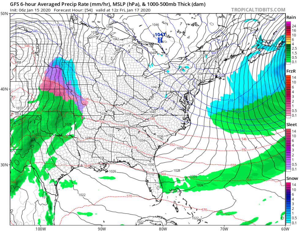
Here is the sequence of this potentially dangerous winter storm, starting with a deepening Lee surface cyclone east of the Rockies early Friday and strengthening while moving across the Midwest into the Great Lakes region and towards the Northeast US through Saturday and Sunday.
Total snowfall along the northern half of the system should deliver 10-15″ (25-40 cm ) of snow in some areas, the highest amount over parts of Minnesota and New York states. Strong winds will also result in dangerous blizzard conditions along the whole swath of the fresh snow, significantly effecting driving conditions due to whiteouts.
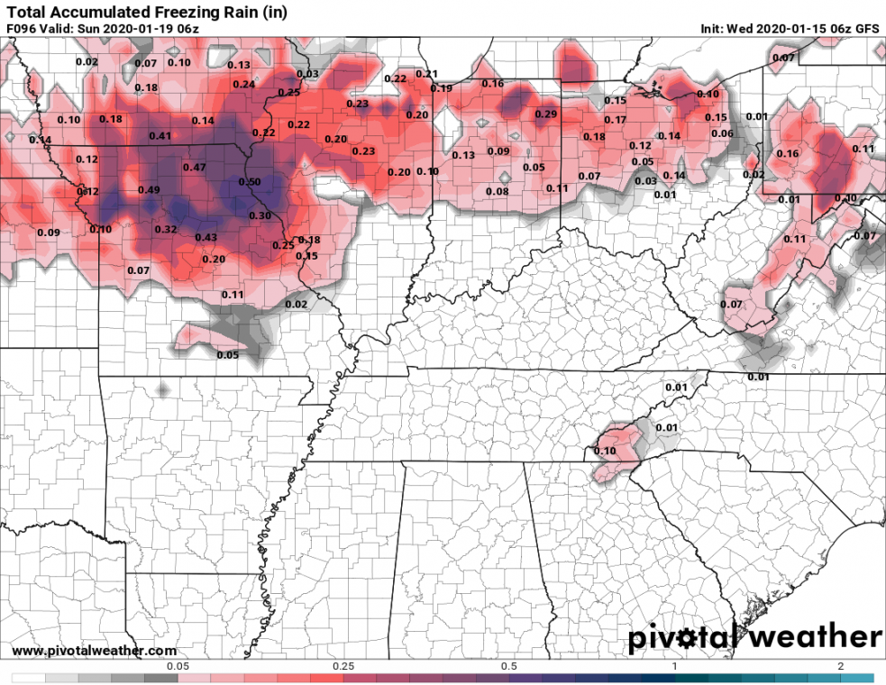
At the beginning of the event, there is also an increased risk of freezing rain across the Ohio valley where strong mid-level airmass advection overrides the still cold lowlands. Locally, around 0.5″ (1.5 cm) black ice can accumulate.
We will keep you updated with further details before the event unfolds – stay tuned!
