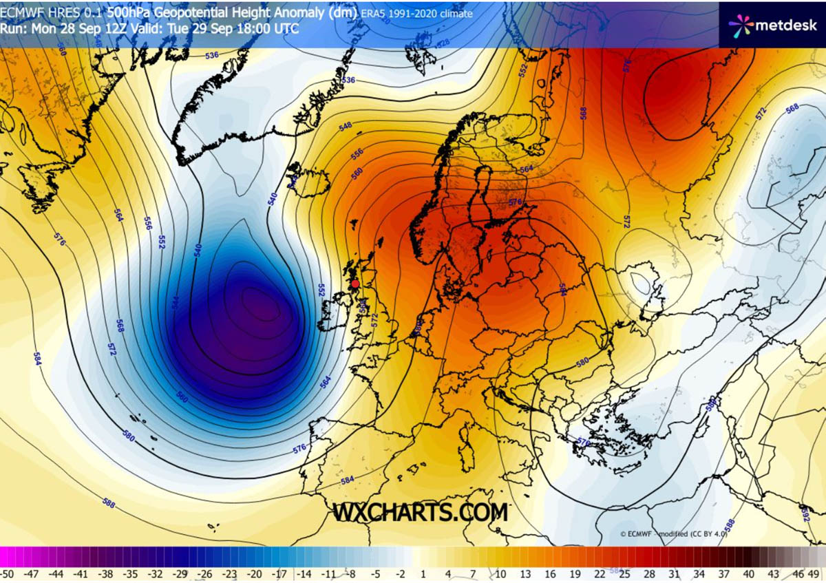
The explosive development is powered by a high-amplitude upper-level trough swinging out of the North Atlantic, colliding with an expansive 1035 hPa blocking high-pressure system anchored over Central Europe and Scandinavia. This steep baroclinic gradient will squeeze isobars across the UK and Ireland, unleashing severe gale-to-storm-force winds, intense squall lines, and high Atlantic swells reaching 8 to 12 meters along Atlantic-facing shores.
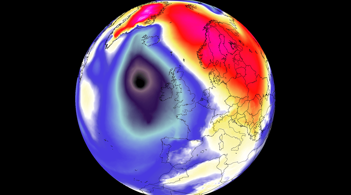
While the primary core of lowest pressure remains west of the UK and Ireland and will track north between Iceland and Scotland, the storm’s huge circulation will affect a wide swath of Western Europe. Peak wind gusts between 100 and 130 km/h will batter Ireland, Northern Ireland, Scotland, and Western England. Strong southerly winds will pull a warm plume northward, fueling heavy rainfall bands and high temperatures far north towards Scandinavia and Iceland.
On Monday night, the rapidly developing Atlantic storm was already visible on the satellite imagery. The following image is the water vapor satellite spectrum, showing a strong baroclinic zone and a developing jet stream, suggesting we will be dealing with a so-called bomb cyclone.
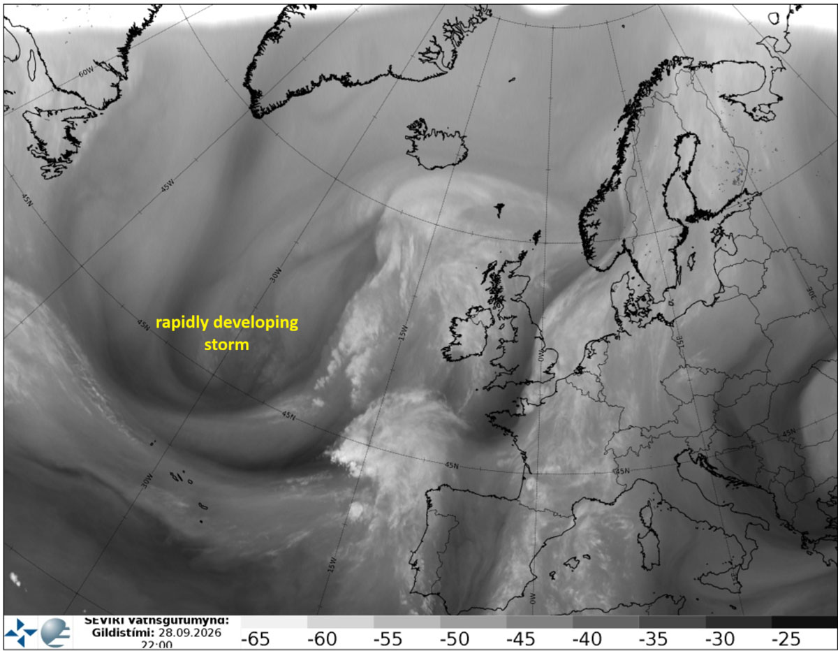
The term bomb cyclone is used when the central pressure of a mid-latitude system rapidly deepens by more than 24 mbar within 24 hours.
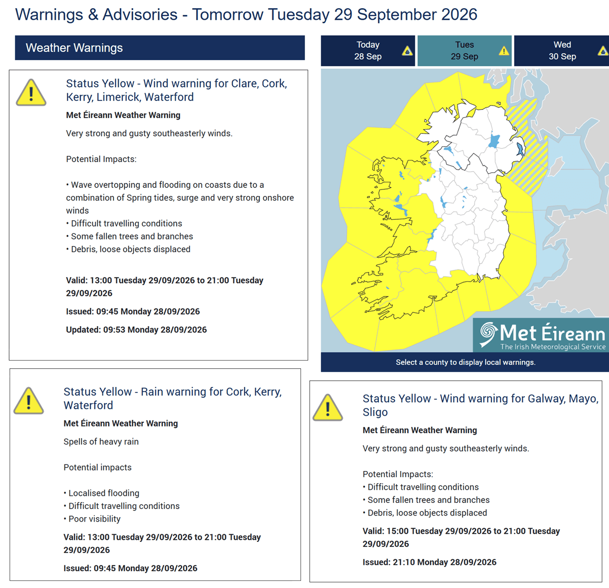
Ahead of a developing and rapidly approaching storm, Met Éireann has issued a yellow warning for coastal Ireland and Northern Ireland on Tuesday. Very strong, gusty southeast winds are expected, bringing difficult driving conditions, possible falling trees, and local flooding.
The animation below shows the rapid development of this deep ~950 mbar Atlantic low through Friday, its trajectory, and the primary wind core approaching western Ireland and Northern Ireland on Tuesday evening.
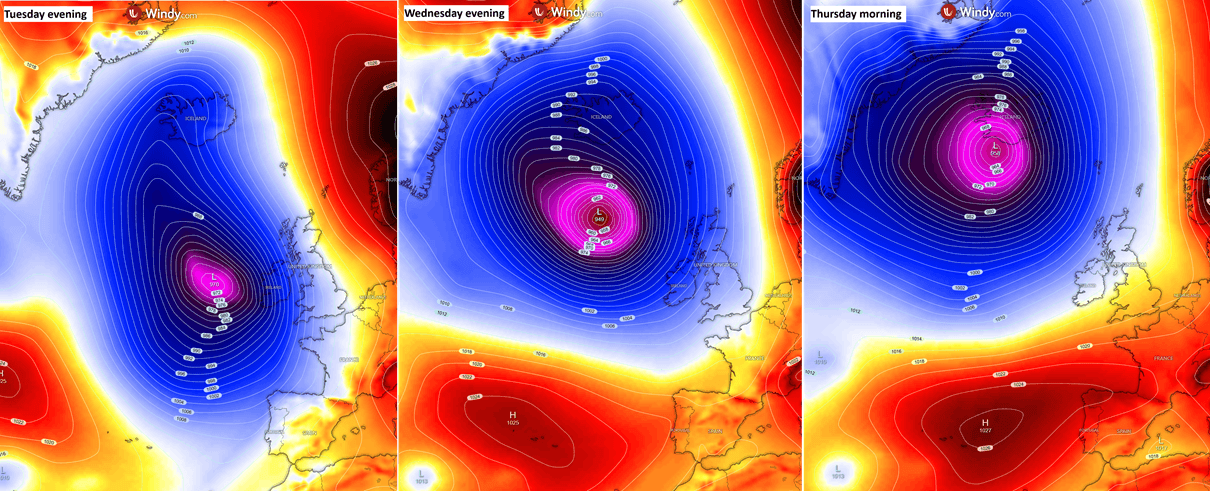
The deep low matures on Wednesday as it continues north, reaching close to 945 mbar in its center, while passing north to the west of the Faroe Islands and reaching Iceland by Thursday morning.
Let’s take a closer look at the developing conditions over the North Atlantic and Western Europe, including the storm’s forecast track and its impacts.
Rapid Cyclogenesis Dynamics: A sub-950 mbar Low Develops Over the Atlantic
The general weather picture over Europe shows a classic Omega blocking pattern, while a deep Atlantic low nears Western Europe. The wave is particularly deep and intense, maturing midweek as it tracks north toward Iceland.
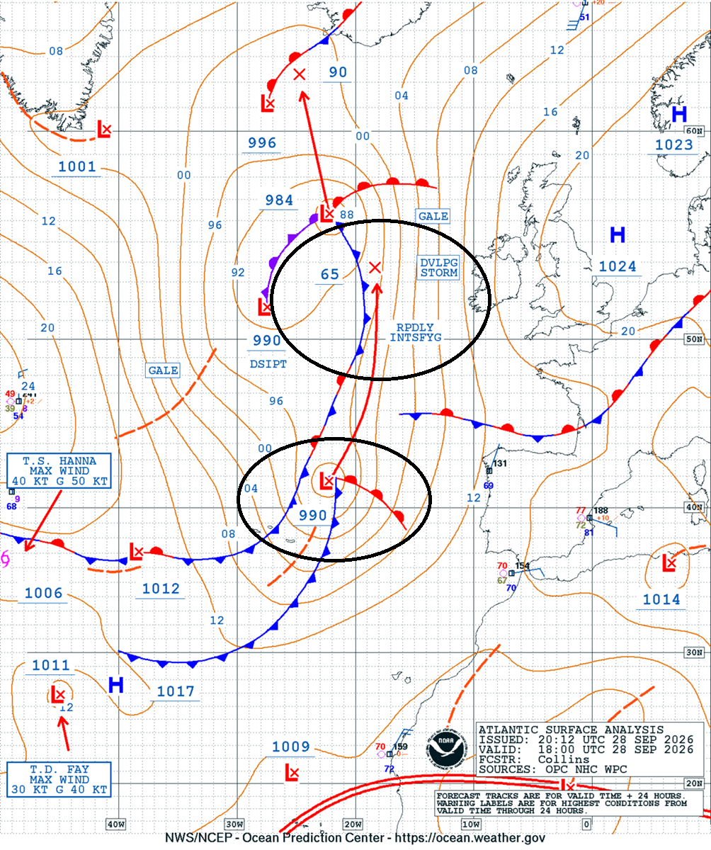
The Ocean Prediction Center (OPC) analysis from Monday night indicated a core of the wave emerging west of the Iberian Peninsula and tracking north, with the deep-wave trajectory aloft.
The chart also showed a rapidly developing storm signal, confirming this Atlantic storm will become a bomb cyclone as pressure falls from near 990 mbar on Monday evening to near 965 mbar by Tuesday evening, with another 15-20 mbar drop by Wednesday midday further north.
The rapidly developing low is organizing this Tuesday morning as it approaches western Europe, as shown on the water vapor satellite above. Its central pressure is falling fast as it undergoes bombogenesis.
The following composite chart shows the low’s center on Tuesday evening, Wednesday evening, and Thursday morning, when the deep Atlantic storm moves ashore in Iceland.
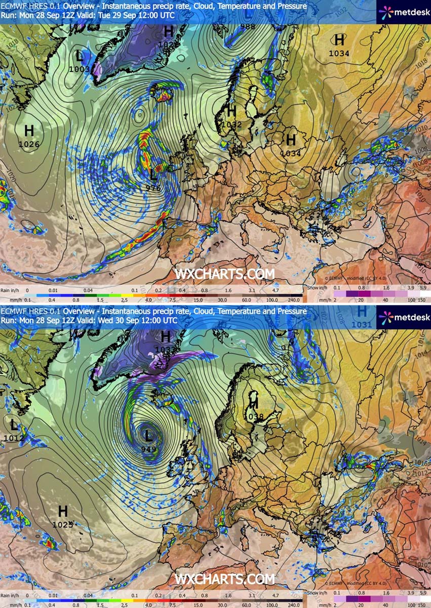
Looking at the surface-front forecast for Tuesday afternoon (upper chart) and Wednesday afternoon (bottom chart), the surface low center nears Ireland on Tuesday as the system intensifies and drifts north. A surface cold front will rapidly move east across Ireland, Northern Ireland, and Scotland, bringing rain squalls and gusty winds.
By Wednesday midday, the central pressure drops below 950 mbar with a tight pressure gradient around the low, meaning near hurricane-force winds will develop around the core.
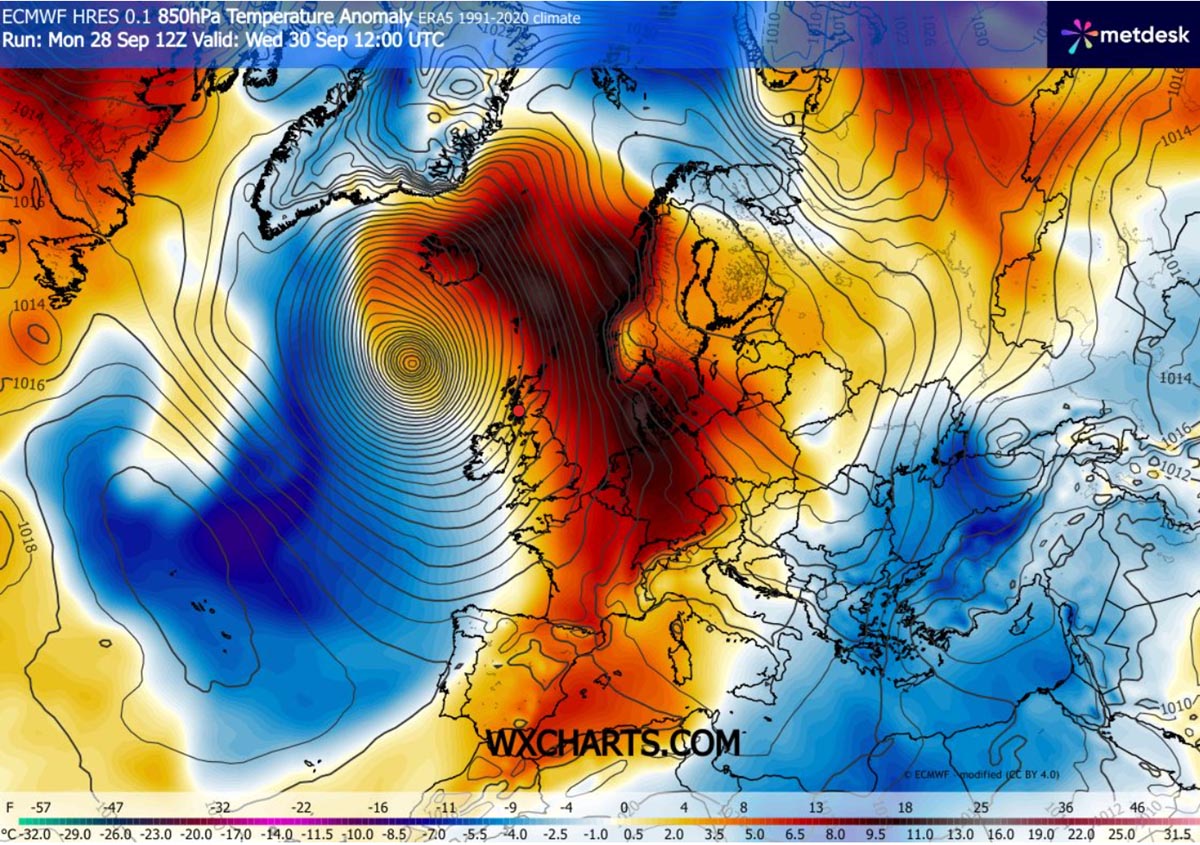
The Atlantic system will be deep and large, so it will also create a significant warm plume on its eastern side. It will deliver an unseasonably warm air mass across Western Europe toward the Faroes, Denmark, Scandinavia, and Iceland on Wednesday.
The most anomalous temperatures will develop across Northwestern Europe.
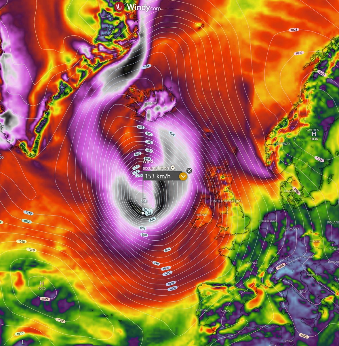
The following peak wind-gust swath forecast shows where the strongest winds will accumulate. The worst will be around the center low, with peak winds surpassing 150 km/h.
Gale-force winds are forecast along Ireland’s western coasts and the Outer Hebrides through Tuesday night. On Wednesday, the low continues north while still strengthening, delivering strong winds towards the Faroes, while significant winds reach Iceland from the south Wednesday night.
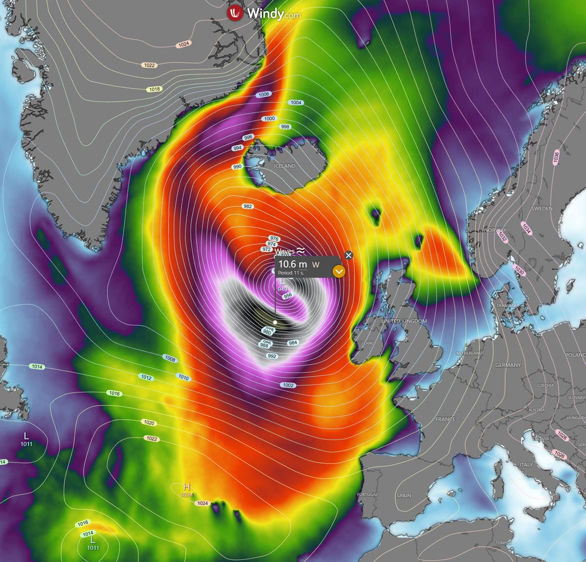
A large Atlantic low will also develop significant wave heights, rounding the core of the system from Tuesday afternoon through Thursday midday when it moves over Iceland and weakens.
The most significant waves are forecast to the west of Ireland and Scotland, with 10-12 meter waves. Along the Atlantic coasts in western Ireland, Northern Ireland and Scottish Outer Hebrides, wave heights of 8-10 meters are possible.
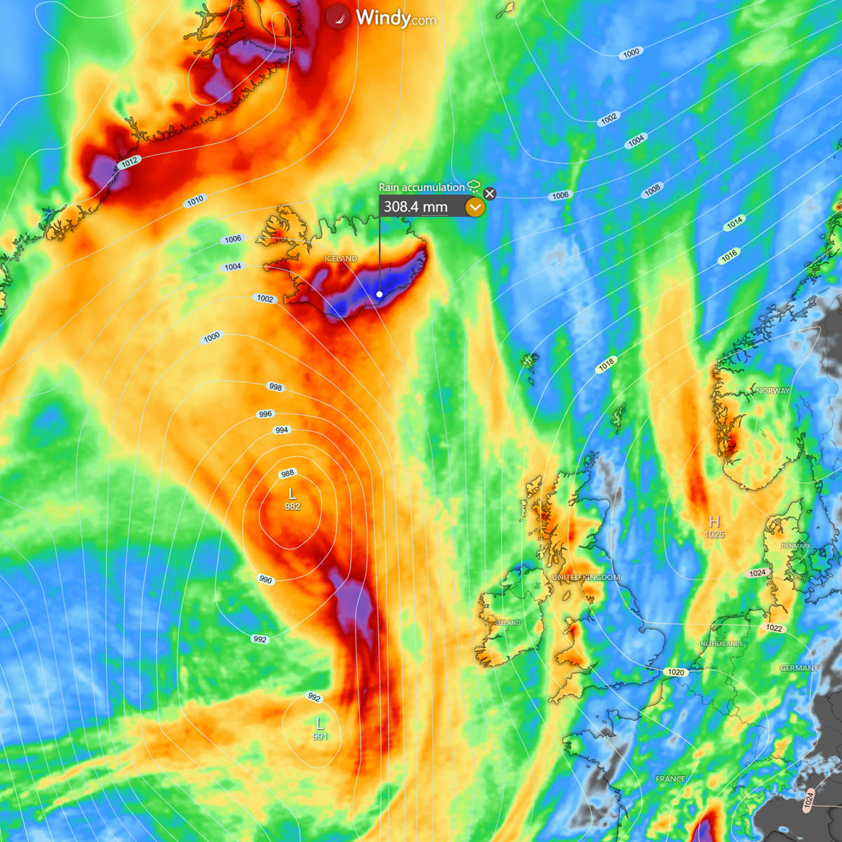
As the frontal squall line passes quickly across Ireland, Scotland, and the western UK, rainfall won’t be significant.
More excessive rainfall is forecast for Iceland from mid-afternoon Wednesday through Thursday. The persistent, powerful south-southeasterly jet stream will establish a classic atmospheric river, bringing intense orographic rainfall to southern and southeastern Iceland. Locally, 250-300 mm or even more is forecast.
Stay alert for potentially dangerous weather conditions.
Windy, Vedur IS, and Wxcharts provided images used in this article.
See also:
The 2026 Super El Niño is Breaking Records, With Winter 2026/2027 Weather Impacts Ahead