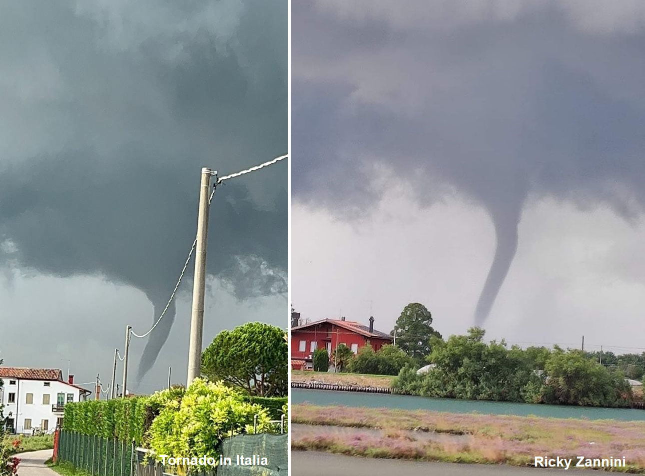
Just after 8 pm today, Aug 1st, a supercell tornado was reported near Ilirska Bistrica, Slovenia. Preliminary reports suggest damage was substantial, with multiple houses severely damaged, blown off roofs, and snapped trees.
Thankfully, no injuries were reported.
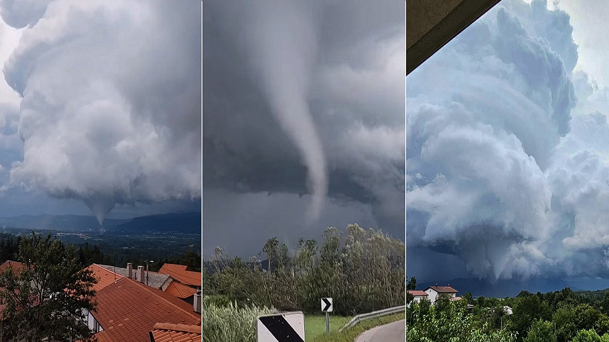
A tornado has developed from an isolated supercell thunderstorm ahead of an approaching cold front. Photo evidence clearly reveals a mesocyclonic tornado.
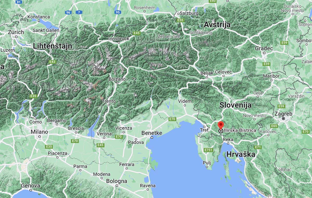
The storm formed on the western side of the elongated valley near Ilirska Bistrica, in southwestern Slovenia. Gained strength as it crossed the valley and spawned a tornado.
It first touched down in Koseze, a small town on the western outskirts of Ilirska Bistrica.
Tornado was active for more than 5 minutes. Below are several close-up videos recorded by residents posted on social media. At some stage, mesovortices appeared just above the ground.
Flying debris can also be observed. Initial reports showed that multiple roofs and residential buildings were severely damaged, with several houses having roof timbers considerably exposed or blown off complete roofs. This is more significant damage to the country, a few days after numerous storms already did severe damage.
This is the first confirmed tornado in Slovenia after August 20th, 2014, when Mahniči, Karst region in SW Slovenia was badly hit. In the past, significant tornadoes in Slovenia were; Gozd near Kamnik (July 13th, 2008) and Hotedršica (August 23rd, 1986).
GENERAL WEATHER CONDITIONS
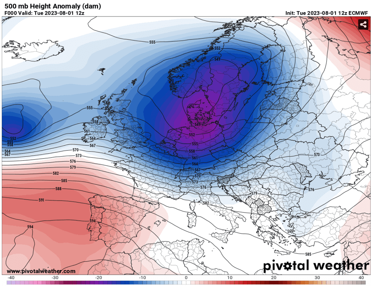
The general weather pattern over Europe today indicated a deep upper low over central and northern Europe, with a High extending into southwestern Europe. In between, a strong western jet stream was in place, creating significant shear over the northern Mediterranean region.
At the surface, a cold front was moving from southern Germany and Czechia towards the Alps during the midday. It gradually strengthened as it crossed the Alps towards the northern Mediterranean and Balkan countries in the afternoon.
A surface low was present over northern Italy, a typical occurrence when this pattern evolves over Europe. The lower pressure over North Italy and Adriatic enhanced the low-level winds from the south, increasing moisture and resulting in a more unstable air mass that overlaps with wind shear aloft.
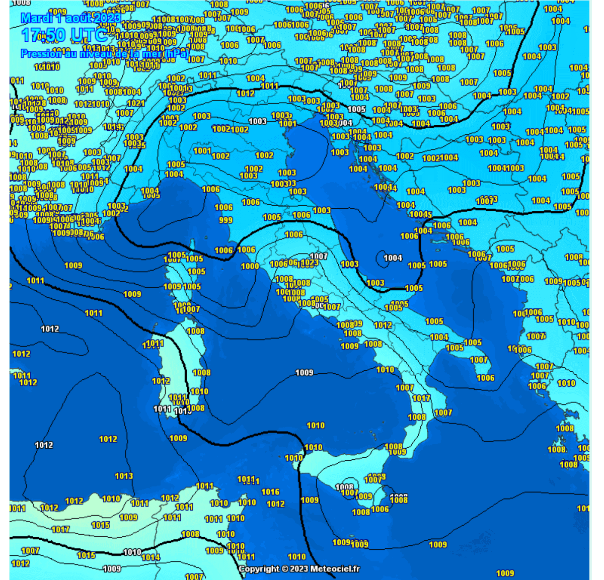
By mid-afternoon, a cold front with embedded severe storms was already moving off the Alpine flank, entering southern Austria, northeast Italy, north Slovenia, and western Hungary.
We can see relatively clear skies in front of it, allowing air mass to warm up considerably below the front arrives.

A few days ago, there was a multi-day severe weather outbreak across Italy, Slovenia, and Croatia. Numerous houses, forests, and vineyards were severely damaged by intense winds, flash floods, destructive hail, and even tornadoes. Damage done is counted in millions of EURos.
RADAR ANALYSIS AND SOUNDING DIAGRAM
The frontal zone was moving southeast into Slovenia in the afternoon, with some pre-frontal storms developing across northeast Italy and south-central Slovenia.
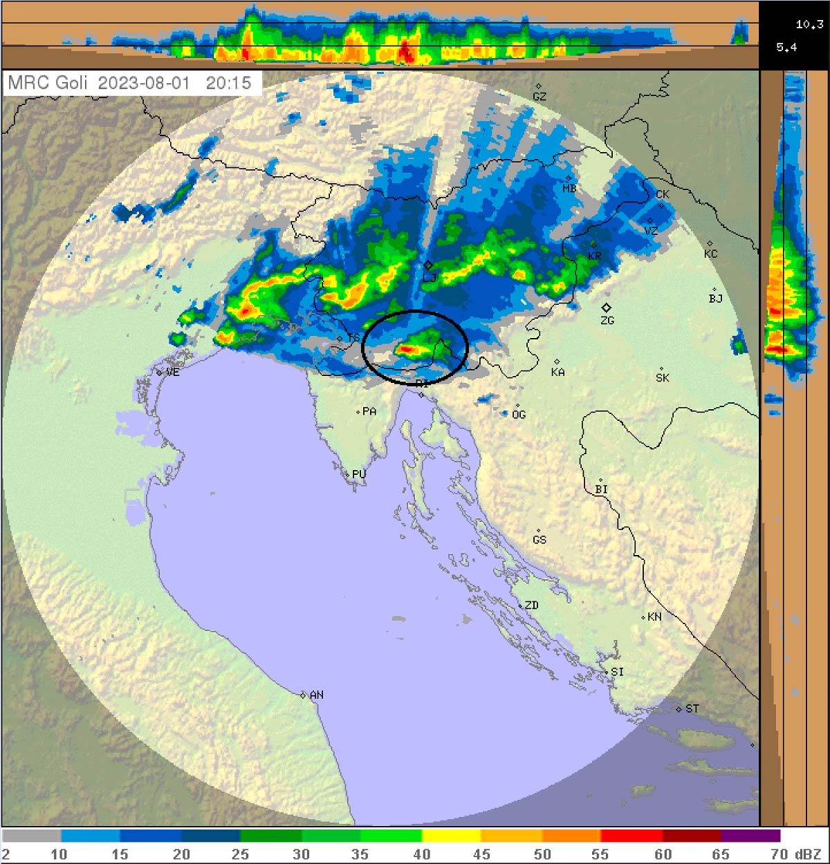
Below is the radar sequence of the isolated supercell storm with this tornado. It looks small, moving due east, compared to the whole frontal storm complex farther north which was moving southeast.
However, the pre-frontal supercells are often associated with the most significant weather events as they form in an intact environment before the cold front mixes air mass.

Here is another view of the supercell with the Croatian radar network; we can also see the vertical cross-section. It is indicating that the storm was pretty shallow, with its cloud tops only around 10 km.
But the intense core was up to around 6 km above the ground.
Today’s stormy activity over the Alpine region towards northern Italy, Slovenia, and Hungary was associated with the cold front from the northeast. The front was tracking along the upper-level wave over central Europe.
A line of thunderstorms first formed along the main Alpine flank over Austria, gradually moving southeast into a more favorable sheared and unstable environment across the northern Mediterranean. Dewpoints along the North Adriatic, southwest Slovenia, and northeast Italy were from 20 to 23 °C.

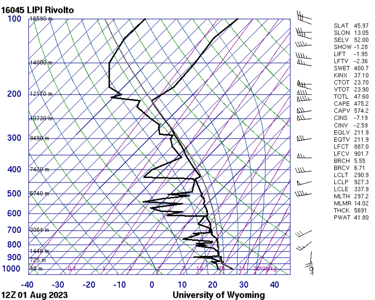
The closest vertical sounding available is in Udine, NE, Italy. The chart below is the release at 12 UTC, Aug 1st. Although the instability (CAPE ~ 500 J/kg) does not appear particularly large, a more unstable air mass was farther south over the northern Adriatic, Kvarner area, and southwestern Slovenia, where Ilirska Bistrica is located.
Vertical wind shear was strong, indicating a textbook curvature of the winds from the ground into the upper levels. With significant veering winds with height in the lowest few kilometers. This normally enhances storm-relative helicity (SREH), one ingredient we observe with tornadic supercell storms.
The nearby weather station Koseze has reported east-southeast winds when thunderstorms and tornados formed, with temperatures around 23 °C and dewpoint 20 °C. This allowed cloud bases to be very low with this supercell, allowing mesocyclone to develop a tornado on the ground.
Additionally, the SE-NW orientation of the valley where Ilirska Bistrica is located allowed winds to channel toward the storm and enhance the low-level SR helicity and rotation.
SIGNIFICANT TORNADO DAMAGE TO RESIDENTIAL HOUSES
According to the damage with house roof timbers considerably exposed or blown off reported, the tornado could be rated as T3, meaning estimated peal winds were between 150 and 200 km/h.
Buildings in the area are generally well-built to withstand strong downslope winds (known as Bora) during winter. So the significant roof damage suggests the tornado was a strong one.

There was an official report of 107 km/h by the National Weather Service (ARSO) at their weather station in Koseze. Tornado did not cross the station or damage this location; it passed a few hundred meters away. Suggesting winds were much more intense where the tornado hit.
Temporarily, fallen, large trees blocked the road between Ilirska Bistrica and Rijeka, Croatia.
****
Additionally, another tornado was near Jesolo, NE Italy, earlier in the day. This indicates how favorable the conditions were for supercell storms and tornadoes in the region today.
Pivotalweather, Meteociel, and ARSO provided images used in this article.
**This is *breaking news* report, more details and updates will be added to the content in the following days as more information is gathered. Stay tuned!