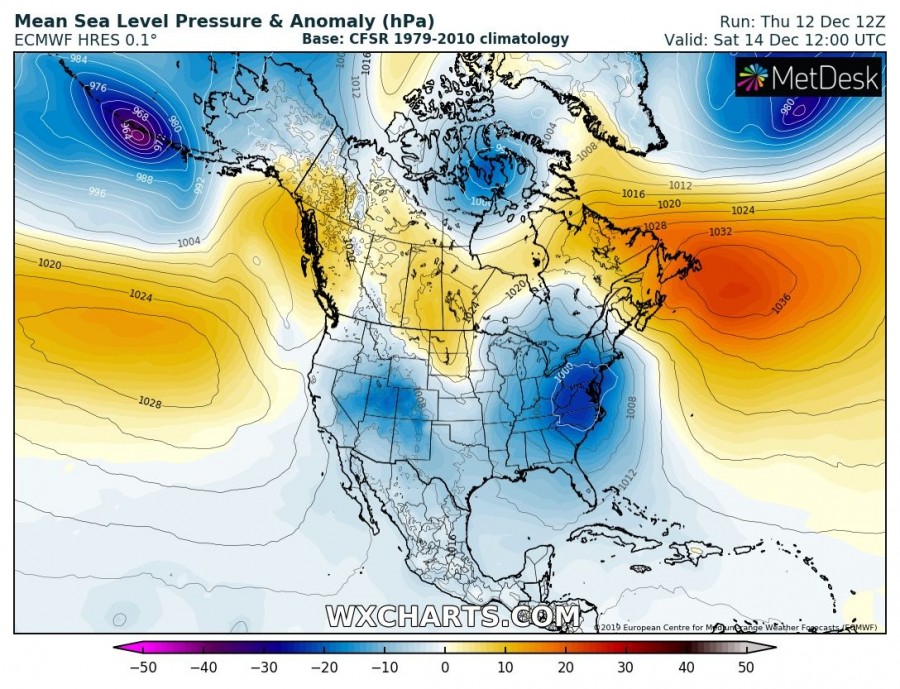
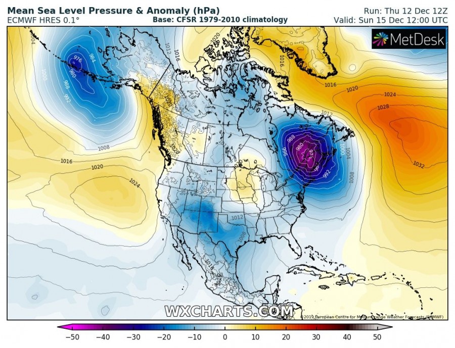
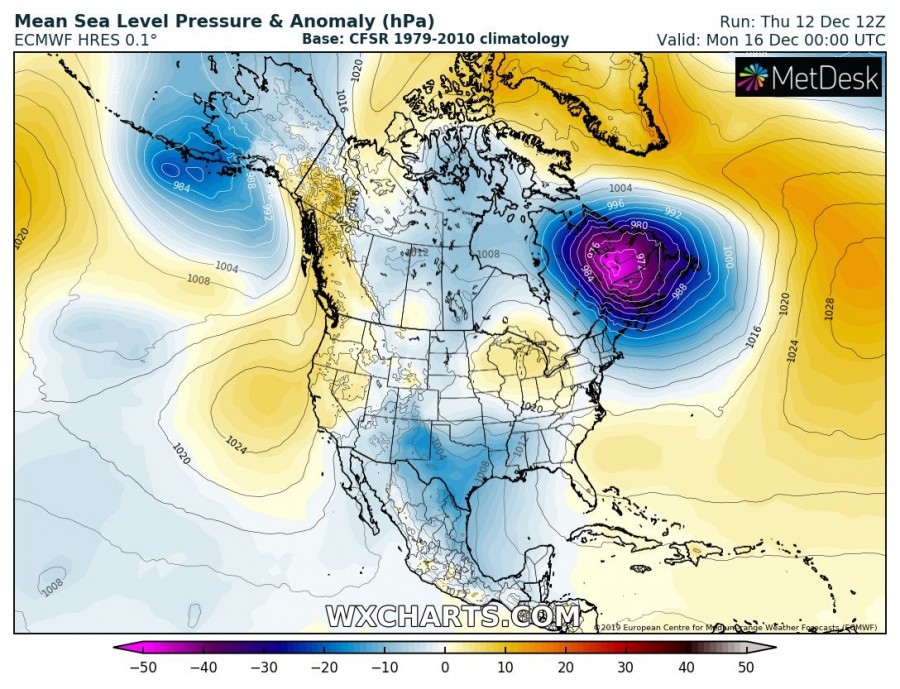
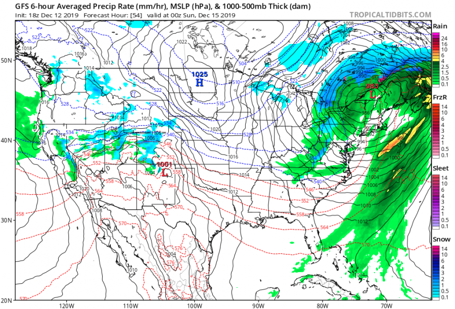
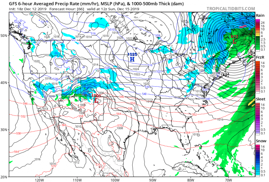
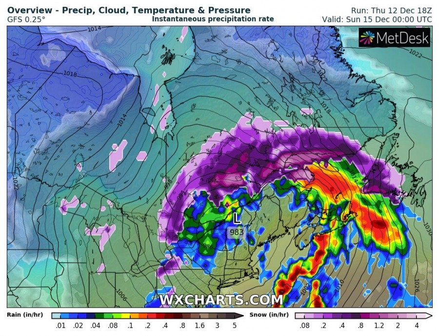
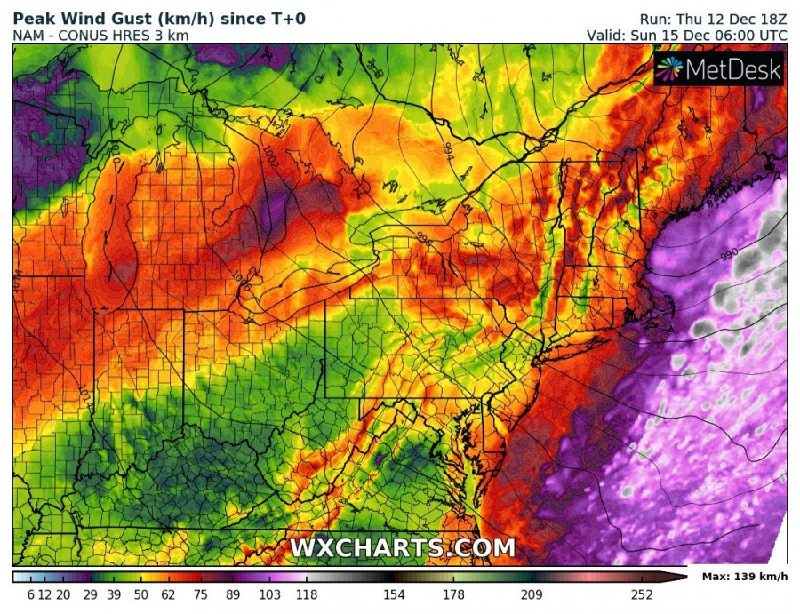
While there is an extensive high-pressure system across the eastern US this week, a pattern flip brings intense cyclogenesis this weekend developing over the East Coast and tracking into eastern Canada while intensifying. Lots of snow is likely across E Canada, while northeast US and Nova Scotia / Newfoundland should experience severe winds and major waves on the southern coasts.
A negatively tilted upper-level trough pushes across the eastern US, developing significant cyclogenesis from the East Coast towards northeast into eastern Canada. A rapidly intensifying surface cyclone moves ahead of the through over the weekend, ejecting into the Labrador Sea on Monday.
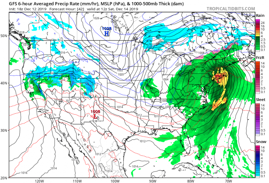
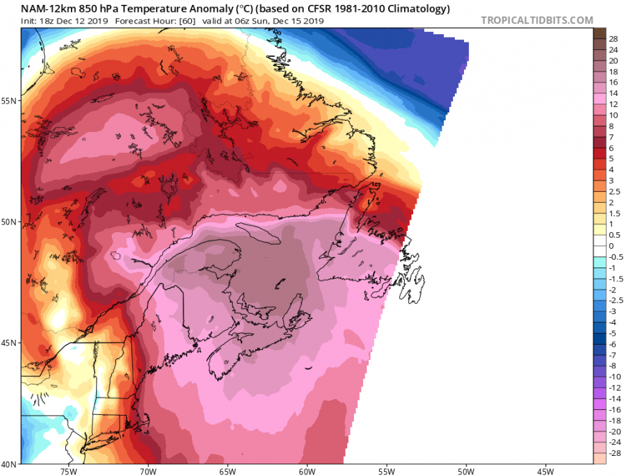
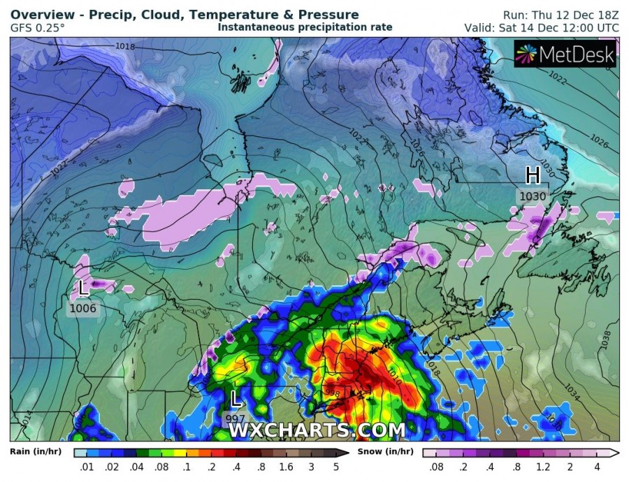
The cyclone develops over East coast on Saturday morning as a result of cold advection across the Great Lakes region towards SE. A rapid intensification is then expected through the afternoon into evening hours as the system drifts into the northeast US. A powerful warm advection develops in front of the cyclone, delivering very warm airmass through mid-level, potentially enhancing the threat for ice accumulation locally across SE Canada since lowlands remain rather cold beneath the warmth.
Zoom-in view of bombogenesis process across the eastern Canada – cyclone has around 985 mbar when exiting NE US on Saturday afternoon local time, beginning its rapid intensification overnight to Sunday and drop into around 965 mbar.
A large cyclone will result in quite a good amount of rain, but its majority should stay off the East Coast over the Atlantic. Combined with severe southerly winds from the Atlantic into the northeast US coast, Nova Scotia and Newfoundland. Quite a good amount of snow is also expected across eastern Canada where airmass remains on the cool side to the north of the surface warm front, developing conditions for heavy snowfall and blizzard as powerful warm/moist advection persists above.
Stay tuned for updates this weekend!
Interested in our calendar? We are proud to present and promote the best weather photographers in Europe – see details:

