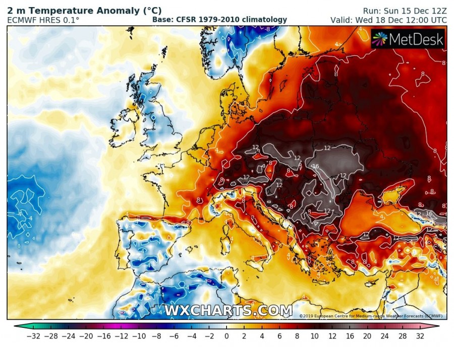
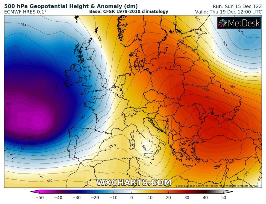
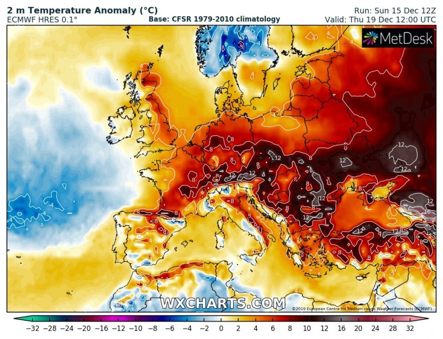
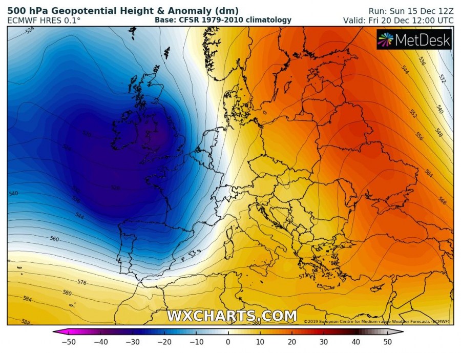
The first 2019/20 winter month in Europe will be just another one in the line with above normal average monthly temperature! While it has been dynamic over the North Atlantic and western Europe lately, similar pattern will likely continue for another week or possibly even two. Such pattern means deep trough over the North Atlantic with numerous storms into western Europe and ridging further east – in other words, unusually warm weather for east-central and southern Europe is expected. Models are trending into an incredible warmth developing this week!
Monday, Dec 16th
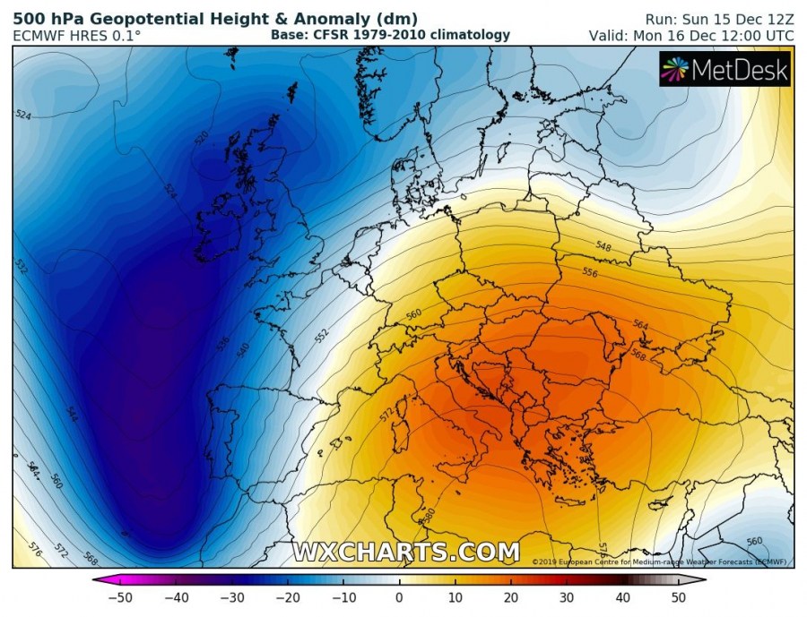
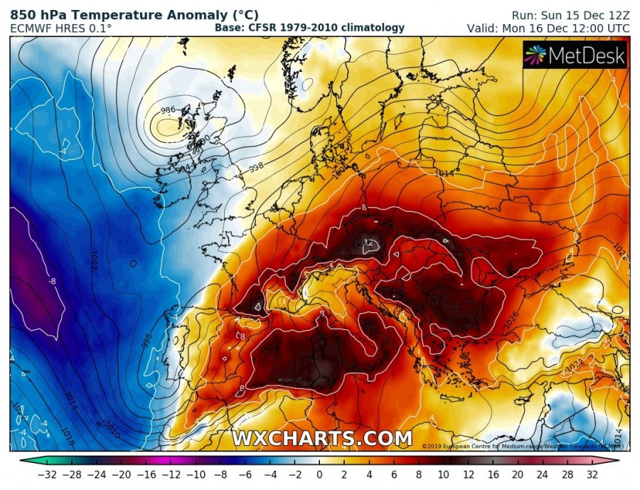
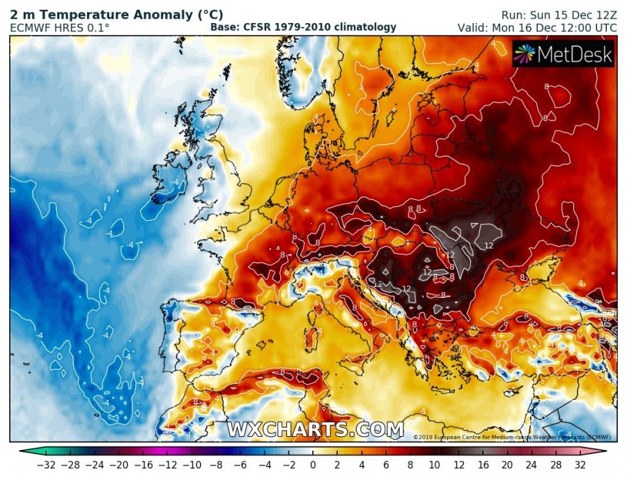
A dipole pattern is establishing over Europe in the new week, with a deep long-wave trough over the North Atlantic, reaching deep south towards western Iberia. To the east, an upper ridging is strengthening across the Mediterranean, gradually expanding into the Balkan peninsula and east-central Europe. Together with the strengthening ridge, warm advection also takes place and spreads into continental Europe. Strongly positive temperature anomaly will develop over the Mediterranean, the Balkans and around the Alps.
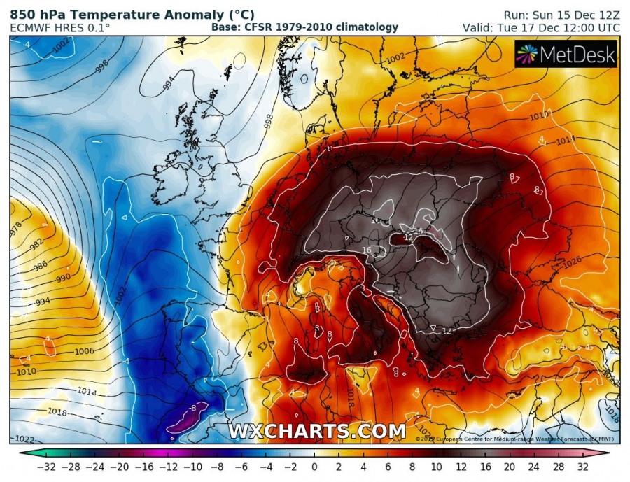
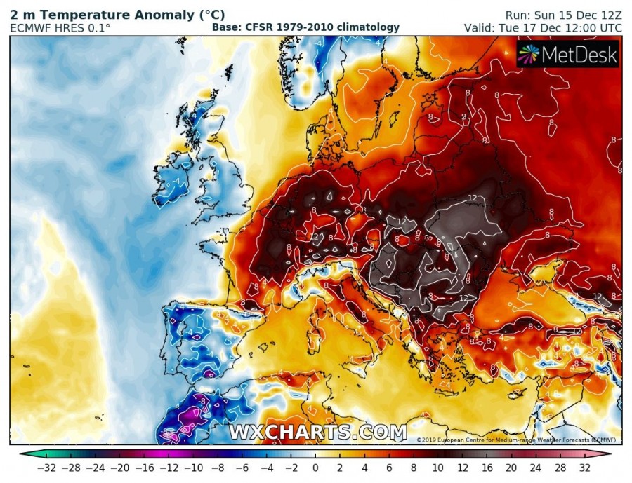
Tuesday, Dec 17th
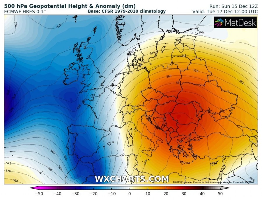
On Tuesday, the upper ridge continues strengthening over the Balkan peninsula while the trough over the North Atlantic pushes onto the Iberian peninsula. This results in even stronger warm advection from the Mediterranean sea towards east-central Europe with a broad area od 12-16 °C average temperature above normal. This will significantly enhance the melting process of the existing snow cover in many areas.
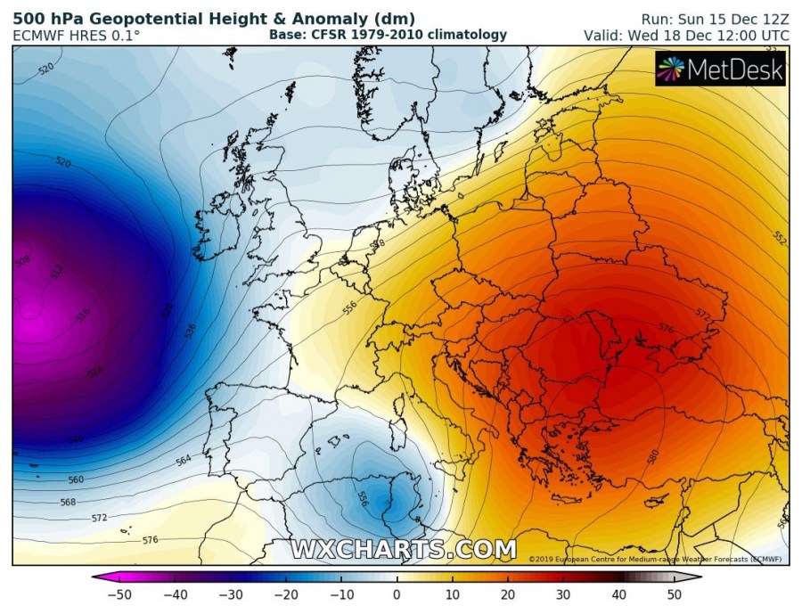
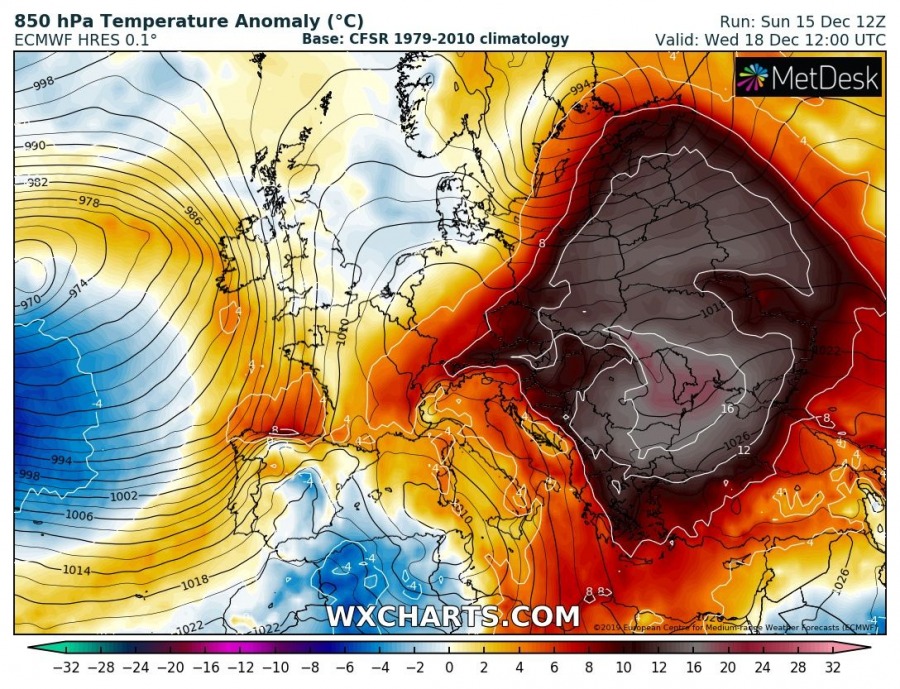
Wednesday, Dec 18th
Through mid-week, upper ridge persists over the ESE parts of Europe while trough over Iberia vanishes. However, a very deep trough / low develops over the North Atlantic again. An incredibly warm airmass persists over the eastern half of Europe with locally 12-18 °C anomaly while literally the whole continent is experiencing above normal temperatures. Very warm weather with close to 20 °C afternoon temperatures are likely over the Balkan peninsula!
Thursday, Dec 19th
A very large trough / deep core low over the North Atlantic drifts further east towards WSW Europe, while the upper ridge over ESE Europe now expands into northern Europe as well. Above normal temperatures are spread across much of Europe, being still extremely warm over SE parts of the continent.
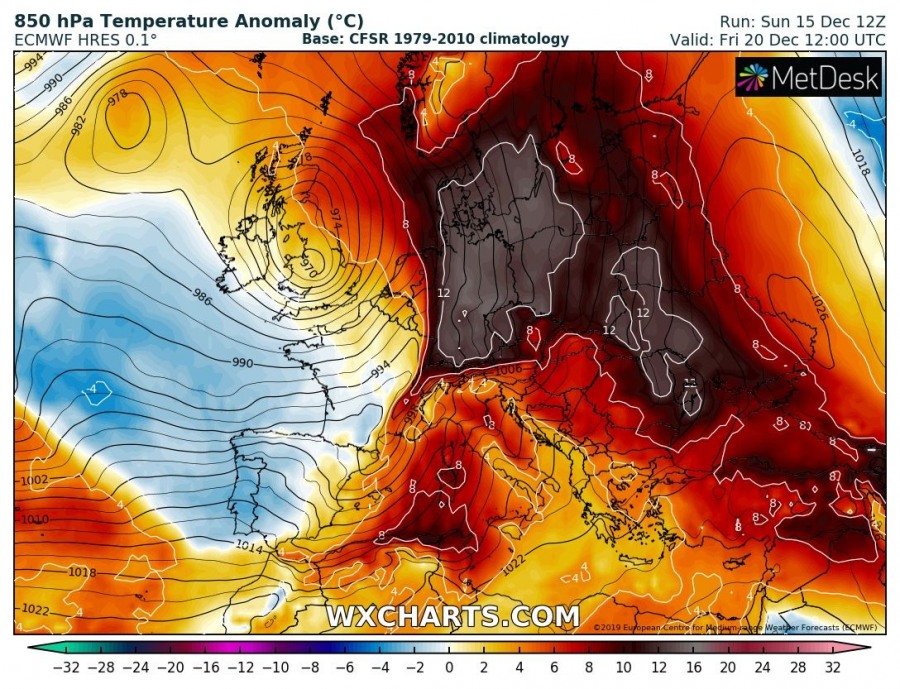
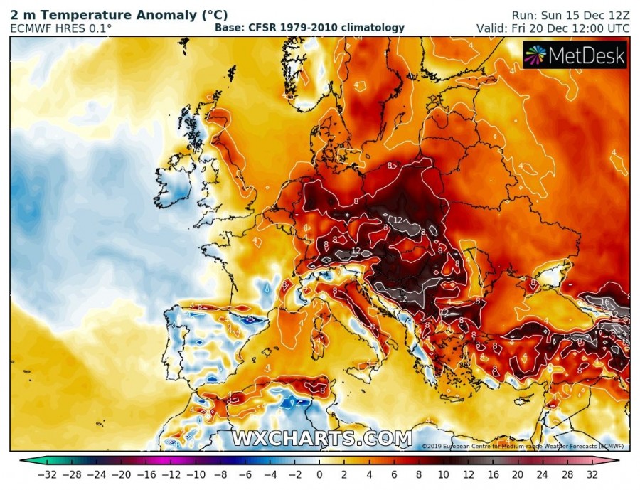
Friday, Dec 18th
Similar pattern as a day before, with a large deep trough persisting over WSW Europe, resulting in the powerful warm advection from the Mediterranean into central Europe. Ridge persists over the eastern half of Europe. Warmth strengthens also towards northern Europe and the Baltic region while at least some cooler weather spreads into SW Europe with the broad maritime airmass from the large North Atlantic trough.
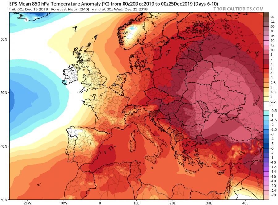
As we can see, the overall temperature trends for Europe this week are trending towards much above normal for a large part of our continent. Long-range models are trending towards the extension of this usually warm weather even into the next week!
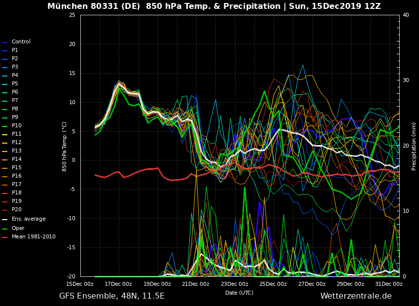
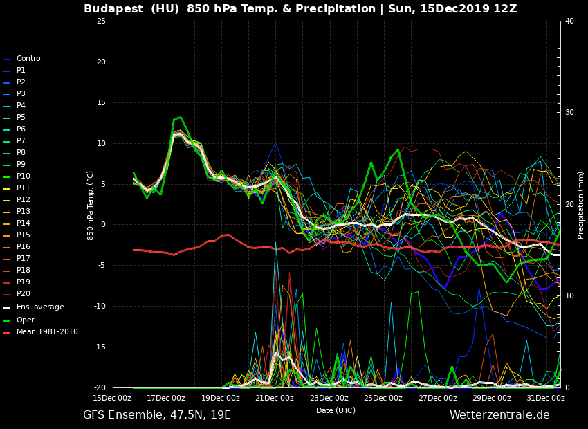
Here are the long-term trends for 850 mbar temperatures for several cities; Munich (south Germany), Budapest (central Hungary) and Bucharest (southern Romania) – all are showing this incredible warmth in the coming week! And looking precisely, we can see the warmth is actually indeed extending further into the end of December.
The cold winter / snowy weather is therefore postponed. Stay tuned!
Interested in our calendar? We are proud to present and promote the best weather photographers in Europe – see details:
