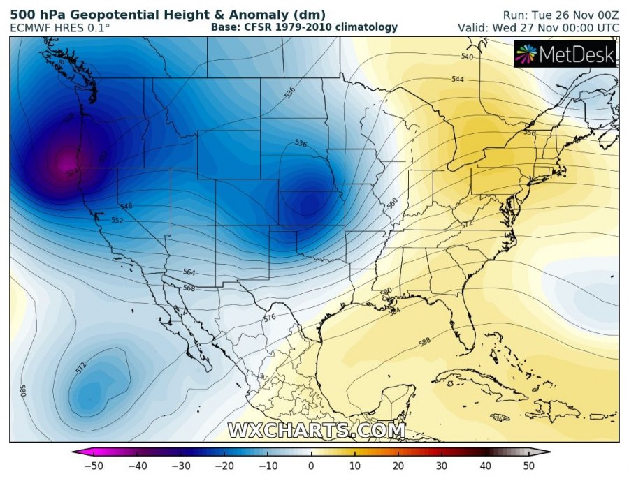
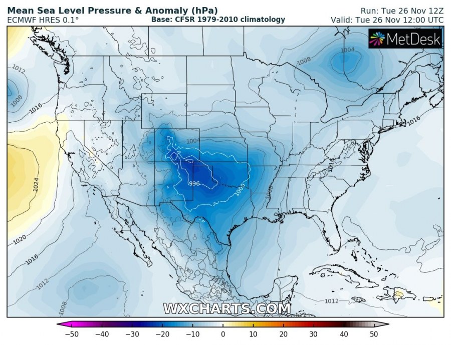
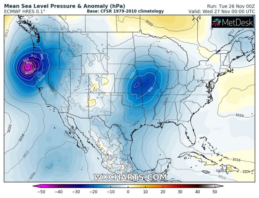
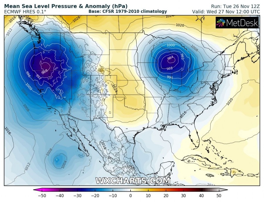
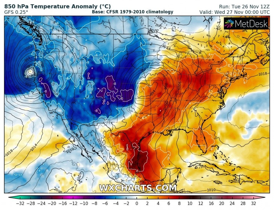
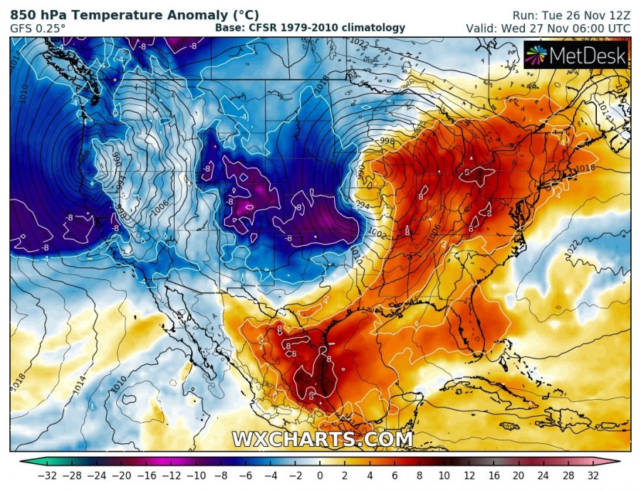
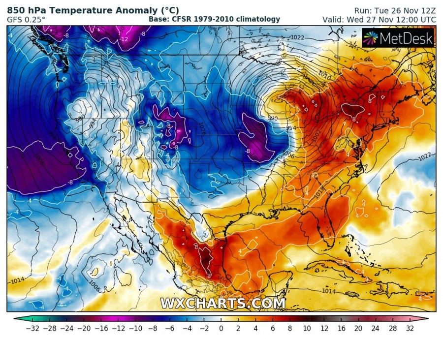
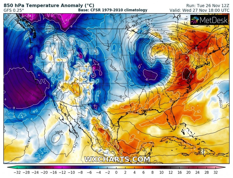
Besides the very deep trough and a powerful cyclone along the Pacific NW coast, another deep cyclone developed further east across the central United States. A cyclone formed in the Lee of the Rockies and is expected to cross the Great Plains while deepening towards the Great Lakes. Severe weather outbreak seems likely along the main cold front over the Dixie Alley and SE USA tonight. On cyclone’s wake, heavy snow blizzard is developing as well and should bring some good amounts of snow from E Colorado across Nebraska into Iowa and S Minnesota tonight and tomorrow.
The classic pattern develops over the central US, a negative-tilted upper trough moves from the Rockies towards the Great Lakes and results in rapid cyclogenesis in the Lee of the Rockies. Cyclone travels NE tonight and arrives over the Great Lakes tomorrow afternoon local time, while gradually deepening along its track.
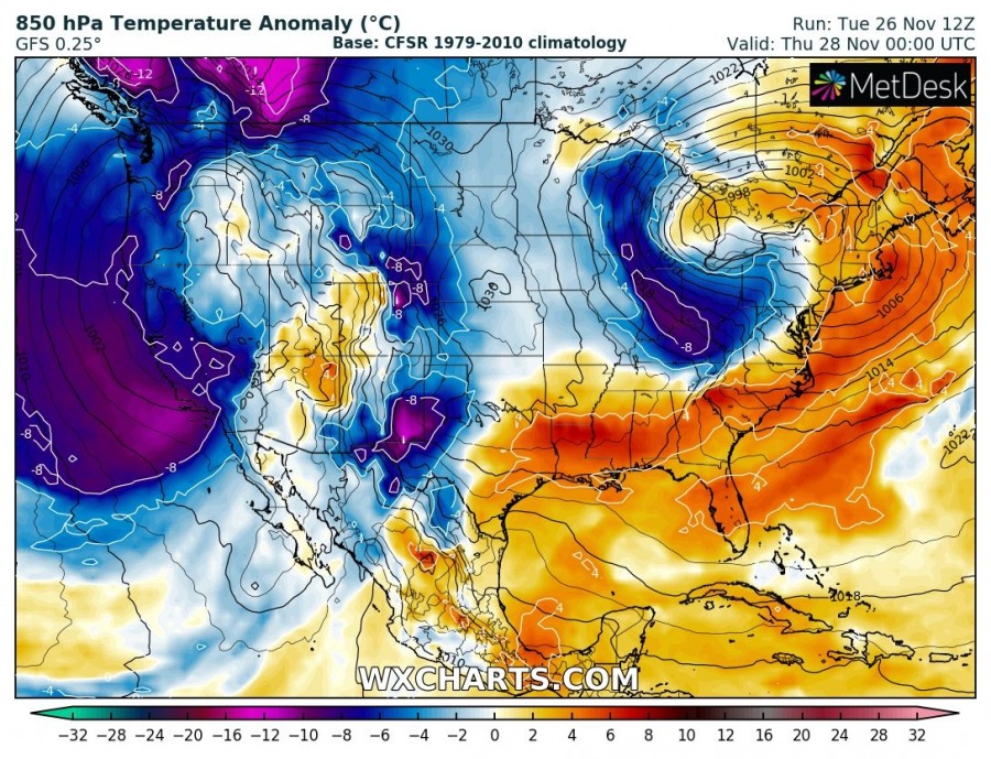
An interesting look is over the 850 mbar temperature with a strong warm advection across the warm sector, supporting unstable airmass along the surface cold front. Behind the front, an intense cold air mass advection develops over the Rockies and spreads across the Great Plains and towards the Ohio Valley tomorrow.
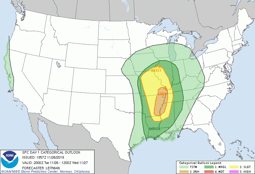
The Storm Prediction Center (SPC) is expecting a localized outbreak of severe storms with a threat for damaging winds and a few tornadoes, especially across parts of the lower to mid-Mississippi Valley region this afternoon through tonight.
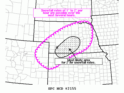
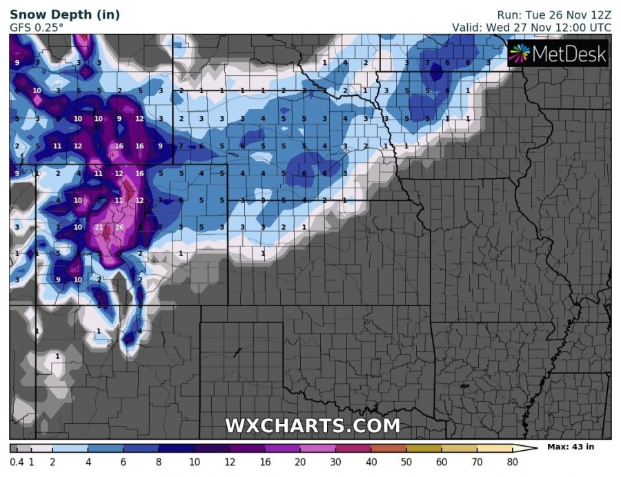
Heavy snow blizzard will develop in the wake of the cyclone, as the parent upper-level trough becomes increasingly negatively tilted and the warm conveyor branches off and begins to wrap around the deepening upper low. This causes a strong warm advection ahead of the low across the Great Plains and therefore heavy snowfall. Combined with strong NNW winds, heavy snow blizzard and whiteout conditions are expected. Locally, 5-10 inches of snow is possible along the broad swath from NE Colorado towards S Minnesota.
See also – A powerful deep cyclone with a pronounced sting jet along the NW USA coast results in extreme snowfall in SW Oregon and Sierra Nevada tonight:
Interested in our calendar? We are proud to present and promote the best weather photographers in Europe – see details:
