While more or less mild pattern continues across Europe with no significant signs of more intense winter weather or cold temperatures, at least Scandinavia had some cold periods lately and that’s about it. But, across the Atlantic, Arctic outbreaks are often occurring this year, again! Yet another intense outbreak of extremely cold Arctic air mass is scheduled to begin tomorrow, advecting brutally cold air mass into Dakotas and Great Lakes region through early-mid next week.
A rather classic winter Arctic cold blast develops over the North American continent, with a very deep upper trough and cold-core across the NE CONUS. Such a pattern is supportive by ridging over the NW CONUS and more meridional flow from the Arctic Canada deep south into the east-central United States. Airmass 15-20 °C colder than normal in the lowest levels should spread across the north-northeast CONUS.
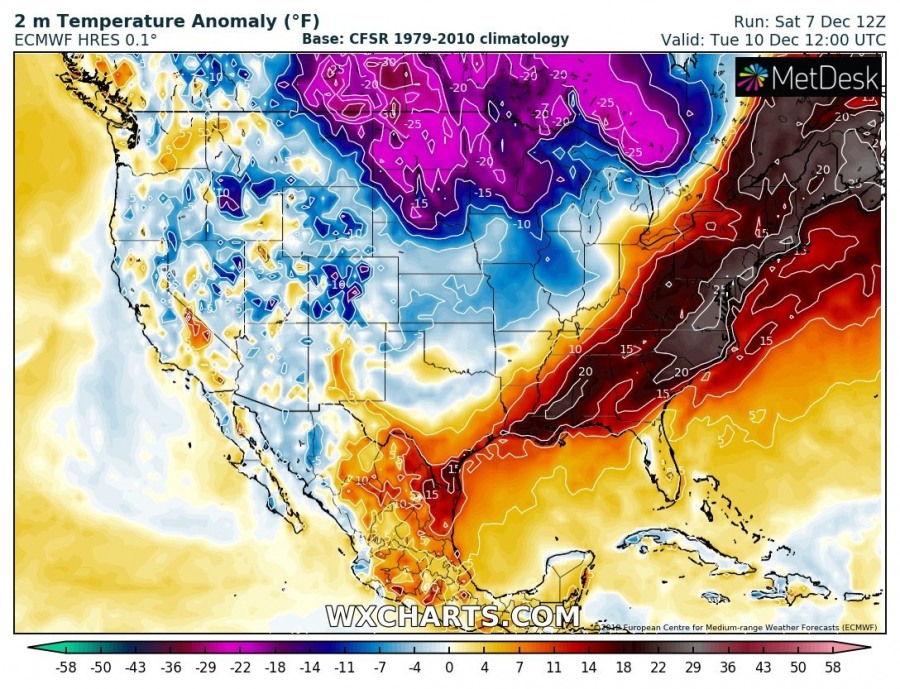
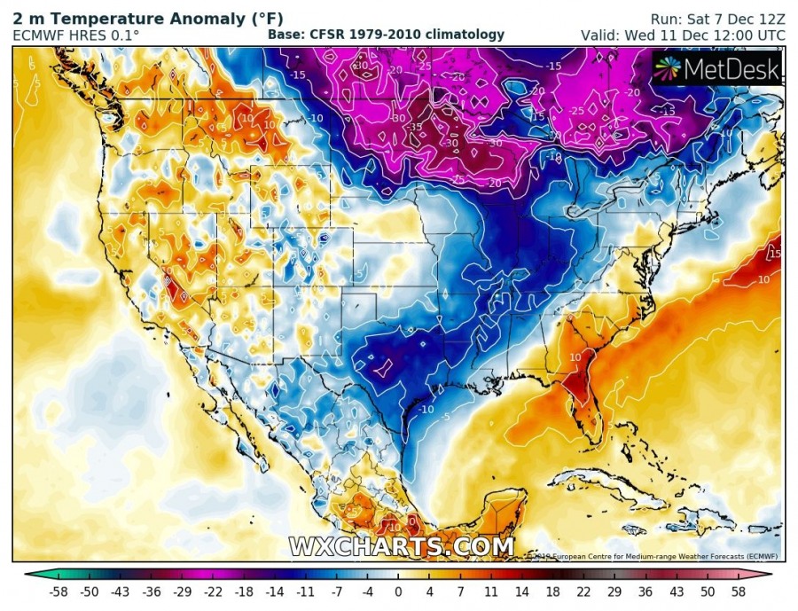
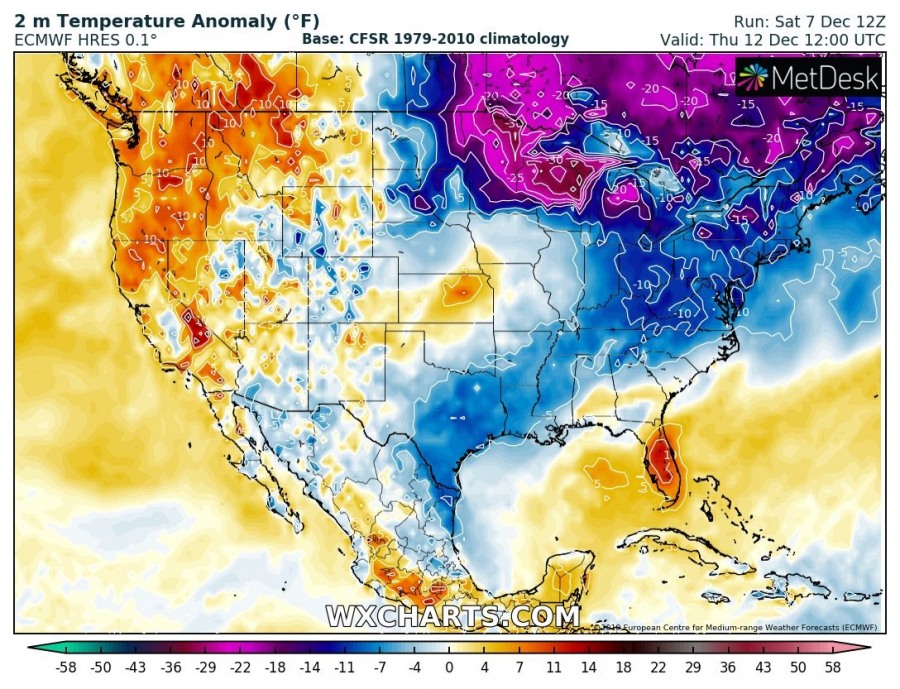
The Arctic outbreak starts along the international border on Sunday with already very cold airmass advecting south, while still mild temperatures are spread across a large part of east and central United States. On Monday and Tuesday, the Arctic front pushes across the Great Plains and Midwest, delivering much colder air mass in its wake. Ahead of the front, strong warm advection brings unusually warm day across the East Coast. Extremely cold airmass begins advecting into Dakotas and spreading into Minnesota, Great Lakes and further east as well through Wednesday while the cold is already vanishing over Montana. Arctic outbreak reaches NE CONUS on Thursday and Friday, diminishing over the weekend.
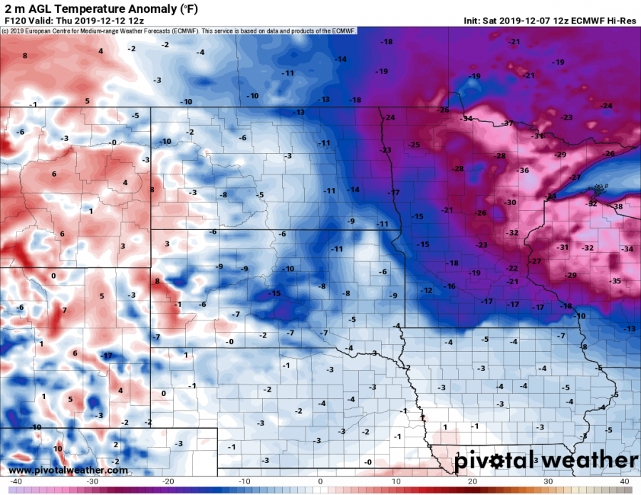
Closer look over 2m temperature anomaly across the northern US through Tuesday, Wednesday and Thursday (Dec 10-12th) – extreme anomaly is expected across a large part of Minnesota and Wisconsin on Wednesday and Thursday, locally 35-40 °F below normal. This means temperature well below -20 °F, combined with brutally cold wind chills.
Extremely low wind chill temperatures are expected across Dakotas and western Minnesota on Tuesday, locally -25 to even lower than 30 °F! That’s below -30 °C! Further north across Canada, windchill should push even below -40 °F.
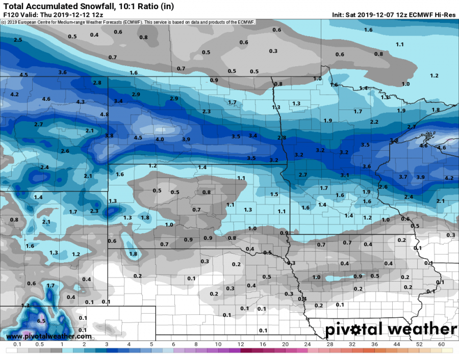
Some snow is also expected along the surface frontal system, crossing from Montana across Dakotas towards the Great Lakes. However, a lack of moisture advection and better wind pattern should limit the excessive amount of snow, so only about 4-7 inches of snow seems possible along the swath from NN Montana across North Dakota into N Wisconsin.
Stay alert for dangerous windchill in the coming days – strong winds could locally also develop blizzard / whiteout conditions where snowfall will occur, as well as blowing snow.
See also – deep cyclones over the Atlantic bring windstorms into western Europe and milder weather across the continent:
Interested in our calendar? We are proud to present and promote the best weather photographers in Europe – see details:


