The extreme heatwave across parts of the United States is getting serious. Conditions should worsen, pushing the heat index even above 115 °F in some areas. An extensive ridge develops over the weekend – should bring scorching heat through the rest of July.
Weekly pattern overview
The heat has been the worst over southern Plains and the southwest US lately, but it is also getting worse into central Plains. With a more stable pattern forming into the weekend and next week, heatwave with extremely high heat index is expected to spread across Midwest, Southeast and towards the Great Lakes.
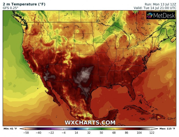
Tuesday, July 14th
Through early this week, the most intense heat is developed across the southern Plains and Southwest. Precisely over Texas, Oklahoma, New Mexico, and Arizona. Peak temperatures are exceeding 110F / 43 °C.
While the heat index is making things even worse. Up to around 115 °F over western Texas!
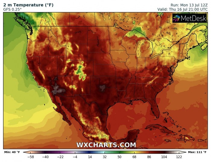
Thursday, July 16th
Similar conditions are likely into mid-week days, with heat improving into High plains as well. But the worst remains over Texas and Arizona. Again, above 110 °F is expected.
The low-level pattern will also introduce an advection of more moisture from the unusually warm Gulf of Mexico. Therefore, the heat index will become more extreme across east Texas, Oklahoma, and across Mississippi valley towards Arkansas.
Saturday, July 18th
Over the weekend, the scorching heat vanishes a bit over the south and Southwest but intensifies further north. Very hot days are likely across central and northern Plains on both Saturday and Sunday. Peak afternoon temperatures should locally exceed 105 °F.
And so will the heat index! With a combination of strong evapotranspiration from the crops and moisture advection from the deep south, the heat index could push towards 110 °F in the Dakotas! Also across the south and southeast.
Monday, July 20th
Early next week, an extensive upper ridge develops across much of the US, resulting in a stable pattern with extreme heat. It is likely to cover most of the midwest, southeast, and also towards the Great Lakes.
To make it even worse, the persistent moist air mass advection from the Gulf will push the heat index into extremely high numbers. It could become deadly in the south. Models are hinting close to 120 °F index locally!
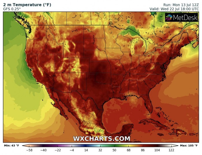
Wednesday, July 22nd
The heat wave does not seem to end anytime soon, though it will shift a bit later next week. It also depends on the overall pattern which brings moisture north.
Some relief seems possible over the southeast by mid next week, at least regarding the lower humidity and therefore heat index. But overall, the heat will remain and is likely to extend into the end of July.
Stay alert for dangerous conditions!
See also:


