After explosively strengthening to a powerful CAT5 hurricane, Dorian is now tracking west, bringing extremely severe winds, torrential rainfall and major storm surge to the Bahamas. We take a look at its future track and which are it will likely affect.
Cameras outside the station captured views of #HurricaneDorian at 12:16 p.m. ET on Sept. 1 as it churned over the northern Bahamas. The storm is a dangerous Category 5 hurricane, carrying the strongest winds in recorded history for the northwestern Bahamas. #Hurricane #Dorian pic.twitter.com/ug0sdD5JOj
— Intl. Space Station (@Space_Station) September 1, 2019
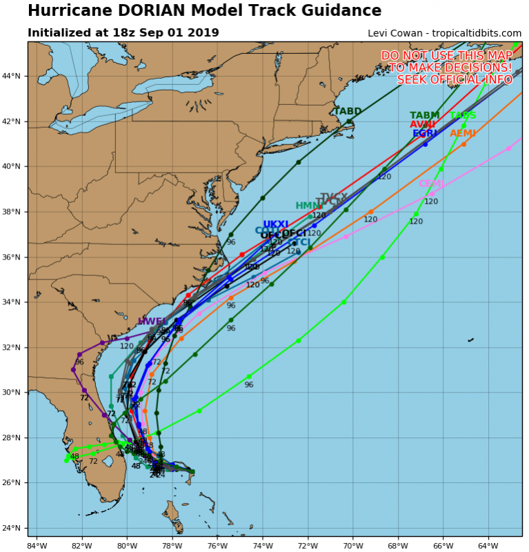
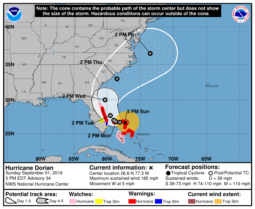
The future track of Dorian is now generally well defined: it is expected to track due west across the northern Bahamas for the next 24 hours, until late on Monday (UTC). It will then make a very sharp northward turn, most likely tracking some distance off the eastern coast of Florida for the next 48 hours, until early on Thursday. There is still some uncertainty about its exact track, with some models pushing it close to the S-CNTRL parts of the eastern coast of Florida.
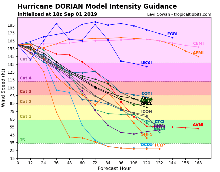
Dorian will likely remain a powerful Category 5 hurricane for the next 24 hours, until late on Monday (UTC), and Category 4 or 5 for the next 24-48 hours.
Hurricane Dorian will remain an extremely powerful Category 5 hurricane as it tracks over the northern Bahamas. Expect similar destruction as seen during first landfall on Abaco Island today. After the northward turn there is still considerable uncertainty in its exact track and to a somewhat lesser extent its strength. The effect on Florida is still not certain, however, this is still a potentially extremely dangerous system for Florida. Even if the hurricane does not make landfall in Florida, it will still bring dangerous torrential rainfal, storm to hurricane force winds and damaging storm surge.
Latest NOAA NWS National Hurricane Center advisory issued Hurricane warning for most of the Bahamas and part of the eastern coast of Florida. Tropical storm warning is in effect for part the eastern coast of Florida. Hurricane watch is in effect for SW Bahamas and a large part of the eastern coast of Florida.
Stay tuned for additional updates soon!
See also:
UPDATE: CAT5 Hurricane Dorian makes a devastating first landfall on Abaco Island, the Bahamas
Seeing hurricane Dorian like few people will ever see it – Hurricane Hunters
https://www.severe-weather.eu/recent-events/update-a-category-5-hurricane-dorian-has-now-central-pressure-of-913-mbar-with-sustained-winds-of-180-mph-abaco-islands-bahamas-under-a-destructive-threat-today/


