Hurricane Leslie remains a Category 1 storm in the central Atlantic and is expected to maintain this strength or even intensify some more in the coming days. Leslie will do a sharp turn east towards Europe next week. It is expected to cross the Azores islands around Thursday and then head towards western Europe and Iceland. Potential is increasing for an intense windstorm developing late next week.
Infrared satellite of deep convective bands around the large eye, packed with sustained winds of 80 mph / 130 km/h and central pressure of 976 mbar.
Infrared satelite animation of CAT 1 hurricane #Leslie in central Atlantic this morning. Quite an impressive eye surrounded by intense convection. Animation via @TropicalTidbits pic.twitter.com/s76wOi21Kd
— severe-weather.EU (@severeweatherEU) October 4, 2018
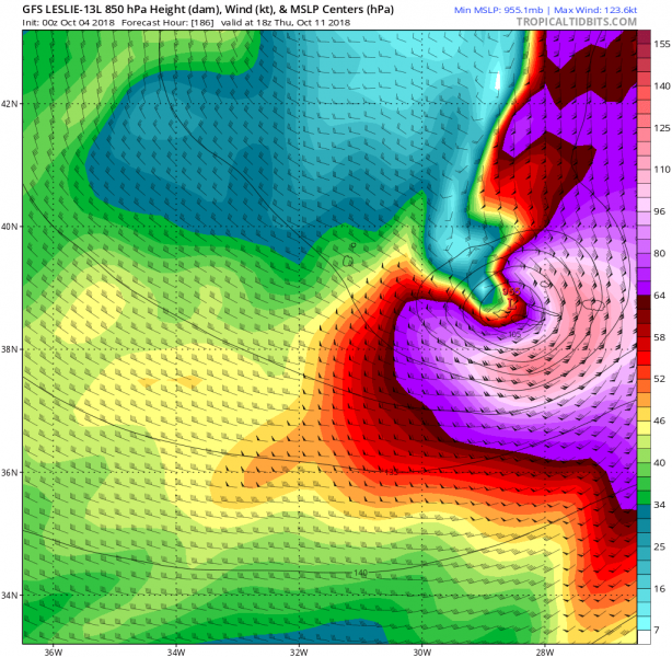
Leslie’s track at the time the hurricane crosses Azores with Category 2 strength:
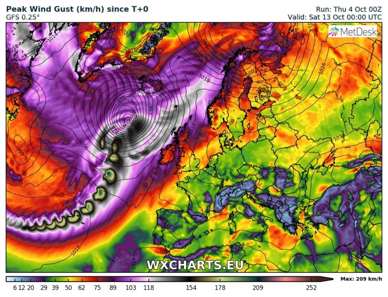
Peak wind gusts swath map per GFS model: we can see Leslie tracking across Azores islands and then west of Ireland towards Iceland (note: due to only 6 hour timestamps, the swath is not continuous).
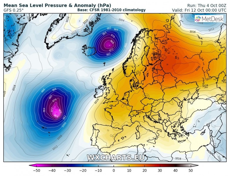
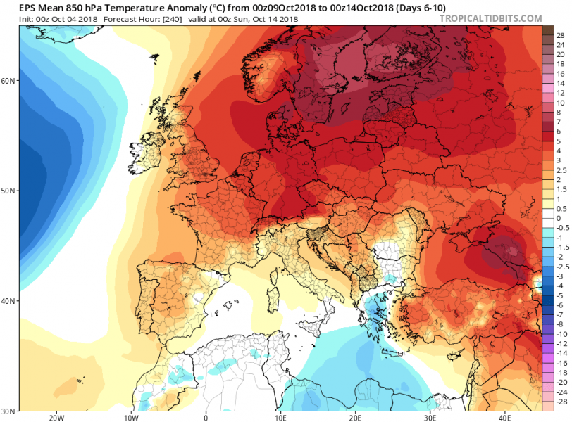
The pattern next week will be characterized by deep troughs and intense cyclones over the north Atlantic while an extensive ridge will dominate the rest of Europe. Much warmer weather should spread across a large part of our continent.
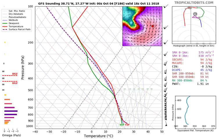
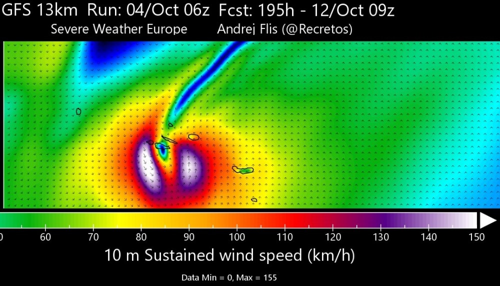
Zoomed map of Azores during the highest winds next week, based on GFS 00 UTC model run today. Max sustained winds of 155 km/h, this corresponds to a Category 2 strength hurricane force. Map produced by our co-admin Andrej Flis)(@recretos via twitter)
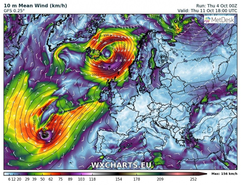
Track of Leslie across the northern Atlantic next week, based on the latest 00 UTC GFS model. Leslie first crosses the Azores and then accelerates NE towards western Europe and Iceland as a post-tropical storm over the weekend. An intense windstorm could develop.
Track of hurricane #Leslie across the northern Atlantic next week, based on the latest 00 UTC GFS model. Leslie crosses Azores and then accelerates NE towards western Europe and Iceland as a post-tropical storm. Animation by @wxcharts pic.twitter.com/hPH7T3YnBs
— severe-weather.EU (@severeweatherEU) October 4, 2018
Stay tuned for further updates!
