VALID FOR 15-03-2019
SYNOPSIS
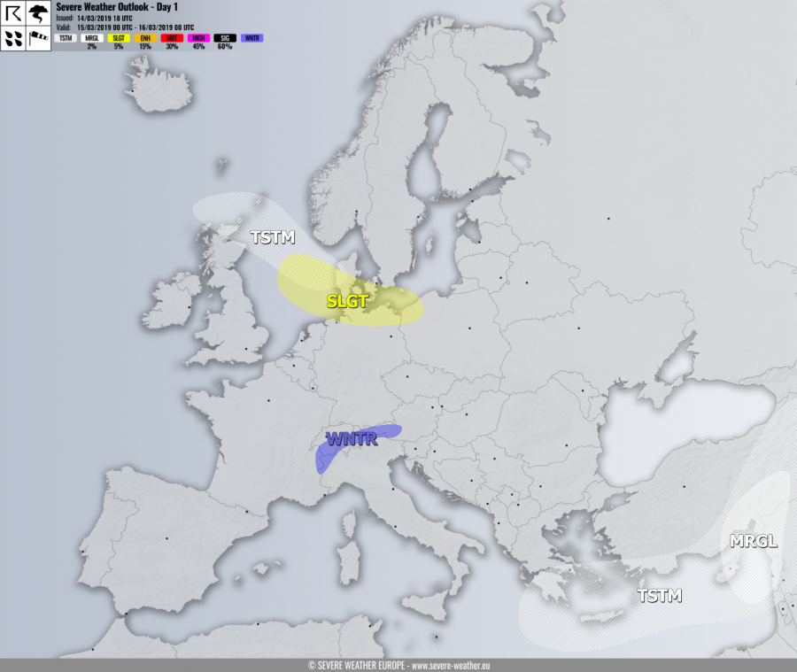
A deep trough pushes from the north Atlantic into northern Europe, while another trough moves across the south Balkan peninsula towards the Middle East. The ridge from the Azores region expands into SW Europe. Surface cyclone over Scandinavia pushes a cold front across the North Sea and Denmark towards Germany and Poland.
DISCUSSION
SLGT risk has been issued for parts of the North Sea, south Denmark, north Germany into northwest Poland with threat for severe winds associated with the cyclone passage.
MRGL risk has been issued for the Middle East where threat for isolated severe storms exists, mainly for marginal hail and severe winds.
WNTR risk has been issued for higher west-central Alps where excessive snowfall is likely due to strong orographic precipitation in the NW flow. Locally more than 50-75 cm of fresh snow will be possible.
TSTM risk areas have been placed where convective storms are most likely to occur.
