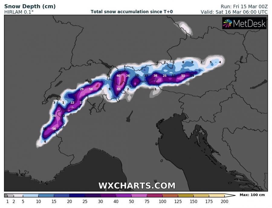
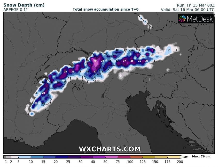
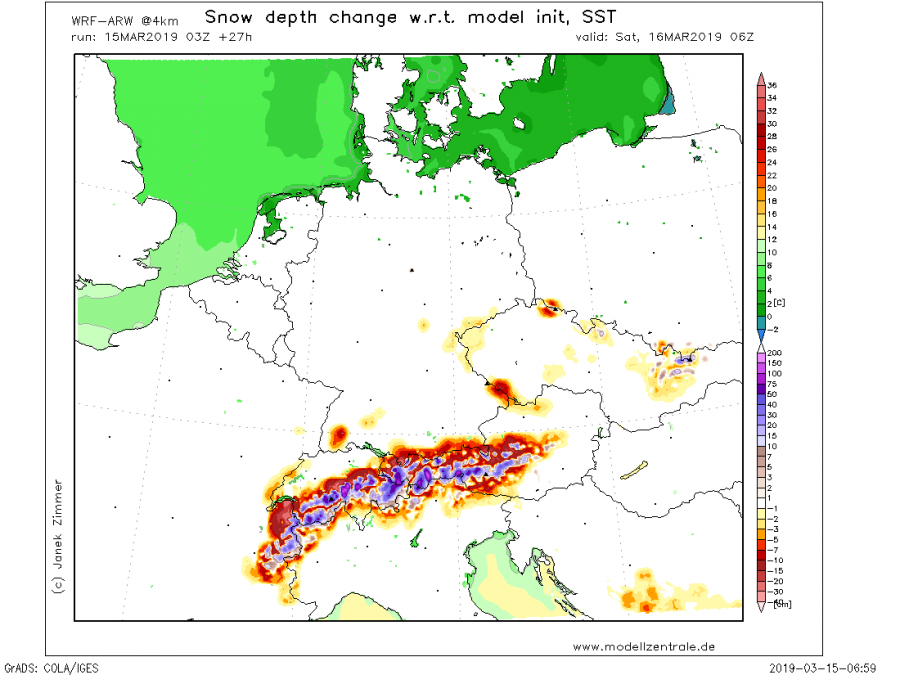
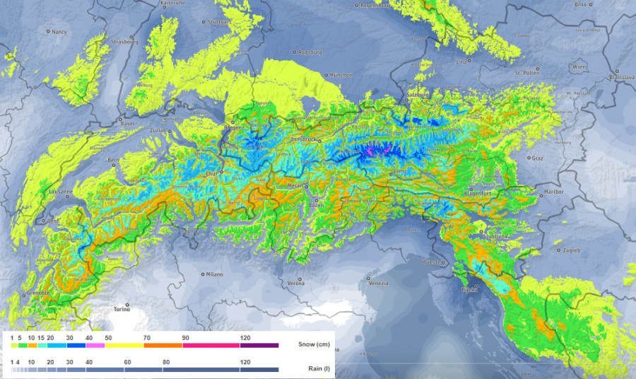
Quite a lot of snow is expected across parts of the Alps this weekend as excessive snowfall event establishes. Most snow with total amounts above 75 cm is expected across the west-central Alps (western Austria and southern Switzerland).
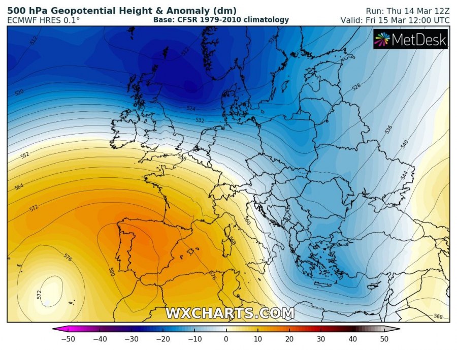
The pattern is characterized by a strong ridge over southwest Europe anda deep trough over east and north Europe, resulting in strong NW flow in between. This brings persistent orographic lifting and moisture advection into the NNW Alps.
Various models are suggesting locally 50-100 cm of fresh snow is likely through the next days at higher elevations in the Alps.
More snow is expected on Monday when a new frontal system, associated with a deep trough, crosses central Europe. Snow will also be possible into lower elevations around the Alpine region (Slovenia, Austria, south Germany) and across Croatia and Bosnia and Herzegovina as well.
A WNTR risk has been issued for this region already today, see details:
