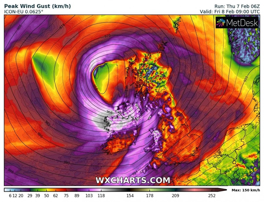
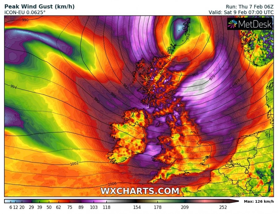
A very deep cyclone will affect the British Isles and Ireland on Friday and Saturday. It will produce storm to potentially hurricane force winds, and locally quite significant rainfall totals. This is a potentially dangerous system for places along the track of maximum winds.
The cyclone formed off the coast of Newfoundland late on Wednesday, moving east-northeast and rapidly deepening to 988 mbar by early Thursday afternoon. The cyclone will track ENE towards the British Isles and Ireland, rapidly deepening
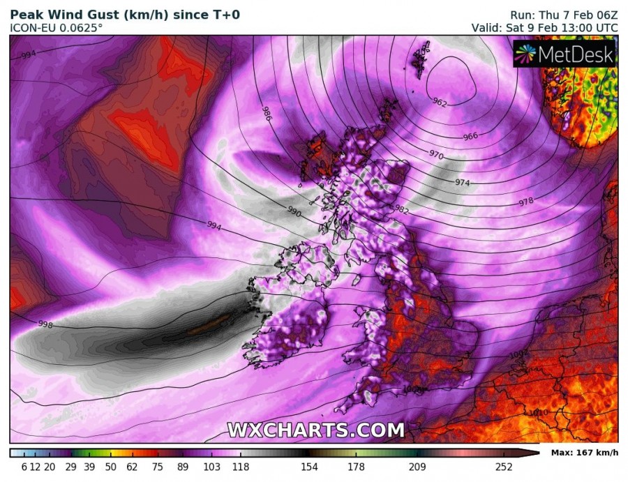
The system will produce a wide swath of severe to locally extremely severe winds. Winds gusting above 100 km/h are expected across much of Ireland, Scotland, southwest and north England and Wales.
Maximum wind gusts across the British Isles and Ireland until early Saturday afternoon. ICON-EU model guidance. Map: Wxcharts.eu.
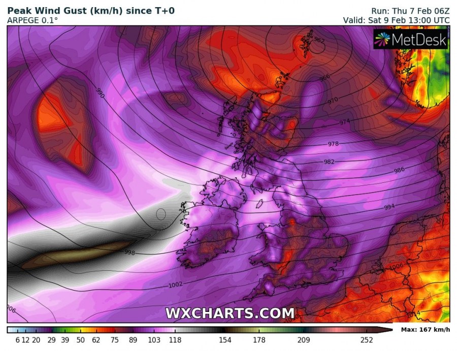
Maximum wind gusts across the British Isles and Ireland until early Saturday afternoon. ARPEGE model guidance. Map: Wxcharts.eu.
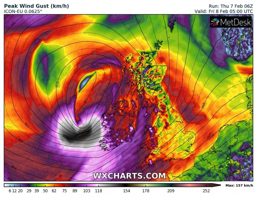
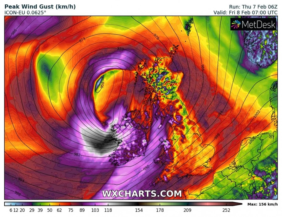
Currently both ICON-EU and ARPEGE models indicate a swath of extremely severe winds, with gusts well in excess of 150 km/h. Interestingly, ARPEGE is indicating stronger winds. This formation of a sting jet is uncertain, however, should it form at the time the cyclone begins affecting land, it could bring extremely severe winds to the coastal are of Ireland.
Gale to strong gale force winds will also affect NW and N France and parts of BeNeLux, as well as southern Norway and southern Sweden.
Maximum wind gusts across the British Isles and Ireland. ICON-EU model guidance. Map: Wxcharts.eu.
Expect major waves with maximum height up to and locally above 10 m along the western, northwestern and southwestern coast of Ireland and southwest England. Also expect major waves, up to about 8 m high along the coast of NW and W France and up to 6-7 m high along parts of the northern coast of Spain.
